world.wikisort.org - United_Kingdom
Kitwood is a hamlet in the parish of Four Marks, Hampshire, England. It is in the south east of the Parish and has been part of Four Marks since its creation in 1932. Prior to this, it was part of Ropley Parish.
This article uses bare URLs, which are uninformative and vulnerable to link rot. (August 2022) |
| Kitwood | |
|---|---|
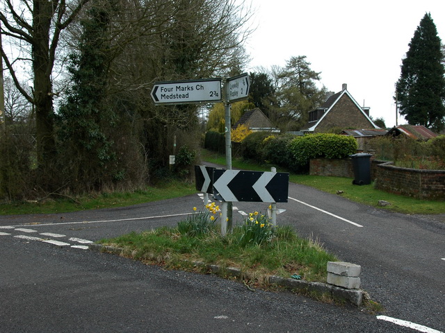 Road junction in the centre of Kitwood | |
 Kitwood Location within Hampshire | |
| OS grid reference | SU6661633840 |
| Civil parish |
|
| District | |
| Shire county | |
| Region | |
| Country | England |
| Sovereign state | United Kingdom |
| Post town | Alton |
| Postcode district | GU34 |
| Dialling code | 01420 |
| Police | Hampshire |
| Fire | Hampshire and Isle of Wight |
| Ambulance | South Central |
Although the settlement was located at the junction of Kitwood road and Swelling, as is visible in older maps, the settlement now spreads all the way from Swelling hill pond to Kitwood farm near Hawthorn Road.
Toponomy
First Mentioned in AD 1403 as kyteswode [1] meaning the Kite('s) wood from Old English 'cýta' and 'wudu' .[2] The actual woodland that is referred to stood somewhere near to where Kitwood Plantation is nowadays (SU 67733 33266).
History
The earliest signs of occupation in Kitwood are a number neolithic flint implements. It is also suggested that Swelling Lane, leading west toward Ropley from the hamlet, is the remains of a Roman Road. Saxon origins are, as can be expected, vague. No finds or information relevant to this period are known. Although it has been suggested that a potential Saxon waterway leads from a postulated Roman villa at Old Down Woods to Four Marks pond, no archaeological evidence has yet been found for this theory.
Medieval
More is known about Kitwood in Medieval times with the first records appearing in the early 15th century. The hamlet has evidence of medieval settlement with medieval potsherds found around the area. Kitwood Lane (SU 66674 33468) had some significance in these times too. A court roll record from 1413 [3] mentions "kitteswodeweye" and during a hedgerow dating survey, commissioned for the Four Marks Village Design Statement,[4] the hedgerow on either side of Kitwood Lane was dated to "approximately 800 years old". This wealth of records suggests significant activity in the area since the 1400s.
Post Medieval
The Post Medieval history of the hamlet is noteworthy. Just west of the "Kitwood Junction" (SU 67130 33377) long, parallel field boundaries running on a NE-SW alignment are visible. These are said to be have been laid as a result of the enclosures act of which Ropley was the first parish to be enclosed by act of parliament in 1709.[5] The 1839 Ropley Tithe Map[6] preserves some surnames of these early 1700s post enclosure tenants in the field names such as Withers piece and Davis' piece.
References
- https://maps.hants.gov.uk/historicenvironment/herResults.aspx?monuid=39220
- "Old English Dictionary: Find Old English Words | Old-Engli.sh".
- held in the records of Winchester College
- https://cdn.easthants.gov.uk/public/documents/27.%20Four%20Marks%20Village%20Design%20Statement.pdf page 27
- Heal, Chris, Ropley's Legacy, The Ridge Enclosures, 1709 to 1850: Chawton, Farringdon, Medstead, Newton Valence and Ropley and the birth of Four Marks (Chattaway and Spottiswood, Four Marks 2021) ISBN 978-1-9161944-3-4
- "Transcription of the 1839 Tithe Map Awards".
External links

Другой контент может иметь иную лицензию. Перед использованием материалов сайта WikiSort.org внимательно изучите правила лицензирования конкретных элементов наполнения сайта.
WikiSort.org - проект по пересортировке и дополнению контента Википедии