world.wikisort.org - United_Kingdom
Holmes is a hamlet in West Lancashire, England. It is adjacent to the larger village of Mere Brow, which is between the much larger villages of Banks to the west and Tarleton to the east. It is directly situated on the A565 road, which gives the village good links with Preston, Southport and Liverpool. Historically, the village was an agricultural settlement, due to the excellent soil, and farming is still important.
| Holmes | |
|---|---|
 Hunters Lane | |
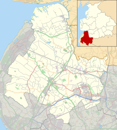 Holmes Location in West Lancashire  Holmes Location within Lancashire | |
| Population | 5,350 2001 Census (Tarleton Parish) |
| OS grid reference | SD433194 |
| Civil parish |
|
| District | |
| Shire county |
|
| Region |
|
| Country | England |
| Sovereign state | United Kingdom |
| Post town | PRESTON |
| Postcode district | PR4 |
| Dialling code | 01772 |
| Police | Lancashire |
| Fire | Lancashire |
| Ambulance | North West |
| UK Parliament |
|
The hamlet is administered by West Lancashire District Council and Tarleton parish council.[1] Holmes and neighbouring Mere Brow were part of the ancient parish of North Meols but now are part of Tarleton parish.
Holmes has a small church. The main business is Huntapac, a farming company that grows and supplies vegetables to supermarkets.[2]
Places adjacent to Holmes, Lancashire | ||||||||||||||||
|---|---|---|---|---|---|---|---|---|---|---|---|---|---|---|---|---|
| ||||||||||||||||
References
- Local Governance, Tarleton Parish Council, archived from the original on 9 March 2012, retrieved 19 March 2011
- "Huntapac Produce Ltd | Huntapac Produce Ltd".
External links
![]() Media related to Holmes, Lancashire at Wikimedia Commons
Media related to Holmes, Lancashire at Wikimedia Commons
This Lancashire location article is a stub. You can help Wikipedia by expanding it. |
Другой контент может иметь иную лицензию. Перед использованием материалов сайта WikiSort.org внимательно изучите правила лицензирования конкретных элементов наполнения сайта.
WikiSort.org - проект по пересортировке и дополнению контента Википедии