world.wikisort.org - United_Kingdom
Greenhalgh-with-Thistleton is a civil parish on the Fylde in Lancashire, England. In 2001 it had a population of 462,[1] falling to 439 at the 2011 Census.[2]
| Greenhalgh-with-Thistleton | |
|---|---|
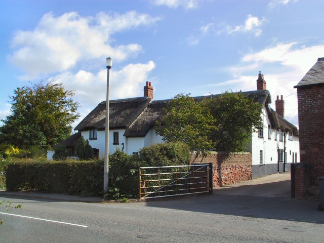 Thatched farm house and buildings at Thistleton | |
 Greenhalgh-with-Thistleton Shown within Fylde Borough  Greenhalgh-with-Thistleton Shown within the Fylde  Greenhalgh-with-Thistleton Location within Lancashire | |
| Population | 439 (2011) |
| OS grid reference | SD406378 |
| Civil parish |
|
| District |
|
| Shire county |
|
| Region |
|
| Country | England |
| Sovereign state | United Kingdom |
| Post town | PRESTON |
| Postcode district | PR4 |
| Dialling code | 01995 |
| Police | Lancashire |
| Fire | Lancashire |
| Ambulance | North West |
| UK Parliament |
|
The parish is in the Borough of Fylde, and contains the hamlets of Greenhalgh, Thistleton, Esprick and Corner Row. It is part of the ward of Singleton and Greenhalgh, which elects one councillor.[3] In 2015 it was represented by Maxine Chew, an independent councillor.[4]
The main road through the parish is the A585 Kirkham to Fleetwood road; there is also a junction with the M55 motorway (M55 J3, Wesham Circle) in the south of the parish. The linear settlement of Esprick is situated along the A585, with Corner Row (used to be known as Cornah Row until M55 was completed 1975) further south where the road crosses the M55. Greenhalgh is to the west, and Thistleton in the north east corner of the parish. Greenhalgh is adjacent to Wesham. The surrounding area is agricultural land.
Thistleton has been designated as a conservation area since 1975.[5]
The nearest railway station is Kirkham and Wesham, with Poulton-le-Fylde a little further away.
History
The Doomsday Book records the village as "Greneholf".[6]
On Fleetwood Old Road is the former Ebenezer Congregational chapel, founded in 1851 and now converted into a private dwelling.[7]
Etymology
Greenhalghe came from OE grēne "green" and healh, halh "corner, hook; haugh" (related to holh "hollow; cave"). The name is pronounced as /ˈɡriːnhælʃ/ or /ˈɡriːnhɔːlʃ/.[8]
See also
- Listed buildings in Greenhalgh-with-Thistleton
References
- Office for National Statistics : Census 2001 : Parish Headcounts : Fylde Retrieved 8 February 2010
- UK Census (2011). "Local Area Report – Greenhalgh-with-Thistleton Parish (E04005165)". Nomis. Office for National Statistics. Retrieved 26 March 2021.
- The Stationery Office: The Borough of Fylde (Electoral Changes) Order 2001 Retrieved 8 February 2010
- "Singleton and Greenhalgh". Fylde Borough Council. Retrieved 9 March 2016.
- "Conservation Areas and Article 4 Directions". Fylde Borough Council. Archived from the original on 16 December 2008. Retrieved 31 December 2008.
- Fishwick, Henry (1874), The History of the Parish of Kirkham, in the County of Lancaster, published by the Chetham Society, ("Remains Historical and Literary connected with the Palatine Counties of Lancaster and Chester - VOL XCII"), p. 8
- "Ebenezer, Greenhalgh - Congregational". genuki.org.uk. 31 May 2011. Retrieved 13 October 2013.
- Pointon, G.E. (1983) BBC Pronouncing Dictionary for British Names, 2nd. ed.,Oxford: Oxford University Press, ISBN 9780192129765
External links
- Greenhalgh-with-Thistleton on British History Online
- Greenhalgh with Thistleton at genuki
Geography of the Borough of Fylde | ||
|---|---|---|
| Towns |
| |
| Villages |
| |
| Parishes |
| |
| Topography |
| |
Другой контент может иметь иную лицензию. Перед использованием материалов сайта WikiSort.org внимательно изучите правила лицензирования конкретных элементов наполнения сайта.
WikiSort.org - проект по пересортировке и дополнению контента Википедии