world.wikisort.org - United_Kingdom
Great Whelnetham (sometimes Great Welnetham[3]) is a village and civil parish in the West Suffolk district of Suffolk in eastern England. Located around two miles south of Bury St Edmunds, in 2005 its population was 820.[1]
| Great Whelnetham | |
|---|---|
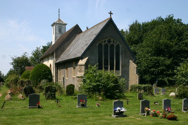 Church of St Thomas à Becket | |
 Great Whelnetham Location within Suffolk | |
| Population | 820 (2005)[1] 849 (2011)[2] |
| District |
|
| Shire county | |
| Region |
|
| Country | England |
| Sovereign state | United Kingdom |
| Post town | Bury St Edmunds |
| Postcode district | IP30 |
| Police | Suffolk |
| Fire | Suffolk |
| Ambulance | East of England |
The parish also contains the hamlet of Cocks Green, and the village of Sicklesmere, with which Great Whelnetham is contiguous. Until the Beeching Axe, the area was served by Welnetham railway station on the Long Melford-Bury St Edmunds branch line.
In 2019, an excavation of an 4th-century Roman cemetery in Great Whelnetham uncovered unusual burial practices. Of 52 skeletons found, up to 40% had been decapitated, which archaeologists claimed gave new insight into Roman traditions. The burial ground includes the remains of men, women and children who likely lived in a nearby settlement. The decapitated skeletons represent "quite a rare find".[4]
History
Demography
According to the Office for National Statistics, at the time of the United Kingdom Census 2001, Great Whelnetham had a population of 830 with 349 households,[5] increasing to 849 in 348 households at the 2011 Census.
Population change
| Year | 1801 | 1811 | 1821 | 1831 | 1841 | 1851 | 1881 | 1891 |
|---|---|---|---|---|---|---|---|---|
| Population | 222 | 266 | 399 | 422 | 514 | 552 | 440 | 362 |
| Year | 1901 | 1911 | 1921 | 1931 | 1951 | 1961 | 2001 | 2011 |
| Population | 357 | 366 | 359 | 315 | 442 | 444 | 830 | 849 |
| Source: A Vision of Britain Through Time[6] | ||||||||
Location grid
Neighbouring villages, and hamlets | ||||||||||||||||
|---|---|---|---|---|---|---|---|---|---|---|---|---|---|---|---|---|
| ||||||||||||||||
References
- Estimates of Total Population of Areas in Suffolk Archived 2008-12-19 at the Wayback Machine Suffolk County Council
- "Civil Parish population 2011". Neighbourhood Statistics. Office for National Statistics. Retrieved 21 August 2016.
- Ordnance Survey: Explorer 211. Shows the civil parish as "Great Whelnetham" but the village as "Great Welnetham". Village signs all show "Great Whelnetham".
- "Decapitated bodies found in Roman cemetery in Great Whelnetham". BBC News. 7 January 2019. Retrieved 6 February 2021.
- "Suffolk County Council - 2001 Census Profiles" (PDF). Archived from the original (PDF) on 28 September 2011. Retrieved 22 February 2011.
- "A Vision of Britain Through Time". University of Portsmouth & others. Retrieved 22 February 2011.
External links
![]() Media related to Great Whelnetham at Wikimedia Commons
Media related to Great Whelnetham at Wikimedia Commons
This Suffolk location article is a stub. You can help Wikipedia by expanding it. |
Другой контент может иметь иную лицензию. Перед использованием материалов сайта WikiSort.org внимательно изучите правила лицензирования конкретных элементов наполнения сайта.
WikiSort.org - проект по пересортировке и дополнению контента Википедии