world.wikisort.org - United_Kingdom
Godalming /ˈɡɒdəlmɪŋ/ is a market town and civil parish in southwest Surrey, England, around 30 mi (48 km) southwest of central London. It is in the Borough of Waverley, at the confluence of the Rivers Wey and Ock. The civil parish covers 3.74 sq mi (9.7 km2) and includes the settlements of Farncombe, Binscombe and Holloway Hill. Much of the area lies on the strata of the Lower Greensand Group and Bargate stone was quarried locally until the Second World War.
| Godalming | |
|---|---|
| Market town and Civil parish | |
 Church of St. Peter & St. Paul, Godalming | |
 Godalming Location within Surrey | |
| Area | 9.68 km2 (3.74 sq mi) |
| Population | 21,804 (Civil Parish 2011)[1] or 22,689 in its Built-up Area[2] |
| • Density | 2,252/km2 (5,830/sq mi) |
| OS grid reference | SU9744 |
| • London | 30.5 miles (49.1 km) |
| Civil parish |
|
| District |
|
| Shire county | |
| Region | |
| Country | England |
| Sovereign state | United Kingdom |
| Post town | Godalming |
| Postcode district | GU7 |
| Dialling code | 01483 |
| Police | Surrey |
| Fire | Surrey |
| Ambulance | South East Coast |
| UK Parliament |
|
The earliest evidence of human activity is from the Paleolithic and the River Wey floodplain at Charterhouse was settled in the middle Iron Age and Roman period. The modern town is thought to have its origins in the 6th or early 7th centuries and its name is thought to derive from that of a Saxon landowner. Kersey, a woollen cloth, dyed blue, was produced at Godalming for much of the Middle Ages, but the industry declined in the early modern period. In the 17th century, the town began to specialise in the production of knitted textiles and in the manufacture of hosiery in particular.
Throughout its history, Godalming has benefitted from its location on the main route from London to Portsmouth Dockyard. Local transport links were improved from the early 18th century with the opening of the turnpike road through the town in 1749 and the construction of the Godalming Navigation in 1764. Expansion of the settlement began in the mid-19th century, stimulated by the opening of the first railway station in 1847 and the relocation of Charterhouse School from London in 1872. The town has a claim to be the first place in the world to have a combined public and private electricity supply.
Several buildings in the town centre date from the 16th and 17th centuries. The distinctive Pepperpot was built in 1814 to replace the medieval market house and the upper floor was used as a council chamber. Among the notable former residents of the civil parish were Jack Phillips, the senior wireless operator on the RMS Titanic and the mountaineer, George Mallory. James Oglethorpe, the founder of the Colony of Georgia, was born in Godalming in 1696 and the town maintains a friendship with the U.S. state and the cities of Savannah and Augusta in particular.
Toponymy
The oldest surviving record of Godalming is from a c. 1000 copy of the c. 880 – c. 885 will of Alfred the Great, in which the settlement appears as Godelmingum. The name is written as Godelminge in Domesday Book and later as Godelminges (c. 1150 – c. 1200), Godhelming (c. 1170 – c. 1230), Godalminges (c. 1220 – c. 1265) and Godalmyn (c. 1485 – c. 1625).The second part of the name is thought to derive from the Old English —ingas and means "people of" or "family of" and the first may refer to a Anglo-Saxon individual called Godhelm.[3][note 1] Thomas William Shore (1840–1905) suggested that Godhelm may be of Gothic origin[5] and Robert Eugen Zachrisson (1880–1937) suggested that Godhelm may have been an early name for the River Ock or another local stream.[3] Residents of Godalming are sometimes called "Godhelmians".[6][7]
The first records of Binscombe and Busbridge are from the 13th century, when they appear as Budenscombe and Bursbrige respectively. They are thought to derive from individuals called Byden and Beohrtsige, names both found in Old English. Catteshall may mean "hill of the wild cat" or "hill belonging to a person called Catt".[3] Farncombe appears in Domesday Book as Fearnecombe and is thought to mean "valley of the ferns".[8] Frith Hill may derive from the Middle English frith, meaning "woodland".[9]
Geography


Location and topography
Godalming is in southwest Surrey, England, around 30 mi (48 km) southwest of central London and 4 mi (6 km) south of Guildford.[10] The town centre is to the south of the River Wey, close to its confluence with the River Ock. The Weald, a remnant forest of small wooded settlements, adjoins the town to the south-west. The North Downs Area of Outstanding Natural Beauty is 2.9 mi (4.7 km) north of the town centre.[10]
Elevations vary between 36 m (118 ft) AOD by the Guildford Road Rugby Union ground and Broadwater lake at the River Wey's exit from Godalming into Peasmarsh, Shalford, and 106 m (347.76 ft) AOD where Quarter Mile meets Hambledon Road (both residential) in the south-east. Hurtmore Road is also residential: Upper Green/Hurtmore is at 102 m (334.64 ft) AOD. Immediately north and south of the town centre, steep hills reach 95 m (311.67 ft) AOD from 40-45m (131.23-147.63 ft) AOD in the town centre itself.[10]
Geology
Godalming lies on the northwestern side of the Weald and primarily sits on the strata of the Lower Greensand Group, which were laid down in the early Cretaceous.[11] Atherfield Clay is found in the extreme north of the civil parish at Binscombe, where there was a former brickworks. Holloway Hill and much of the town centre are on the Hythe Beds, a loamy, fine-grained sandy layer that also includes some sandstone and chert. Although rare elsewhere in these strata, fossils of mollusc species occur in these beds in the Godalming area, including the bivalves Ostrea macroptera and Exogyra sinuata, and the brachiopods Rhynchonella parvirostris and Waldheimia tamarindus.[11][12]
Frith Hill and Charterhouse are on the iron-rich Bargate Beds, a part of the more widespread lower Sandgate Formation that is only found in the Godalming area. This layer contains Bargate stone, a dark honey-coloured calcerous sandstone that was quarried until the Second World War at several sites in the civil parish.[13][14][15] There are also small exposures of the sandy Folkestone Beds at Busbridge and to the northwest of Charterhouse.[16] River gravels are found in the valleys of the Wey and Ock to the west and south of the town centre, and as a terrace at Farncombe.[11][17] Alluvial deposits of sand and silt are found in the floodplain of the Wey, especially between Bridge Street and Cattershall.[11][18]
History
Early history
![Bronze Age arrowhead, found in Godalming in 2017[19]](http://upload.wikimedia.org/wikipedia/commons/4/44/A_Bronze_Age_barbed_and_tanged_arrowhead%2C_Godalming.jpg)
The earliest evidence of human activity in the Godalming area is from the Stone Age. At least two Paleolithic hand axes[20] as well as Mesolithic flint blades[21] and flakes[22][23] have been found in the civil parish. In 2017, a local schoolboy found a Bronze Age barbed and tanged arrowhead, which he subsequently donated to Godalming Museum.[19] The higher ground above the River Wey floodplain at Charterhouse was occupied during the middle Iron Age[24] and human habitation is thought to have continued into the early Roman period.[25] There is thought to have been a small farmstead on the site in the late first century C.E.[26] and there was a villa at Binscombe.[27][note 2]
![An early Anglo-Saxon spearhead, found in Farncombe in 1985[28]](http://upload.wikimedia.org/wikipedia/commons/a/aa/Early_medieval%2C_Spearhead_%28FindID_223955%29.jpg)
The Anglo-Saxon settlement at Godalming is thought to have been founded in the 6th or early 7th centuries, in the area surrounding the parish church.[29][30][note 3] The oldest stonework in the church dates from c. 820 – c. 840 and the base of the west wall of the tower is of Anglo-Saxon origin.[32] The earliest documentary evidence for Godalming, is from the will of Alfred the Great in 880, in which the settlement and surrounding land is left to his nephew, Æthelwold ætheling.[33][34] By the end of the Anglo-Saxon period, the town was the administrative centre of the Godalming Hundred, which stretched from Puttenham in the northwest to Chiddingfold in the southeast.[33]
Governance
The town appears as Godelminge in Domesday Book. In 1086, it was held by Ranulf Flambard,[35] who also held Tuesley and parts of Guildford.[36][37][note 4] The manor had sufficient land for 25 plough teams. It included 40 acres of meadow, woodland for 103 swine, three mills, two churches, and generated an annual income of £34.[35] Farncombe appears in Domesday book as Fernecome and was held by Odo of Bayeux.[38]
At some point in the late 11th century, the Manor of Godalming was divided into two parts. The King's Manor was held by the Crown through the 12th century. There is evidence to suggest that it was held by Stephen de Turnham in 1206, but in 1221 it was granted to the Bishop of Salisbury by Henry III. It was held by the Bishop until 1541, when it was conveyed to Thomas Paston, who returned it to the Crown the following year. It was held by the monarch through the Tudor period until 1601, when Elizabeth I sold it to George More of Loseley Park.[39][40]
The second part of the Manor of Godalming, known as the Rectory Manor or Deanshold, was granted to Salisbury Cathedral by Henry I in the early 12th century. It remained in the custodianship of the Dean and Chapter until the mid-19th century. For much of its history, the manor was leased by the Castillion family, but was held by the Ogelthorpe family in the 18th century. In 1846, the Rectory Manor was transferred to the Ecclesiastical Commissioners, who began to break up and sell off the estate in the early 1860s.[39]
The first charter to be granted to Godalming was issued by Edward I on 7 June 1300. In it, he authorised a weekly market and a three-day annual fair on the Feast of Saints Peter and Paul in late June.[41] The right to hold a market was confirmed by Elizabeth I in 1563[40] and, in January 1575, the Queen issued a Charter of Incorporation, enabling Godalming to become a self-governing borough. The charter specified that a "warden" (effectively a mayor) should be elected by the town each year at Michaelmas.[42] In 1620, Francis Bacon, the Lord Chancellor under James I, issued a document entitled "Ordinances and constitutions made and established for the better and government of the Town of Godalming in the County of Surry", which specified that the administration of the town should be the responsibility of the Warden and eight assistants. It also provided for the appointment of a bailiff and restricted the amount of time that townspeople could spend in local inns and hostelries.[43]
The modern system of local government began to emerge in the first half of the 19th century. Under the Municipal Corporations Act 1835, the town became a borough corporation under the control of a Mayor and elected councillors.[44] The following year, the Guildford Poor Law Union was formed, with responsibility for a total area of 12 sq mi (31 km2) stretching from Godalming to Woking.[45] As a result of the Local Government Act 1888, several responsibilities were transferred from the borough to the newly formed Surrey County Council. Farncombe was originally a separate civil parish, but became part of Godalming borough in 1892.[46] The most recent change in local government took place in 1974, when the municipal boroughs of Godalming and Haslemere were merged with the Farnham Urban District and Hambledon Rural District to form Waverley District.[47] At the same time, Godalming Town Council was constituted as the lowest tier of local government in the civil parish.
Commerce and industry
The right to hold a market was granted to Godalming in 1300 by Edward I. It probably took place each week at the junction of Church Street and the High Street.[41] The right was confirmed in the 1563 charter of Elizabeth I, which stipulated that the market should be held every Wednesday.[40] In 1674, the day was changed to Friday, but had reverted to Wednesday by the start of the 19th century. The market ceased in around 1879.[42] The right to hold an fair each July was also granted in the charter of 1300 and continued to be held until 1870. A second annual fair, to take place over three days around Candlemas in February was granted by Elizabeth I. By the start of the 19th century, the fair had been reduced to a single day and is last recorded in 1910.[42]
Three watermills are recorded in the entry for Godalming in Domesday Book.[34][35] Although their identities are uncertain, the present day Catteshall, Hatch and Westbrook Mills on the River Wey are thought to be the likely locations of the mills in the late-11th century.[14][48] Hatch Mill, close to the parish church, may be the oldest mill site in Godalming.[14] Catteshall Mill, to the northeast of the town centre, is first recorded in 1300 and was used for milling corn from c. 1660 until 1836. The two Westbrook Mills, also on the Wey, are around 100 m (110 yd) apart and are not clearly distinguished in historical records until the mid-19th century, when the upper mill became known as Salgasson Mill.[48]
Godalming's medieval prosperity was founded on the wool trade. The North Downs provided good grazing land for sheep, there were local deposits of Fuller's earth in Surrey and the Wey provided a source of both water and power for fulling mills. Like Guildford, to the north, the town specialised in the manufacture of kersey, a coarse cloth, dyed blue.[49][50][note 5] Fulling took place at Catteshall Mill between 1300 and 1660, and at the Westbrook Mills in the 17th and early-18th centuries.[48] Dyers are known to have been active in the town in the 17th century, but the industry went into a steep decline in the middle of the century.[49] Woollen cloth production ended at Guildford in the 1710s, but continued on a small scale in Godalming for around another 100 years.[51][52]
![Stocking frame held by Godalming Museum.[53][note 6]](http://upload.wikimedia.org/wikipedia/commons/3/34/Stocking_frame%2C_Godalming_Museum%2C_Surrey.jpg)
As the manufacture of woollen cloth declined in Godalming, it was replaced by the production of knitted and woven textiles. A cottage industry developed in the town in the 17th century, producing woollen, silk and later cotton garments.[51][54] Hosiery was knitted using a stocking frame invented by William Lee in the 1580s.[53] Until the 18th century, most garments were produced by families working at home, but thereafter the industry became increasingly centralised. George Holland set up a factory in around 1790 for the manufacture of "Fleecy and Segovia Hosiery", using specially prepared wool.[51] The Pitchers company was established in the town in 1885 and produced "Charterhouse sweaters", among other woollen items. The firm, which closed in the 1960s, is credited with the invention of a machine to produce the cable stitch.[55]
Leather production was a significant part of the local economy from the mid-15th to mid-20th centuries.[56] Tanneries are recorded at several sites in the town, including at Ockford Road, Meadrow and Cattershall Lock. In 1808, a "bark house" was erected in Mill Street for grinding bark[51] and chamois leather was produced at the Westbrook Mills in the 19th century. The final leather producer in Godalming closed in 1952.[57][note 7]
The Godalming area was an important centre for papermaking and, in the early-17th century, several mills in the town produced coarse sheets of "whited brown paper".[51] Papermaking took place at the Westbrook Mills in the 17th and early 18th centuries, and at Catteshall Mill from the 1660s until 1928.[48][60][61][note 8]
Transport and communications

A ford across the Wey at the site of the current Town Bridge was established by the 12th century and, in late-medieval times, there was also a bridge owned by the Lord of the Manor at this location. but the ford was used by townspeople except in times of flood.[30][note 9] The road through Godalming between Kingston upon Thames and Petersfield was turnpiked in 1749[63] and the present Town Bridge was constructed in 1782 by the County Surveyor, George Gwilt.[64][note 10][note 11] The road south from the town centre through Busbridge to Hascombe was turnpiked in 1826.[65]

The Wey has been used for navigation since ancient times and it is likely that wool, cloth and timber were transported via the unimproved river during the medieval period. The River Wey Navigation, between the River Thames and Guildford was authorised by Act of Parliament in 1651.[66][67] Although its southern terminus was four miles from the town, the opening of the new waterway had a positive impact on the economy of Godalming.[68][69] The Wey Navigation Act 1760 authorised the construction of the Godalming Navigation, which opened with four locks in 1764.[69][70] A 10-acre (4.0 ha) wharf was constructed on the south side of the river, close to the town centre.[71] The busiest period for the navigation was during the 1810s, when timber, flour, and goods made of iron were shipped from Godalming, but after the arrival of the railway in 1845, it went into sharp decline.[64] After 1918, there were only two barges working the river south of Guildford and the final shipments from Godalming took place in 1925. The Godalming Navigation passed to the National Trust in 1968.[72]
The first railway station in Godalming opened in 1847 on the north side of the Wey.[73] It was the southern terminus of the line, built by the London and South Western Railway (LSWR) from Guildford.[73] The line to Havant was contructed speculatively by the engineer, Thomas Brassley. The 32.75 mi (52.71 km) line was initially single track and joined the branch from Guildford to the north of the first railway station.[74] Although construction was completed in 1858, the first passenger trains south of Godalming did not run until January of the following year.[73] Initially there were four services in each direction per day between Guildford and Havant, which had increased to seven (with a single short working to Petersfield by 1890.[75] The opening of the line necessitated the building of the current railway station, although the original station was retained until 1969 for freight.[76][note 12] Farncombe railway station, the only intermediate station between Guildford and Godalming, opened on 1 May 1897.[78][79] The line south of Godalming was doubled in 1871[80] and was electrified in 1937.[81]
In the late 19th century, improvements in the local road network included the construction of Borough Road and Borough Bridge in the 1870s to link the newly opened Charterhouse School to the town centre.[82] The 9.1 mi (14.6 km) Guildford and Godalming bypass (now the A3) was opened in July 1934.[83] In the 1990s, Flambard Way was built to divert through traffic around the town centre. Its construction divided Queen Street in two[84] and severed the connections from Mill Lane and Holloway Hill to the High Street.[85][note 4]
Residential development
The basic layout of Church Street, the High Street and Bridge Street are thought to have been established by the 13th century and may be pre-conquest in origin. The Saxon settlement was concentrated in the Bridge Street area and the town expanded along the modern High Street in the 11th and 12th centuries. The first houses may have been constructed in The Mint in the late 13th or early 14th centuries. The town does not appear to have expanded significantly in early modern period, although the oldest surviving buildings in the centre date from the 16th century.[30] The settlement at Binscombe village grew up in the medieval period around Binscombe Farm. Much of the hamlet, including the original farmhouse, is designated a Conservation Area.[86]
Godalming began to grow in the mid-19th century, catalysed by the opening of the first railway station in 1849 and the arrival of Charterhouse School in 1872.[73][note 13] Cottages were constructed in Crownpits in the 1880s and farmland to the south of the town centre was sold for development in the same decade. Summerhouse, Busbridge and Oakdene Roads had been laid out by the mid-1890s and the first houses built fronting them.[88] The area north of Home Farm Road was developed in the 1970s and the Bargate Wood estate was built in the 1980s.[89]
Farncombe began to grow in the early Victorian era, with terraced housing, semi-detached houses and larger villas being built along new streets branching from existing roads such as Hare Lane, Summers Road and Farncombe Street.[86] Until the mid-19th century, Charterhouse and Furze Hill were part of Deanery Farm, although much of the latter was woodland.[9][note 14] In 1865, the land was sold in lots, with 70 acres (28 ha) being acquired for the site of Charterhouse School. Houses in Deanery and Peperharrow Roads were built in the early 1870s, but in the mid-20th century many were either divided into flats or demolished, and higher-density housing was constructed on their former gardens. In the 1960s, the school vacated its properties on Frith Hill Road and on Markenholm, and the sites were sold for residential development.[9] Housing on The Brambles was constructed in the mid-1980s.[90] The most recent major developments in Farncombe took place in the early 21st century off Furze Lane.[86]
The first council housing in the civil parish was constructed in 1920 around The Oval and Broadwater Lane in Farncombe.[86] The first 168 houses on the Ockford Ridge estate, west of the town centre, were completed in 1931 and were followed by a further 32 new homes on Cliffe Road in 1935. After the Second World War, the Aarons Hill development was built on the site of the former Ockford House.[91] The Binscombe estate was constructed in the 1950s, to the northwest of Farncombe.[92][86]
Godalming in the world wars
During the First World War, soldiers were billeted at nearby Witley Camp. A canteen was set up in Croft Road for those arriving via Godalming station.[93] Allotments were planted at the Whitehart Field cricket ground[94] and villagers in Busbridge were employed to manufacture baskets for 18 lb high-explosive shells. In October 1914, the Red Cross opened a hospital for wounded soldiers at Charterhouse School.[95]
During the Second World War, the defence of Godalming was the responsibility of the 4th Battalion of the Surrey Home Guard, part of South East Command.[96] A total of 213 bombs fell on the town, including two V-1 flying bombs, although no civilians were killed.[97][98] In September 1939, around 40 children were evacuated to Busbridge from Wandsworth[99] and several houses in Godalming were requisitioned to provide accommodation for soldiers.[100] St Thomas's Hospital Medical School was also evacuated to Godalming and used the Charterhouse School science laboratories to teach in. Many students joined local home guard.[101] A British Restaurant was opened in Angel Yard and Branksome House, in Filmer Grove, served as a district control centre.[100] The manufacturer, RFD, set up a factory in Catteshall Lane to produce barrage balloons, inflatable boats and life jackets and, by the end of the war, was employing over 1000 local people.[102]
National and local government
UK parliament
The entirety of the Godalming Civil Parish is in the parliamentary constituency of South West Surrey and has been represented at Westminster since May 2005 by Conservative Jeremy Hunt.[103][104] Between 1984 and 2005, the seat was held by Virginia Bottomley, who was elevated to the House of Lords as Baroness Bottomley of Nettlestone in the year she left the House of Commons.[104][105]
County Council
Surrey County Council, headquartered in Reigate, is elected every four years. Godalming is represented by two councillors.[106]
| Election | Member[106] |
Ward | |
|---|---|---|---|
| 2017 | Penny Rivers | Godalming North | |
| 2021 | Paul Follows | Godalming South, Milford and Witley | |
Borough Council

The town is divided into five wards; Binscombe, Central and Ockford, Charterhouse, Farncombe and Catteshall, and Holloway.[107] Godalming has 10 representatives governing the Borough of Waverley, headquartered in Godalming:
| Election | Member[108] |
Ward | |
|---|---|---|---|
| 2019 | Paul Rivers | Godalming Binscombe | |
| 2019 | Nick Palmer | Godalming Binscombe | |
| 2017 | Paul Follows | Godalming Central and Ockford | |
| 2019 | Anne-Marie Rosoman | Godalming Central and Ockford | |
| 2019 | Steve Williams | Godalming Charterhouse | |
| 2019 | Steve Cosser | Godalming Charterhouse | |
| 2019 | Penny Rivers | Godalming Farncombe and Catteshall | |
| 2019 | George Wilson | Godalming Farncombe and Catteshall | |
| 2019 | Joan Heagin | Godalming Holloway | |
| 2010 | Peter Martin | Godalming Holloway | |
Godalming Town Council
Godalming Town Council is the lowest tier of local government in the civil parish. A total of 20 councillors is elected every four years. Each year, one councillor is chosen as the Mayor, who represents the town on civic occasions and who is recognised as the principal citizen of Godalming.[109] Godalming is twinned with Mayen, Germany (April 1982) and Joigny, France (May 1985).[110][111] The town retains strong friendship links with the state of Georgia, USA, and with the cities of Savannah and Augusta in particular, through the organisation, the Friends of Oglethorpe.[112] Since 2011, the town council has held the power to confer the titles of "Honorary Freeman" and "Honorary Freewoman" on residents who have demonstrated outstanding service to or made a significant contribution to the community. As of 2022, two people (Zadie Caudle and John Young) have been recognised in this way.[113]
Demography and housing
| Output area | Population | Households | Owned outright | Owned with a loan | Social rented | Private rented |
|---|---|---|---|---|---|---|
| Godalming Binscombe[114] | 4,087 | 1,698 | 30.8% | 31.2% | 30.3% | 5.8% |
| Godalming Central and Ockford[115] | 4,692 | 1,984 | 26.6% | 34.5% | 18.3% | 19.2% |
| Godalming Charterhouse[116] | 4,105 | 1,575 | 34.0% | 35.1% | 5.1% | 22.2% |
| Godalming Farncombe and Catteshall[117] | 4,600 | 2,091 | 29.8% | 35.7% | 13.0% | 17.7% |
| Godalming Holloway[118] | 3,287 | 1,633 | 45.1% | 44.0% | 2.3% | 7.5% |
| Total for Godalming Civil Parish[1] | 21,804 | 8,954 | 32.8% | 36.0% | 14.1% | 14.8% |
| South East Region | 8,634,750 | 3,555,463 | 35.1% | 32.5% | 13.7% | 16.3% |
| Output area | Detached | Semi-detached | Terraced | Flats and apartments |
|---|---|---|---|---|
| Godalming Binscombe[114] | 26.4% | 45.5% | 20.1% | 8.0% |
| Godalming Central and Ockford[115] | 16.7% | 36.0% | 21.8% | 25.4% |
| Godalming Charterhouse[116] | 36.1% | 17.3% | 12.0% | 34.6% |
| Godalming Farncombe and Catteshall[117] | 16.4% | 35.0% | 25.4% | 23.2% |
| Godalming Holloway[118] | 64.0% | 19.8% | 10.8% | 5.4% |
| Total for Godalming Civil Parish[1] | 30.3% | 31.3% | 18.6% | 19.8% |
| South East Region | 28.0% | 27.6% | 22.4% | 21.2% |
Public services
Utilities

For much of the town's history, residents obtained drinking water from local rivers or from wells.[119] In the early 19th century, a hand-operated pump was installed next to the Pepperpot in the High Street.[120][note 15] A 45 m deep (148 ft) well was dug at Charterhouse to supply the school with water. Water mains were installed in Godalming and Farncombe c. 1880 and were fed from a water tower on Frith Hill.[119][121] In 1899, the borough council purchased the water tower, becoming responsible for the drinking water supply to the town until 1974.[122] In that year, the water tower was decommissioned and a new covered reservoir was opened at Sandy Lane.[123]
The town sewerage system was constructed in 1894 and included a sewage works at Unstead Farm, to the north of Farncombe.[73] Until this point, waste water had been disposed of in cess pits in the town, resulting in the contamination of drinking water wells and outbreaks of cholera and typhoid are recorded in the 18th and 19th centuries.[124] The municipal tip was opened next to the sewage works in the early 1900s.[73][note 16]
The Godalming Gas and Coke Company was established in 1825[125] and purchased part of Godalming Wharf for the site of its gasworks.[126][71] Gas was provided for street lighting between 1836 and 1881, and again from 1884 to 1900. The coal required initially arrived by barge, but was delivered by train after the first railway station opened in 1849. The gasworks closed in 1957, when the town supply was linked to that of Guildford.[119]

Godalming has a claim to be the first town in the world to have a combined public and private electricity supply.[127] The price of gas had risen during the 1870s and the borough sought an alternative method of providing street lighting.[57] In 1881, the London firm of Calder and Barrett installed a generator driven by two Poncelet waterwheels at Westbrook Mill. The electricity was used to power three 250 V arc lights at the mill and overhead cables were run above Mill Street to the town centre, where four further arc lights had been installed. A second, 40 V circuit supplied 34 incandescent lamps (of which seven were at the mill and the remainder were in the town centre). The scheme met with mixed success and there were criticisms that the lights in the town centre were too dim, while those at the mill were too bright.[125][127] By the end of 1881, the generator had been moved to the rear of the White Hart pub, where it was driven by a steam engine[127] and in April of the following year, Siemens took over the operation. The electricity supply continued until 1884, when Siemens refused to bid for the renewal of its contract and the town reverted to gas lighting.[125][127]
The second power station in Godalming was opened in Borough Road in 1902.[128] By the end of the following year, two 90 kW and one 200 kW steam-powered generators had been installed, which were replaced in 1928 by a 200 kW diesel-driven generator.[125] Under the Electricity (Supply) Act 1926, Godalming was connected to the National Grid, initially to a 33 kV supply ring, which linked the town to Guildford, Hindhead, Woking and Aldershot. In 1932, the ring was connected to the Wimbledon-Woking main via a 132 kV substation at West Byfleet.[129] By the time of its closure in 1949, the Borough Road power station had an installed capacity of 600 kW.[128]
Emergency services
From the early part of the 17th century, the borough appears to have employed a "bedle" or "bellman" to apprehend troublemakers and, in 1747, there is a reference to a "cage prison" in Godalming. By 1762, a uniformed town watchman was employed with an annual salary of £10 and a "constable of Godalming" is first recorded in 1817.[130] The borough police force was formed in 1836 and briefly became part of the county force from 1851-1857.[131] By 1868, the police station was in Moss Lane and had three cells capable of holding a total of nine people. The force was led by had superintendent, assisted by a constable, a night watch and several special constables.[132]
In 1889, the borough force became part of the Surrey Constabulary, following the Local Government Act 1888.[132] A new police station, built on the site of the former gasworks, opened in 1969 and closed in 2012.[119][133] In 2022, policing in the civil parish is the responsibility of Surrey Police and the nearest police station run by the force is at Guildford.[134][135]

The first fire station in Godalming was constructed in Moss Lane in 1816. It housed a manual fire pump, mounted on a pushcart, that could be used by local residents when the need arose. It was not until 1870 that the town fire brigade was formally constituted, initially as a volunteer force, with the equipment funded by public subscription.[136][137] Six years later, the station moved to Godalming Wharf and, in 1894, the borough took over the running of the brigade. From this point onwards, the firefighters were paid for each incident that they attended, with costs being paid by each property owner who used their services.[136][138] In 1904, the borough purchased a horse-drawn steam pump and, in May of the same year, the force moved to a new fire station in Queen Street.[139][140] During the Second World War, the became part of the National Fire Service and, in 1948, Surrey Fire and Rescue Service was formed. The fire brigade moved to the current station in Bridge Road in 1972.[136][139]
In 2022, the local fire authority is Surrey County Council and the statutory fire service is the Surrey Fire and Rescue Service.[141] Godalming Ambulance Station, in Cattershall Lane, is run by the South East Coast Ambulance Service.[142]
Healthcare
The Meath Epilepsy Charity was founded in 1892 by Mary Jane Brabazon, Countess of Meath. She purchased Westbrook House and opened the "Home of Comfort for Epileptic Women and Girls". By 1920, The Meath, as it became known, was offering residential care for 87 patients.[143][144] In 2020, 82 adults with epilepsy were offered residential care and the charity supported an additional 30 clients.[145] Changing Perceptions, in Godalming High Street, is The Meath's social enterprise and offers patients opportunities to work in the furniture workshop and in the café.[146]
The nearest hospital with an A&E is the Royal Surrey County Hospital, 6.3 km (3.9 mi) from Godalming.[147] As of 2022, the town has two GP practices, one at Cattershall Mill and one at Binscombe.[148]
Transport
Bus and train

Godalming is linked by a number of bus routes to surrounding towns and villages in southwest Surrey. Operators serving the town include Compass Bus, Stagecoach and the Compo Community Bus.[149]
South Western Railway operates all services from both Godalming and Farncombe stations. Trains run to London Waterloo via Guildford and to Portsmouth Harbour via Haslemere.[150][151] There is a taxi rank at Godalming station.[152]
River navigation

The River Wey is navigable from Godalming northwards to Weybridge and the navigation authority is the National Trust.[153] The head of navigation is at Godalming Wharf, about 50 m (55 yd) downstream of Town Bridge. Catteshall Lock has a fall of 1.7 m (5.6 ft) and is the southernmost lock on the connected inland waterways of Great Britain.[154][155]
Long-distance cycleway and footpath
The Farnham Link of the Surrey Cycleway runs through the civil parish from Charterhouse via the town centre to Holloway Hill.[156] The final stage of the Tour of Britain 2012 passed through Godalming.[157]
The Fox Way, a 39 mi (63 km) footpath that encircles Guildford,[158] follows the towpath of the Wey Navigation from Catteshall to Town Bridge, before running north of the town centre and Aaron's Hill towards Eashing.[159]
Localities
Catteshall
Catteshall is a directly attached neighbourhood and commercial estate in the east of Godalming civil parish, formerly a hamlet between Godalming and the villages of Unstead and Thorncombe Street. It incorporates another previously distinct but now largely forgotten hamlet called Langham. Catteshall Manor is at the top of the hill and the former Ram Cider House at the bottom. Its name is first attested c. 1130[160] and likely derives from the Old English for ‘wild cat hill’.[161] Two buildings are listed: Ram Cider House and Catteshall Grange, as the manor house is on the higher land now in Busbridge Civil Parish.[162]
Catteshall houses high-tech firms such as Cloud Computing Provider MTI Technology, the business data specialists The Content Group, and the new Surrey Data Park, home to Aegis Data Centre.
Frith Hill
Immediately north of the Lammas lands, Frith Hill is a hillside and hilltop residential neighbourhood that includes seven listed residential buildings: a converted water tower liked by the architectural expert Nicholas Pevsner, two small cemetery chapels, railings and gates form three separate Grade II listings on the town-side hill slope.[162]
Binscombe
This section needs additional citations for verification. (June 2021) |
Formerly a hamlet distinct from Farncombe and with closer links to Compton, Binscombe expanded significantly from the 1950s onwards with the addition of the Binscombe Housing Estate. It predates both Godalming and Farncombe as a settlement, originating in the Iron Age if not earlier, and continuing into the Roman era as a likely villa site with an associated cemetery. As such it may have had links with the Compton Roman villa and the Roman temple at Wanborough, and so have constituted a comparative local hub within sparsely settled Roman Surrey. Continuity between this and later Saxon settlement is not clear.[27]
The name Binscombe, deriving from 'Budenscumbe' or Bȳda's/Bȳden's valley, is first attested in 1227.[163] A notable manorial lord of Binscombe (traditionally linked with the Westbrook estate in Godalming) was Theophilus Oglethorpe (1650–1702), soldier, MP and Jacobite, of Westbrook Place.[164]
'Binscombe Farm' is of at least medieval origin. Quaker leader George Fox is said to have preached in Binscombe, presumably in the Farm, which was then owned by a noted local adherent - hence 'Fox's Barn'.[165] Adjacent to it and marked by a plaque is a Quaker burial ground in use from 1660 to 1790. A number of other nearby houses date from the 16th century or before. Binscombe's centre is designated a conservation area of special architectural or historic interest.
An indirect casualty of the First World War, Charles Wheatley of the Royal Field Artillery, died during a training exercise accident in the field below Binscombe Ridge on 15 March 1915, aged 28. He is buried in Eashing Cemetery.
Binscombe has a church which opened in 1965, a school, a doctors' surgery and adjacent pharmacy, and a parade of shops, including a dentist's and dog groomer's. It appears never to have had a public house, although an "off-sales beerhouse" opened in the late 19th century, gradually evolving into a village shop, which closed in 1964.[166] However, the White Hart in Bourne Road can be said to be within Binscombe's boundaries.
Education
Educational establishments in Godalming include:
Independent schools

- Charterhouse School is one of England's foremost historic schools. Along with Eton College and Harrow School, it was one of nine schools investigated for poor conditions and financial mismanagement under the terms of the Clarendon Commission established in 1861. The subsequent Public Schools Act passed in 1868 gave rise to the common term of reference and to an improved governance framework for seven independent schools. The school was founded in 1611 in a former Carthusian monastery near Smithfield in London and relocated to Godalming in 1872.[167] School buildings in the 200-acre estate include sporting and academic facilities and a chapel designed by Sir Giles Gilbert Scott. The Sixth Form is mixed (2:1 boys/girls) and most pupils board.[168]
- Prior's Field School is an independent girls' boarding school founded at the beginning of the 20th century by Julia Huxley.[169] There are 450 pupils of which about a quarter are boarders (weekly or termly). The main entry points to the school are at ages 11, 13 and 16. Its most recent ISI inspection in March 2011 awarded the school the top rating, excellent, in all nine categories.[170]
- St Hilary's School is an independent preparatory school for boys 2½–7 (around 90) and girls 2½–11 (around 200).[171]
College
- Godalming College is in the Holloway Hill area of Godalming. Founded in 1975 on the campus of Godalming Grammar School, it caters for 16–19-year-olds and is state maintained.[172] Awarded Beacon status in 2006, it was the best performing state school for AS/A levels in the Surrey area in 2004; its Ofsted report for 2005 graded the college as "outstanding" in six of the seven key areas and "good" in the 7th.[173]
State secondary schools
Numbers in brackets show the percentage of pupils achieving 5 A–C GCSEs in total, including the key subjects of maths and English.[174]
- Broadwater School in the Farncombe area of Godalming, caters for young people from 11 to 16 and has no sixth form (42, 29).
- Rodborough Technology College in the village of Milford on the outskirts of Godalming, caters for young people from 11 to 16 and has no sixth form (64, 59).
State primary schools (including grant-aided)
All primary schools in Godalming are coeducational. Infant schools cover the age range 4–7, junior schools cover 8–11.
The figures shown in brackets are value-added (VA) measures of how pupils' performance has improved and aggregate score (AGG), the summed percentages of pupils achieving expected levels in English, maths and science (maximum possible 300).[175]
- Loseley Fields Primary School (VA 98.9, AGG 195) is in Binscombe.
- Busbridge C of E Aided Junior School, built over 100 years ago by members of nearby Busbridge Church, with which it retains close links. It admits 60 children a year, with preference for Christians, in particular children of Busbridge/Hambledon parish members (VA 100.9, AGG 279).
- Busbridge County Infants School in Hambledon Road, Godalming, caters for some 150 children (2007).[176]
- Chandler C of E Junior School in Witley civil parish caters for some 330 children.
- Godalming Junior School in the Farncombe area of Godalming[177] has 230 children in eight classes (four per year, VA 100.6, AGG 275).
- Milford School is an infants school.[178]
- Moss Lane School is an infants school.[179]
- St Edmunds Catholic Primary School is a voluntary-aided parish school covering primary and junior ranges (4–11). It has links with St Edmund's Church in Godalming and St Joseph's Church in Milford. A 2005 Ofsted report called it as "a good school with a well deserved reputation of providing a good standard of education".[180](VA 100.1, AGG 282)
- Witley C of E Infant School is an infants school.[181]
Earlier schools
- Godalming Grammar School 1930–1978
- Green Oak C of E Primary School, formerly St Mark's 2008-2019 [182][183]
Community

at the centre of Godalming

Places of worship
The Parish Church of St Peter and St Paul's meets in a Grade I listed building. It has an early Saxon chancel and a Norman tower.[184] The Roman Catholic,[185] Quaker,[186] and Unitarian places of worship,[187] the former Congregational chapel,[188] and former Salvation Army hall[189] are all Grade II listed buildings. Godalming currently contains places of worship belonging to five denominations:
- Busbridge Church is an evangelical Anglican Church in Busbridge on the southern hill of Godalming.[190]
- Godalming Baptist Church is a Baptist church in the centre of Godalming.[191]
- St Edmund's is the Roman Catholic parish church, on a hillside off Flambard Way, near the town centre.[192]
- Godalming Friends Meeting House is a Quaker place of worship.
- Meadrow Unitarian Chapel[193] is on the outskirts of the town in Meadrow.
Music and theatre
- Godalming Band[194] has been active in its current form since 1937, there having been a previous town band established in 1844. The main band and Youth Band play at various community events and concerts throughout the year, some at the town's bandstand, in aid of the band and other local charities.
- The amateur Godalming Theatre Group puts on three shows a year at the Ben Travers Theatre, Charterhouse School, Godalming: a spring musical, an autumn drama or comedy, and a Christmas pantomime or show. It also runs a youth theatre group.[195]
Community centres
- The Denningberg Centre for the Elderly is named after Danny Denningberg (1923−2011), a local politician granted the Honorary Freedom of the Borough of Waverley in 2007. Denningberg was a community activist and fund-raiser who served on Godalming Borough Council in 1954 and then again from 1963 continuously through the formation of Waverley until 2003, when he retired. Denningberg was also Mayor of Godalming and Mayor of Waverley at times during his public career.[196][197]
- The Wilfrid Noyce Community Centre in Godalming is named after Wilfrid Noyce (1917–1962), a master at Charterhouse and a mountaineer, who was on the expedition that made the first ascent of Mount Everest in 1953.[198]
- The Clockhouse, or Milford and Villages Day Centre, is a day centre for people over 50. The money to build it in 1997 was raised from charitable donations and local fundraising.[199]
Godalming is home to The National Autistic Society (NAS) resource centre for the south east and the NAS horizons day centre.
In popular culture
This section appears to contain trivial, minor, or unrelated references to popular culture. (July 2022) |
- In Charles Dickens's novel Nicholas Nickleby, Nicholas and Smike walk to Godalming from London on their way to Portsmouth, and stay the night: "To Godalming they came at last, and here they bargained for two humble beds, and slept soundly."
- The comic novel The Return of Reginald Perrin, by David Nobbs, contains the following: "Note: It is believed that this book mentions Godalming more than any other book ever written, including A Social, Artistic and Economic History of Godalming by E. Phipps-Blythburgh." The novel was the second in a trilogy, all of which were adapted for television.
- Ian Fleming's James Bond short story, Quantum of Solace, referred to Godalming as a venue for retired colonial civil servants with memories of postings to places "that no one at the local golf club would have heard about or would care about."[200]
- In the novel Dracula by Bram Stoker, the character Arthur Holmwood is the only son and heir of Lord Godalming and later succeeds to the title.
- Much of the action in Bulldog Drummond by Sapper takes place in Godalming.
- In The Rose of Tibet (1962) by thriller writer, Lionel Davidson, two characters are described as talking "for hours" of a shared link with Godalming. In a somewhat "backhanded compliment", their exotic (and perilous) Tibetan location is held to be "All a long, long way from damp, soft Godalming with its mushy autumnal leaves underfoot and its dark green trains commuting to Waterloo."
- Binscombe features as a location in The Hog's Back Mystery (1933) by the detective-fiction writer Freeman Wills Croft. Binscombe is also the nominal setting for John Whitbourn's The Binscombe Tales (1998 onwards), a multi-volume Twilight Zone style story collection.
The town's typically English appearance, attractive shop fronts and streets have led to its use as a shooting location for films and television.[201] In February 2006, High Street and Church Street, which runs from the Pepperpot to the parish church, appeared in the production of The Holiday.[201]
Sport
Leisure centre
Godalming Leisure Centre at Broadwater Park was opened in 2012, replacing the previous centre dating from the 1970s.[202][203] It offers a 25 m pool, a teaching pool a fitness gym, a sauna and a soft play area.[204]
Association football
Godalming Town F.C. was founded as Godalming United F.C. in 1950 by former pupils of Godalming Grammar School. Originally, the team played its home games at the Holloway Hill Recreation Ground, but moved to Meadrow in Farncombe in 1970. The current stadium is named in memory of Bill Kyte, a former president and longstanding supporter of the club.[205][206]
Old Carthusians F.C. was founded in 1876 by a group of former pupils of Charterhouse School.[207][208] The team won the FA Cup in 1881[209] and the FA Amateur Cup three times in the 1890s.[210][211][212] In 2022, the club is a member of the Arthurian League and the first team plays its home games at the school playing fields.[213]
Other sports
- Godalming Angling Society[214] was founded in 1881 and has fishing rights to six lakes and the River Wey from Lower Eashing to Guildford.
- Cricket has been played in Godalming since at least 1767.
- Godalming Cricket Club plays at the Holloway Hill Recreation Ground.
- Farncombe Cricket Club
- Guildford Rugby Club (formed in 2002 by the merger of Guildford & Godalming RFC and Old Guildfordians RFC) plays in the London 2 South West league at the Broadwater Sports Club in Godalming.
- Guildford Hockey Club is based at Broadwater School. The men's 1XI compete in the England Hockey League.[215]
- Flat Green Lawn Bowls: Godalming and Farncombe Bowls Club plays at the Burys in central Godalming, Holloway Hill Bowls Club at Holloway Recreation Ground, and Milford Bowls Club at Chapel Lane, Milford.
- Several Contract Bridge clubs play at various venues in the town.
Notable buildings and landmarks


Godalming Town Council's area has 138 listed buildings, of which 82 are within the town centre itself, and 18 of which are monuments.[162] These include Tudor timber framed buildings, 17th-century brickwork buildings and a wide selection of other buildings. One of its most famous landmarks is 'The Pepperpot' which is Godalming's old town hall.
Significant buildings in the town include Edwin Lutyens's Grade II* listed Red House,[216] and an English public school, Charterhouse, which stands 0.7 mi (1.1 km) from the town centre, on Charterhouse Hill, which is half-separated from Frith Hill by a steep ravine. Its main building is Grade II listed[217] and the chapel, built by Sir Giles Gilbert Scott, is Grade II* listed.[218]
Town halls
The 19th-century town hall, nicknamed The Pepperpot due to its cupola, is a distinctive octagonal building in the High Street. Its uniqueness has made it emblematic of the town. Built in 1814, it took over from the medieval Old Market House, which had held the site since the early Middle Ages. It was in this Market House and its predecessors that the local Hundred Court met and discussed local matters for over a thousand years. The upstairs rooms continued to be used for civic gatherings until 1908. The Pepperpot later housed the town museum and continues to be used as a public function room. The arched area at street level has been used as a market place.[219] Its successor, Godalming Borough Hall, fronts onto Bridge Street.[220]
Jack Phillips memorial cloister and gardens
The radio operator of RMS Titanic, Jack Phillips, was born and lived in Farncombe, worked in Godalming and was then at sea. He is famed for remaining at his post, sending repeated distress calls, until the ship sank.[221] Phillips is remembered in several ways around the town, including a section of Godalming Museum, a memorial fountain, a cloister and garden walk near the church, and a public house named in his honour.
The Red House, Frith Hill
The Grade II* Red House was built in 1899 by architect Edwin Lutyens, using Flemish bond brickwork, for a retired clergyman and school housemaster for nearby Charterhouse School. It has been described as "an early seminal work by Lutyens".[216][222]
Parks and open spaces
Broadwater Park
The 29 ha (72-acre) Broadwater Park is a mixed-use recreation ground to the northeast of Farncombe. For much of its history, the area was owned by the More Molyneux family of Loseley House[223] and the first record of cricket being played there is from 1827.[224] The estate, including the cricket ground, was sold in 1836 to the timber merchant, George Marshall, for the site of Broadwater House. The property remained in the Marshall family until the early 20th century, when it was bought by George Edward Price, a director of the Canadian firm, Price Brothers Ltd. During the First World War, the house was used to accommodate Belgian refugees[223] and the lake was used as an ice rink by Canadian soldiers, who were billeted at Witley Camp.[93]
In 1936, the estate was purchased by Mr W. Hoptroff, a local builder, who in turn offered some of the land to the borough for use as a recreation area. In November of that year, an area of 1.8 ha (4.4 acres), including the cricket ground, were bought by P. C. Fletcher, the Mayor of Godalming, and presented to the town.[223] In December 1938, an area of 13.3 ha (33 acres) was designated a King George's Field.[225] In 2022, the park is owned by the borough council and includes areas of woodland and grassland, a multi-use games area, football pitches and tennis courts.[226]
Lammas Lands
The Lammas Lands are a 31.8 ha (79-acre) area of floodplain on the north bank of the River Wey between the town centre and Farncombe. From medieval times until the early 19th century, the area was managed as a hay meadow and, once the grass had been cut around Lammas Day (1 August), local residents were permitted to graze their cattle until Candlemas (1 February) the following year. These rights of common were extinguished in with the 1808 Act of Inclosure, but at least two of the dole stones, which formerly denoted individual plots of land, survive.[59][72] Today the Lammas Lands are designated a Site of Nature Conservation Interest and are mostly owned by the borough council. A 1994 survey noted the presence of over 108 species of flowering plants, including black knapweed, meadow saxifrage, marsh marigold and water mint. Some 227 types of invertebrate were recorded in 2001, including populations of reed beetle on the banks of the Wey, whirligig beetle in Hell Ditch and click beetle in areas with taller grasses.[58][59]
Notable people
- See also alumni of Godalming Grammar School and List of notable Old Carthusians
- Jonas Moore (1617–1679) mathematician, surveyor and ordnance officer – died at Godalming[227]
- John Balchen (1670–1744) Admiral of the White, Royal Navy – was born and lived in Godalming until he joined the navy at the age of 15[228]
- James Oglethorpe (1696–1785) army officer and founder of the Colony of Georgia – was born in Godalming and lived at Westbrook Place[229]
- Mary Toft (c. 1703–1763) convinced medical professionals that she had given birth to rabbits – born, lived and died in Godalming[230]
- Owen Manning (1721–1801) clergyman and historian of Surrey – was vicar of Godalming from 1763 until his death[231]
- George Barrett (1752–1821) actuary – lived in Godalming from 1816 until his death[232]
- James Inskipp (1790–1868) artist – lived for the latter part of his life in Cattershall Lane[233]
- Joseph Dando (1806–1894) violinist and viola player – lived at Attwell Cottage, Peperharow Road from 1875 until his death[234]
- Alfred Russel Wallace (1823–1913) biologist and critic – lived in Godalming from 1881 to 1889[235]
- Julius Caesar (1830–1878) cricketer – born, lived and died in Godalming[236]
- Thomas Page (1850–1936) classicist and schoolmaster – served for 30 years on Godalming Town Council, was a founder of Godalming Grammar School, died at his home on Frith Hill[237]
- Philip Cardew (1851–1910 army officer in the Royal Engineers and pioneer of electrical engineering – died at Crownpits House, Godalming[238]
- Ernest Irving (1878–1953) musical director and composer – born and lived in Godalming as a child[239]
- George Mallory (1886–1924) teacher and mountaineer – lived at Frith Hill from 1910 until his death[240]
- Jack Phillips (1887–1912) senior wireless operator on the RMS Titanic was born in Godalming and lived in the town as a child[241]
- W. H. C. Romanis (1889–1972) surgeon and medical author – was born in Godalming and spent his childhood in the town[242]
- Aldous Huxley (1894–1963) writer and philosopher – was born at Laleham, Peperharow Road and spent his childhood in Godalming[243][note 17]
- Milicent Bagot (1907–2006) British intelligence officer – lived at Jubilee Nursing Home from 2001 until her death[246]
- Nick Clarke (1948–2006) broadcaster – was born in the town[247]
- Elspeth Beard (b. 1959) architect and motorcyclist – lives and works in Godalming[248]
Notes
- The name Godhelm is "not found in any known textual source related to England in the period between the 5th and 11th centuries CE", but a similar name, Godohelm, is found in Old High German sources.[4]
- The Roman villa at Binscombe may have been abandoned after a violent incident that resulted in the collapse of one of the walls of an outbuilding.[27]
- The earliest Saxon settlement in the Godalming area is thought to have been at Tuesley, in the Busbridge civil parish. The church at Tuesley is thought to have been founded shortly after the conversion of England to Christianity by Augustine of Canterbury in the early 7th century and may have been built on an existing religious site, dedicated to the pagan god Tiw.[31]
- Flambard Way, the inner relief road that bypasses the High Street, is named after Ranulf Flambard, who was Lord of the Manor of Godalming under William I.[30]
- In the 1330s, it became illegal for cloth to be manufactured outside of market or corporate towns. Thereafter, in southwest Surrey, cloth could only be produced in Godalming, Guildford and Farnham.[49]
- This stocking frame was donated to Godalming Museum in 1936 by Allen, Solly and Company of Arnold, Nottinghamshire. The firm operated in Godalming between 1860 and 1888. This frame is able to produce four stockings at a time.[53]
- Hell Ditch, which runs across part of the Lammas Lands between Godalming and Farncombe, was constructed in the 15th century. It may have been dug as a flood relief channel, but it may also have been used to divert foul-smelling waste water from the local leather tanneries away from the town centre.[58][59]
- Papermaking also took place at Eashing Mill, Eashing from 1658 until at least the 1870s.[61][62]
- In the late-medieval period, local townspeople were only permitted to use the bridge during times of flood and were required to cross the Wey via the ford when the water level was sufficiently low.[63]
- The Town Bridge has been widened twice, in the 1920s and 1930s, and was strengthened with the addition of a concrete saddle in 1992.[64]
- There are remains of a medieval stone bridge at Cattershall Lock. It is unclear whether it remained standing into the early modern period, but if so, it would have been necessary to demolish it when the Godalming Navigation was constructed in the 1760s.[64]
- The site of the old Godalming railway station, on the north side of the River Wey, was cleared for development in the early 1970s. It is now occupied by the houses in Old Station Way. [77]
- The horticulturist, Gertrude Jekyll, who lived at Munstead Wood, attributed the growth of Godalming to the arrival of the school. In her book, Old West Surrey, published in 1904, she wrote: "The building of Charterhouse School, finished in 1872, did much to awaken [the town], and to raise the value of land in the immediate neighbourhood for building. It also gave a lively impetus to trade; and Godalming is now flourishing and commercially active a town as any of its size in the south of England."[87]
- Deanery Farm farmhouse still stands and is now 46 Charterhouse Road.[9]
- The 1.5 m tall (4.9 ft) cast-iron pump was manufactured by Clinton and Owens in London. It was relocated from the north side to the south side of the Pepperpot in the 1870s.[120]
- Before the opening of the municipal tip at Unstead Farm, coal dust was collected from houses in the town by private contractors and was sold to brick manufacturers to mix with clay to make cheaper bricks.[73]
- Aldous Huxley's father, Leonard Huxley, was a teacher at Charterhouse School from 1884 to 1901, when the family lived at Laleham, Peperharow Road.[244] His oldest brother, Julian Huxley, was born in London, but lived at the family home in Godalming as a child.[245]
References
- Key Statistics; Quick Statistics: Population Density Archived 6 January 2009 at the Wayback Machine United Kingdom Census 2011 Office for National Statistics Retrieved 21 November 2013
- UK Census (2011). "Local Area Report – Godalming Built-up area sub division (1119884687)". Nomis. Office for National Statistics. Retrieved 23 February 2019.
- Gover, Mawer & Stenton 1969, pp. 9–10
- Briggs, Robert J. S. (11 June 2016). Godalming and Old English -ingas name formations. Surrey Archaeological Society Medieval Studies Forum. Godalming. Archived from the original on 17 October 2022. Retrieved 1 June 2022.
- Shore 1906, p. 256
- Janaway 1987, p. 10
- Head 1994, Fig. 56
- Mills 2003, p. 186
- Haig-Brown 1990, pp. 1–4
- "UK Grid Reference Finder". Archived from the original on 22 November 2012.
- Janaway 1993, pp. 11–12
- Dines, Edmunds & Chatwin 1929, pp. 17–19
- Dines, Edmunds & Chatwin 1929, pp. 27–28
- Head 2005, pp. 68–69
- Allen, D. J. (1997). "The physical properties of the major aquifers in England and Wales" (PDF). British Geological Survey Technical Report. 8. Archived (PDF) from the original on 18 August 2022. Retrieved 16 October 2022.
- Dines, Edmunds & Chatwin 1929, p. 33
- Dines, Edmunds & Chatwin 1929, pp. 137–138
- Dines, Edmunds & Chatwin 1929, p. 146
- Maslin, S. (21 October 2018). "Barbed and tanged arrowhead". The Portable Antiquities Scheme. Archived from the original on 9 October 2022. Retrieved 9 October 2022.
- Maslin, S. (21 October 2018). "Handaxe". The Portable Antiquities Scheme. Archived from the original on 13 October 2022. Retrieved 9 October 2022.
- Maslin, S. (22 February 2022). "Blade". The Portable Antiquities Scheme. Retrieved 9 October 2022.
- Maslin, S. (22 February 2022). "Debitage". The Portable Antiquities Scheme. Archived from the original on 13 October 2022. Retrieved 9 October 2022.
- Maslin, S. (22 February 2022). "Debitage". The Portable Antiquities Scheme. Archived from the original on 12 October 2022. Retrieved 9 October 2022.
- Whittingham, Lucy; Edwards, Catherine (2018). "Evidence for Middle Iron Age settlement activity at Charterhouse, Godalming" (PDF). Surrey Archaeological Collections. 101: 65–75. doi:10.5284/1069440. Archived (PDF) from the original on 17 October 2022. Retrieved 12 October 2022.
- Harrison, E. E. (1961). "A pre-Roman and Romano-British site at Charterhouse, Godalming" (PDF). Surrey Archaeological Collections. 58: 21–34. doi:10.5284/1068913. Archived (PDF) from the original on 17 October 2022. Retrieved 12 October 2022.
- Hall, Melanie (1999). "Excavation of part of a Roman settlement at Charterhouse, near Godalming, Surrey, 1994" (PDF). Surrey Archaeological Collections. 86: 151–161. doi:10.5284/1069252. Archived (PDF) from the original on 17 October 2022. Retrieved 12 October 2022.
- Smith, Chloe (1977). "A Romano-British site at Binscombe, Godalming" (PDF). Surrey Archaeological Collections. 71: 13–42. doi:10.5284/1069029. Archived (PDF) from the original on 17 October 2022. Retrieved 12 October 2022.
- Williams, D. (24 February 2011). "Spear". The Portable Antiquities Scheme. Retrieved 7 November 2022.
- Dedman 1972, p. 5
- Poulton, Rob (January 2004). "Extensive Urban Survey : Godalming" (PDF). Surrey County Archaeological Unit. Archived (PDF) from the original on 17 October 2022. Retrieved 10 October 2022.
- Head 2005, p. 70
- Bott, Alan; Goodall, John; Gravett, Kenneth (1999). "The ancient roof and heraldic bosses in Godalming church" (PDF). Surrey Archaeological Collections. 86: 33–51. doi:10.5284/1069246. Archived (PDF) from the original on 17 October 2022. Retrieved 12 October 2022.
- Janway 1993, pp. 15–16
- Head 2005, p. 11
- Powell-Smith A (2011). "Godalming". Open Domesday. Archived from the original on 28 February 2022. Retrieved 10 October 2022.
- Powell-Smith A (2011). "Tuesley". Open Domesday. Archived from the original on 21 September 2022. Retrieved 15 October 2022.
- Powell-Smith A (2011). "Guildford". Open Domesday. Archived from the original on 8 August 2022. Retrieved 15 July 2022.
- Powell-Smith A (2011). "Farncombe". Open Domesday. Archived from the original on 25 February 2022. Retrieved 15 October 2022.
- Janaway 1993, pp. 20–22
- Dedman 1972, pp. 14–15
- Head 2005, p. 13
- Janaway 1993, pp. 26–27
- Janaway 1993, p. 30
- "A brief history". Godalming Town Council. 15 June 2022 [2 March 2016]. Retrieved 4 November 2022.
- Chapman Davies 2004, p. 17-21
- Head 1994, Fig. 64
- "History of Town Council". Farnham Town Council. 1 September 2021. Archived from the original on 3 November 2021. Retrieved 21 November 2021.
- Crocker 2003, pp. 13–15
- Crocker 1999, pp. 45–46
- Head 2005, p. 64
- Janaway 1993, pp. 39–41
- Crocker 1999, p. 47
- Crocker, Glenys (1989). "The Godalming framework knitting industry" (PDF). Surrey History. IV (1): 3–16. Archived (PDF) from the original on 17 October 2022. Retrieved 10 January 2021.
- Janaway 1987, pp. 45–46
- Janaway 1993, p. 48
- Janaway 1987, pp. 34–36
- Head 2005, p. 66
- McGibbon, Rob (17 May 2016). "The Lammas Lands : Vision and management objectives" (PDF). Godalming Town Council. Retrieved 9 November 2022.
- Underhill-Day, John; Lake, Sophie (January 2017). "Lammas Lands management plan 2017" (PDF). Footprint Ecology. Retrieved 9 November 2022.
- Crocker, Alan (1989). "The paper mills of Surrey" (PDF). Surrey History. IV (1): 49–64. Archived (PDF) from the original on 17 October 2022. Retrieved 10 October 2022.
- Janaway 1993, p. 42
- Crocker, Alan (1992). "The paper mills of Surrey Part II" (PDF). Surrey History. IV (4): 211–230. Archived (PDF) from the original on 17 October 2022. Retrieved 10 October 2022.
- Crocker 2003, p. 30
- Crocker 2003, pp. 36–37
- Crocker 2003, p. 373
- Hadfield 1969, pp. 118–119
- Vine 1996, pp. 10–11
- Vine 1996, p. 14
- Vine 1996, pp. 17–18
- Head 1984, Fig. 23
- Wardle 2003, pp. 147–148
- Currie, Christopher K. (1996). "A Historical and Archaeological Assessment of the Wey and Godalming Navigations and their Visual Envelopes: Volume 1". CKC Archaeology. doi:10.5284/1006440. Retrieved 3 November 2022.
- Janaway 1987, pp. 62–63
- Mitchell & Smith 1985, Historical Background
- Michell & Smith 1985, Passenger services
- Michell & Smith 1985, Passenger services
- Michell & Smith 1985, Fig. 38
- Head 1984, Fig. 68
- Mitchell & Smith 1985, Fig. 35
- Michell & Smith 1985, Fig. 42
- Michell & Smith 1985, Fig. 59
- Head 2005, pp. 76–77
- "A highway and not a street". The Times. No. 46818. London. 28 July 1934. p. 9.
- Head 2001, p. 26
- Head 2001, p. 22
- "Farncombe Village & Binscombe: Community Vision For A Greener Cleaner Sustainable Future" (PDF). Godalming Town Council. 27 July 2022. Retrieved 29 October 2022.
- Jekyll 1904, p. 282
- Janaway 1993, pp. 53–54
- "Character Area: Busbridge and Holloway Hill" (PDF). Godalming Town Council. 16 December 2016. Retrieved 3 November 2022.
- Haig-Brown 1990, p. 7
- Coombes 1987, p. 40
- Coombes 1987, p. 1
- Janaway 1993, pp. 66–67
- Head 1994, Fig. 43
- "The war at home". Godalming Museum.
- Crook 2000, p. 25
- Hills & Bailes 2002, pp. 17–18
- Janaway 1993, p. 69
- Nyazai 1994, p. 67
- "Second World War, 1939–45". Godalming Museum.
- Crook 2000, p. 39
- "War work". Godalming Museum.
- "South West Surrey". UK Parliament. Archived from the original on 10 September 2021. Retrieved 10 September 2021.
- Hunt, Jeremy (2021). "South West Surrey Constituency". Constituency. Archived from the original on 10 September 2021. Retrieved 10 September 2021.
- "Bottomley of Nettlestone". Who's Who. ukwhoswho.com. A & C Black, an imprint of Bloomsbury Publishing plc. doi:10.1093/ww/9780199540884.013.U8194. (Subscription or UK public library membership required.)
- "Surrey's County councillors". Surrey County Council. 3 February 2012. Archived from the original on 10 October 2011. Retrieved 2 March 2012.
- "Election Maps". Archived from the original on 20 February 2016.
- Waverley councillors by ward Archived 10 November 2012 at the Wayback Machine
- "An overview". Godalming Town Council. 10 October 2022 [15 June 2022]. Retrieved 4 November 2022.
- "Twinning and friendship". Godalming Town Council. 2022. Retrieved 17 October 2022.
- "Godalming Joigny Friendship Association". Godalming Joigny Friendship Association. 2022. Retrieved 17 October 2022.
- "About the Friends of Oglethorpe". 2002. Retrieved 17 October 2022.
- "Honorary Freeman/Freewoman Scheme". Godalming Town Council. 9 September 2022 [30 April 2019]. Retrieved 4 November 2022.
- UK Census (2011). "Local Area Report – Godalming Binscombe Ward (E05007429)". Nomis. Office for National Statistics. Retrieved 17 October 2022.
- UK Census (2011). "Local Area Report – Godalming Central and Ockford Ward (E05007430)". Nomis. Office for National Statistics. Retrieved 17 October 2022.
- UK Census (2011). "Local Area Report – Godalming Charterhouse Ward (E05007431)". Nomis. Office for National Statistics. Retrieved 17 October 2022.
- UK Census (2011). "Local Area Report – Godalming Farncombe and Catteshall Ward (E05007432)". Nomis. Office for National Statistics. Retrieved 17 October 2022.
- UK Census (2011). "Local Area Report – Godalming Holloway Ward (E05007433)". Nomis. Office for National Statistics. Retrieved 17 October 2022.
- Crocker 2003, pp. 45–47
- Jackson, F. Jack (22 August 1999). "Pump set on south side of the Pepper Pot". Historic England. Archived from the original on 13 October 2022. Retrieved 13 October 2022.
- Historic England. "Water tower at junction of Frith Hill Road with Knoll Road (Grade II) (1294172)". National Heritage List for England.
- Head 1994, Fig. 66, Fig. 68
- Haig-Brown 1990, p. 8
- Janaway 1993, pp. 47–48
- Gravett, Kenneth (1981). "The electric light at Godalming, 1881" (PDF). Surrey History. II (3): 102–109. Archived (PDF) from the original on 17 October 2022. Retrieved 10 January 2021.
- Coates 1995, Fig. 59
- Crocker 1999, p. 114
- Tarplee, Peter (2007). "Some public utilities in Surrey: Electricity and gas" (PDF). Surrey History. VII (5): 262–272. Archived (PDF) from the original on 5 February 2021. Retrieved 10 January 2021.
- Crocker 1999, p. 118
- Bartlett 2020, p. 231
- Head 1984, Fig. 26
- Bartlett 2020, pp. 234–235
- MacLachlan, Kate (15 August 2021). "Lost Surrey police stations that were demolished and what is there now". Surrey Live. Archived from the original on 17 May 2022. Retrieved 15 October 2022.
- "Ockford Ridge, Aarons Hill, Busbridge & Godalming Town Centre". Surrey Police. 2021. Archived from the original on 26 September 2020. Retrieved 15 October 2022.
- "Farncombe, Binscombe & Charterhouse". Surrey Police. 2021. Archived from the original on 26 September 2020. Retrieved 15 October 2022.
- "How Godalming's fire service started out in a shed in Moss Lane". Godalming Nub News. 28 March 2021. Archived from the original on 17 October 2022. Retrieved 15 October 2022.
- Squires, Roy (2016). "Moss Lane Era". www.godalmingfirestation.com. Archived from the original on 2 February 2022. Retrieved 15 October 2022.
- Squires, Roy (2016). "The Wharf Era". www.godalmingfirestation.com. Archived from the original on 17 October 2022. Retrieved 15 October 2022.
- Squires, Roy (2016). "The Queen Street Era". www.godalmingfirestation.com. Archived from the original on 17 October 2022. Retrieved 15 October 2022.
- Coates 1995, Fig. 89, Fig. 111
- "Our Fire Station". Surrey County Council. Archived from the original on 7 April 2021. Retrieved 15 October 2022.
- "Our Locations". South East Coast Ambulance Service. Archived from the original on 10 November 2020. Retrieved 9 January 2021.
- "History". The Meath Epilepsy Charity. 3 July 2020. Archived from the original on 17 October 2022. Retrieved 15 October 2022.
- "Countess of Meath". Godalming Museum. 2006. Archived from the original on 17 October 2022. Retrieved 15 October 2022.
- "The Meath Epilepsy Charity". Changing Perceptions. 30 January 2020 [27 September 2019]. Retrieved 15 October 2022.
- "The background". Changing Perceptions. 30 January 2020 [27 September 2019]. Archived from the original on 17 October 2022. Retrieved 15 October 2022.
- "Hospitals near Godalming". National Health Service. Archived from the original on 17 October 2022. Retrieved 16 October 2022.
- "GPs near Godalming". National Health Service. Archived from the original on 17 October 2022. Retrieved 16 October 2022.
- "Guildford, Godalming and Haslemere bus timetables". Surrey County Council. 30 May 2022. Archived from the original on 4 May 2019. Retrieved 12 August 2022.
- "Trains to Godalming station". South Western Railway. Retrieved 12 August 2022.
- "Trains to Farncombe station". South Western Railway. Retrieved 12 August 2022.
- "Godalming station : Onward travel information" (PDF). National Rail. October 2020. Retrieved 8 November 2022.
- "Information for boat users: River Wey Navigations" (PDF). National Trust. 2014. Archived (PDF) from the original on 3 September 2021. Retrieved 31 August 2021.
- Head 2005, p. 51
- "Information for boat users : River Wey Navigations" (PDF). National Trust. 2019. Retrieved 8 November 2022.
- "The Surrey Cycleway" (PDF). Surrey County Council. 7 July 2019. Archived (PDF) from the original on 2 January 2021. Retrieved 3 September 2020.
- Ben-David, Jake (28 December 2016) [18 March 2015]. "Tour of Britain in Surrey throughout the years". Surrey Live. Retrieved 8 November 2022.
- "The Fox Way". The Fox Way. Archived from the original on 21 December 2021. Retrieved 20 June 2022.
- "The Fox Way" (PDF). The Fox Way. Archived (PDF) from the original on 19 April 2022. Retrieved 20 June 2022.
- ‘Index to the Charters and Rolls in the British Museum'. 2 vols., 1900-12.
- ‘The Place-Names of Surrey' by J. E. B. Gover, A. Mawer and F. M. Stenton, in collaboration with Arthur Bonner. English Place Name Society. First edition 1934.
- Map created by Ordnance Survey, courtesy of English Heritage Archived 24 April 2012 at the Wayback Machine
- Rotuli Liitterarium Claussarum, 2 vols. 1833–1844.
- D. Hayton; E. Cruickshanks; S. Handley, eds. (2002). The History of Parliament: the House of Commons 1690-1715. Retrieved 13 August 2021.
- Peter Stock, 1999, Hidden Nonconformity: a study of Nonconformity in the Godalming area from the 17th century. Farnham: Arrow Press.
- John Janaway, 2003, Godalming and Farncombe Pubs and Breweries. Ammonite Press.
- "Charterhouse School's History". Archived from the original on 2 January 2007.
- "Charterhouse School website". Archived from the original on 5 January 2007.
- "Priorsfield - independent private girls boarding school in Surrey, England, UK". 21 December 2002. Archived from the original on 21 December 2002. Retrieved 23 February 2019.
- "Prior's Field School :: Independent Schools Inspectorate". Archived from the original on 28 September 2013.
- "Home - St Hilary's School". Archived from the original on 9 February 2007.
- "Godalming College". Archived from the original on 9 October 2006.
- Godalming College - departmental rankings Archived 9 October 2006 at the Wayback Machine
- "2006 GCSE and A-level results: Surrey". The Guardian. London. Archived from the original on 24 May 2011. Retrieved 3 May 2010.
- "BBC News, School league tables 2004, Surrey LEA". BBC News. Archived from the original on 22 January 2021. Retrieved 3 May 2010.
- Busbridge County Infants School Archived 29 September 2007 at the Wayback Machine
- "Welcome to Godalming Junior School". Archived from the original on 28 September 2007.
- "The School". 16 September 2007. Archived from the original on 16 September 2007. Retrieved 23 February 2019.
- "Welcome to Moss Lane School". Archived from the original on 10 February 2007.
- "200 invalid-request". Stedmundsschool.co.uk. Archived from the original on 5 May 2011. Retrieved 7 May 2018.
- "Witley CofE Infant School". Archived from the original on 9 February 2007.
- Administrator, getsurrey (11 September 2008). "Green Oak puts down new roots". Archived from the original on 4 October 2011.
- "Green Oak CofE Primary School and Nursery". gov.co.uk. Retrieved 4 September 2021.
- Historic England. "Church of St Peter and St Paul (Grade I) (1044546)". National Heritage List for England. Retrieved 5 November 2012.
- Historic England. "Church of St Edmund King and Martyr, Croft Road (south side), Godalming (Grade II) (1189582)". National Heritage List for England. Retrieved 5 October 2015.
- "Listed Buildings". English Heritage. 2012. Archived from the original on 5 January 2013. Retrieved 1 November 2015.
- Historic England. "Unitarian Chapel and Cottage, Meadrow (east side), Godalming (Grade II) (1044505)". National Heritage List for England. Retrieved 5 October 2015.
- Historic England. "Former Congregational Church and attached Sunday School, now Messenger, May & Baverstock Premises, Bridge Street (north-west side), Godalming (Grade II) (1294577)". National Heritage List for England. Retrieved 5 October 2015.
- Historic England. "Salvation Army Meeting Hall, 18 Mint Street (north side), Godalming (Grade II) (1044475)". National Heritage List for England. Retrieved 5 October 2015.
- Busbridge Church Archived 1 August 2012 at the Wayback Machine, Busbridge Church website.
- Godalming Baptist Church Archived 6 April 2012 at the Wayback Machine, Godalming Baptist Church website.
- Sladen, Teresa; Antram, Nicholas (11 November 2005). Architectural and Historic Review of Churches in the Roman Catholic Diocese of Arundel and Brighton (PDF) (Report). English Heritage. Archived (PDF) from the original on 4 October 2015. Retrieved 1 November 2015.
- Stell, Christopher (2002). Nonconformist Chapels and Meeting-houses in Eastern England. Swindon: English Heritage. ISBN 1-873592-50-7.
- "Godalming Band - Welcome". Archived from the original on 17 March 2015.
- "GTG". Archived from the original on 16 April 2007.
- Administrator, getsurrey (18 October 2007). "Former mayor awarded freedom of town after 'worst year of his life'". Archived from the original on 5 April 2012.
- Denningberg Centre for the Elderly Archived 21 July 2011 at the Wayback Machine
- Wilfrid Noyce Community Centre page Archived 10 April 2009 at the Wayback Machine godalming-tc.gov.uk Accessed 29 July 2008
- Godalming Town Council: The Clocktower/Milford and Villages Day Centre Archived 21 July 2011 at the Wayback Machine
- Fleming, Ian (1960). "Quantum of Solace". For Your Eyes Only. England: Jonathan Cape Ltd.
- Hughes, Seren (29 December 2020). "Godalming: The quaint Surrey market town that stars in The Holiday". Surrey Live. Retrieved 22 April 2021.
- "Godalming Leisure Centre car park demand grows". BBC News. 12 October 2012. Retrieved 10 November 2022.
- "Godalming leisure centre work begins". BBC News. 17 June 2011. Retrieved 10 November 2022.
- "Leisure centres". Waverley Borough Council. Retrieved 10 November 2022.
- "Our club history". Godalming Town F.C. 14 September 2020. Retrieved 10 November 2022.
- Maerkl, Maximilian (7 February 2018). "'We will never be able to replace him': Friends and colleagues pay tribute to 'Mr Godalming Town' after football club president of 57 years passes away". Surrey Live. Retrieved 10 November 2022.
- Cavallini 2005, p. 52
- Harvey 2005, p. 23
- "Football". The Times. No. 30165. London. 11 April 1881. p. 11.
- "Multiple sports items". Dundee Courier. No. 12720. 9 April 1894. p. 5.
- "Football". The Standard. No. 22097. 29 April 1895. p. 7.
- "Football". Daily Gazette for Middlesborough. 19 April 1897.
- "Old Carthusians". Arthurian League. Retrieved 10 November 2022.
- Godalming Angling Society Archived 19 February 2009 at the Wayback Machine
- "Guildford Hockey Club". Archived from the original on 13 April 2012. Retrieved 16 March 2013.
- Historic England. "The Red House (1044519)". National Heritage List for England. Retrieved 2 February 2019.
- Historic England. "Charterhouse School (main building) (1190288)". National Heritage List for England. Retrieved 2 February 2019.
- Historic England. "Chapel at Charterhouse School (1352726)". National Heritage List for England. Retrieved 2 February 2019.
- History of The Pepperpot, Godalming Town Council website Archived 6 February 2008 at the Wayback Machine
- McDonald, Jacqui. "Hiring Godalming Borough Hall". Waverley.gov.uk. Archived from the original on 24 September 2017. Retrieved 7 May 2018.
- "John George Phillips:Titanic Victim". 24 September 2015. Archived from the original on 24 September 2015.
{{cite web}}: CS1 maint: bot: original URL status unknown (link) - The English House 1860-1914 (The Flowering of English Domestic Architecture) 1986, Gavin Stamp, pp. 100–101.
- Andrews, Ann (20 September 2021). "Broadwater House, Godalming, 1853". The Andrews Pages. Retrieved 9 November 2022.
- "Miscellaneous matches played on Broadwater Park". Cricket Archive. Retrieved 9 November 2022.
- "King George's Field (Godalming)". Fields in Trust. 4 July 2022. Retrieved 9 November 2022.
- "Broadwater Park, Farncombe". Waverley Borough Council. Retrieved 9 November 2022.
- Willmoth, Frances (26 May 2016). "Moore, Sir Jonas". Oxford Dictionary of National Biography (online ed.). Oxford University Press. doi:10.1093/ref:odnb/19137. (Subscription or UK public library membership required.)
- Baugh, Daniel A. (3 January 2008). "Sir John Balchen". Oxford Dictionary of National Biography (online ed.). Oxford University Press. doi:10.1093/ref:odnb/1152. (Subscription or UK public library membership required.)
- "James Oglethorpe and Georgia". Godalming Museum. 2006. Retrieved 6 November 2022.
- Wilson, Philip K. (29 May 2014). "Toft [née Denyer], Mary". Oxford Dictionary of National Biography (online ed.). Oxford University Press. doi:10.1093/ref:odnb/27494. (Subscription or UK public library membership required.)
- Clunies Ross, Margaret (3 January 2008). "Manning, Owen". Oxford Dictionary of National Biography (online ed.). Oxford University Press. doi:10.1093/ref:odnb/17973. (Subscription or UK public library membership required.)
- Brown, Robert (23 September 2004). "Barrett, George". Oxford Dictionary of National Biography (online ed.). Oxford University Press. doi:10.1093/ref:odnb/1523. (Subscription or UK public library membership required.)
- Johnson, Chloe (23 September 2004). "Inskipp, James". Oxford Dictionary of National Biography (online ed.). Oxford University Press. doi:10.1093/ref:odnb/14433. (Subscription or UK public library membership required.)
- Golby, David J. (23 September 2004). "Dando, Joseph Haydon Bourne". Oxford Dictionary of National Biography (online ed.). Oxford University Press. doi:10.1093/ref:odnb/40937. (Subscription or UK public library membership required.)
- Smith, Charles H. (23 September 2004). "Wallace, Alfred Russel". Oxford Dictionary of National Biography (online ed.). Oxford University Press. doi:10.1093/ref:odnb/35352. (Subscription or UK public library membership required.)
- Amey 2000, pp. 3, 7, 83
- Rudd, Niall (23 September 2004). "Page, Thomas Ethelbert". Oxford Dictionary of National Biography (online ed.). Oxford University Press. doi:10.1093/ref:odnb/35352. (Subscription or UK public library membership required.)
- Vetch, R. H. (23 September 2004). "Cardew, Philip". Oxford Dictionary of National Biography (online ed.). Oxford University Press. doi:10.1093/ref:odnb/32287. (Subscription or UK public library membership required.)
- Lamb, Andrew (23 September 2004). "Irving, (Kelville) Ernest". Oxford Dictionary of National Biography (online ed.). Oxford University Press. doi:10.1093/ref:odnb/67645. (Subscription or UK public library membership required.)
- Hansen, Peter H. (6 January 2011). "Mallory, George Herbert Leigh". Oxford Dictionary of National Biography (online ed.). Oxford University Press. doi:10.1093/ref:odnb/34847. (Subscription or UK public library membership required.)
- "Jack Phillips and the Titanic". Godalming Museum. 2021. Retrieved 6 November 2022.
- "Mr W. H. C. Romanis". The Times. No. 58387. London. 28 January 1972. p. 16.
- King Dunaway, David (6 January 2011). "Huxley, Aldous Leonard". Oxford Dictionary of National Biography (online ed.). Oxford University Press. doi:10.1093/ref:odnb/34082. (Subscription or UK public library membership required.)
- Murray, John (7 January 2016). "Huxley, Leonard". Oxford Dictionary of National Biography (online ed.). Oxford University Press. doi:10.1093/ref:odnb/34083. (Subscription or UK public library membership required.)
- Olby, Robert (4 October 2012). "Huxley, Sir Julian Sorell". Oxford Dictionary of National Biography (online ed.). Oxford University Press. doi:10.1093/ref:odnb/31271. (Subscription or UK public library membership required.)
- West, Nigel (17 September 2015). "Bagot, Milicent Jessie Eleanor". Oxford Dictionary of National Biography (online ed.). Oxford University Press. doi:10.1093/ref:odnb/97212. (Subscription or UK public library membership required.)
- "Nick Clarke". The Times. No. 68866. London. 24 November 2006. p. 78.
- Yip, Ann (18 August 2018). "Meet the first British woman to ride a motorcycle around the world". SurreyLive. Retrieved 19 November 2018.
Bibliography
- Amey, Geoffrey (2000). Julius Caesar : the ill-fated cricketer. Bodyline Books. ISBN 978-0-95-383870-7.
- Bartlett, Robert (2020). Policing Rural Surrey: From the Distant Past to the First World War. Robert Bartlett. Archived from the original on 15 May 2021. Retrieved 15 October 2022.
- Cavallini, Rob (2005). The Wanderers F.C. Dog N Duck. ISBN 978-0-95-504960-6.
- Chapman Davies, Helen (2004). The Guildford Union Workhouse and the Vagrants' Casual Ward. Guildford: Guildford Museum. ISBN 978-0-95-437531-7.
- Coates, Nigel (1995). Godalming : A pictorial history. Chichester: Phillimore. ISBN 978-0-85-033983-3.
- Coombes, David (1987). Memories of Farncombe and Godalming (2nd ed.). Godalming: Godalming Trust.
- Crocker, Glenys (1999). Surrey's Industrial Past. Guildford: Surrey Industrial History Group. ISBN 978-0-95-239188-3.
- Crocker, Glenys, ed. (2003). A guide to the industrial history of the Borough of Waverley. Guildford: Surrey Industrial History Group. ISBN 978-0-95-381221-9.
- Crook, Paul (2000). Surrey Home Guard. Midhurst: Middleton Press. ISBN 1-901-70657-5.
- Dedman, Stanley C. (1972). The early history of Godalming from Saxon times. Godalming: Godalming Museum.
- Dines, H.G.; Edmunds, F.H.; Chatwin, C.P. (1929). The geology of the country around Aldershot and Guildford : Explanation of one-inch geological sheet 286, new series. London: British Geological Survey. Archived from the original on 2 June 2022. Retrieved 23 May 2022.
- Gover, J.E.B.; Mawer, A.; Stenton, F.M. (1969). The place-names of Surrey. Cambridge: Cambridge University Press.
- Haig-Brown, Hilda (1990). Frith Hill then and now.
- Harrison, E. E. (1971). Dedman, Stanley C. (ed.). Godalming : Natural features and the dawn of history. Godalming: Godalming Museum.
- Harvey, Adrian (2005). Football, the First Hundred Years. London; New York: Routledge. p. 23. ISBN 978-0-41-535018-1.
- Head, Ronald E. (1984). Godalming in old picture postcards. Vol. 1. Zaltbommel: European Library.
- Head, Ronald E. (1994). Godalming in old picture postcards. Vol. 3. Zaltbommel: European Library. ISBN 978-9-02-885917-3.
- Head, Ronald, ed. (2001). Godalming : A photographic history of your town. Salisbury: Black Horse Books. ISBN 978-1-90-403341-7.
- Head, Ronald E. (2005). Godalming. Salisbury: Francis Frith Collection. ISBN 978-1-85-937976-9.
- Hills, Mollie; Bailes, Howard (2002). St Hilary's School Godalming : A history of its first seventy-five years.
- Horbrough, J. E., ed. (1985). Local history of Godalming. Guildford: University of Surrey.
- Janaway, John (1987). Yesterday's town : Godalming. Buckingham: Barracuda Books. ISBN 978-0-86-023291-9.
- Janaway, John (1993). Godalming : A short history. Godalming: Ammonite Books. ISBN 978-1-86-986608-2.
- Jekyll, Gertrude (1904). Old West Surrey. London: Longmans, Green and Co.
- Mills, A.D. (2003). Oxford Dictionary of British Place Names. Oxford: Oxford University Press. ISBN 978-0-19-852758-9.
- Mitchell, Vic; Smith, Keith (1985). Woking to Portsmouth. Midhurst: Middleton Press. ISBN 978-0-90-652025-3.
- Nyazai, Maureen (1994). The best days of their lives : A history of Busbridge School, Godalming. Godalming: Busbridge Books. ISBN 978-0-95-238260-7.
- Shore, Thomas William (1906). Shore, T. W. Jr; Shore, L. E. (eds.). Origin of the Anglo-Saxon race: A study of the settlement of England and the tribal origin of the Old English people. London: Stock, Elliot.
- Stock, Peter (1993). From Workhouse to Workbook. Godalming: Moss Lane County First School.
- Stock, Peter (1999). Hidden Nonconformity: a study of Nonconformity in the Godalming area from the 17th century. Farnham: Arrow Press.
- Vine, P.A.L (1996). London's lost route to the sea (6th ed.). Newton Abbot: David and Charles. ISBN 978-1-87-379378-7.
- Wardle, Alan (2003). The Wey Navigations : An historical guide. Guildford: Surrey Industrial History Group. ISBN 978-0-95-381222-6.
External links
- Godalming Town Council
- Godalming Museum Archived 1 November 2012 at the Wayback Machine
- Godalming aerial photographs
- www.geograph.co.uk : photos of Godalming and surrounding area
- Godalming Electricity
| Towns, villages and hamlets |
| 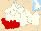 | |||
|---|---|---|---|---|---|
| Parks |
| ||||
| Churches |
| ||||
| Education |
| ||||
| Transport |
| ||||
| Buildings and structures |
| ||||
| Sport |
| ||||
Authority control | |
|---|---|
| General | |
| National libraries | |
| Other |
|
На других языках
[de] Godalming
Godalming [.mw-parser-output .IPA a{text-decoration:none}ˈgɒdəlmɪŋ] ist eine Kleinstadt in England mit ungefähr 20.000 Einwohnern. Sie befindet sich in der südenglischen Grafschaft Surrey und ist Verwaltungssitz des Waverley Borough.- [en] Godalming
Другой контент может иметь иную лицензию. Перед использованием материалов сайта WikiSort.org внимательно изучите правила лицензирования конкретных элементов наполнения сайта.
WikiSort.org - проект по пересортировке и дополнению контента Википедии