world.wikisort.org - United_Kingdom
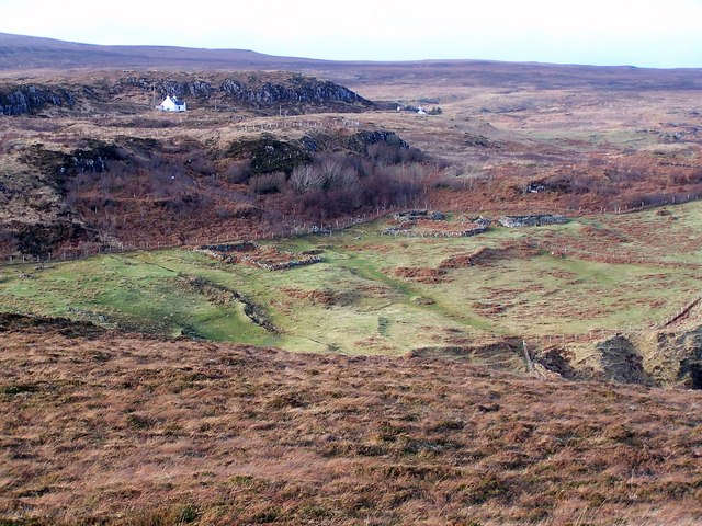
Galtrigill (Scottish Gaelic: Galtraigil) is a largely abandoned crofting township on the far north end of the east side of the Duirinish peninsula on the Isle of Skye, and is in the Scottish council area of Highland.[1]
Galltrigill
| |
|---|---|
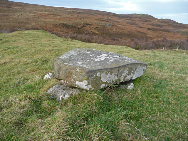 The Manners Stone is marked as such on the OS map. It sits in a field near the end of the surfaced road at Galtrigill. Once there was a big village here. Now there is just a scattering of ruins. | |
 Galltrigill Location within the Isle of Skye | |
| OS grid reference | NG186539 |
| Council area |
|
| Country | Scotland |
| Sovereign state | United Kingdom |
| Post town | Dunvegan |
| Postcode district | IV55 8 |
| Police | Scotland |
| Fire | Scottish |
| Ambulance | Scottish |
The villages of Borreraig, Uig and Totaig are located directly south. The Stone of Manners (Scottish Gaelic: Clach a Mhodha) lies north of Galtrigill, and is the only one known to exist on the Isle of Skye.[2]
References
- Clive Aslet (2011). Villages of Britain: The Five Hundred Villages that Made the Countryside. Bloomsbury Publishing. p. 578. ISBN 978-1-4088-1799-5.
- Otta Swire (2006). Skye: The Island and its Legends. Birlinn. p. 137. ISBN 978-0-85790-971-8.
| Wikimedia Commons has media related to Galtrigill. |
This Highland location article is a stub. You can help Wikipedia by expanding it. |
Текст в блоке "Читать" взят с сайта "Википедия" и доступен по лицензии Creative Commons Attribution-ShareAlike; в отдельных случаях могут действовать дополнительные условия.
Другой контент может иметь иную лицензию. Перед использованием материалов сайта WikiSort.org внимательно изучите правила лицензирования конкретных элементов наполнения сайта.
Другой контент может иметь иную лицензию. Перед использованием материалов сайта WikiSort.org внимательно изучите правила лицензирования конкретных элементов наполнения сайта.
2019-2025
WikiSort.org - проект по пересортировке и дополнению контента Википедии
WikiSort.org - проект по пересортировке и дополнению контента Википедии