world.wikisort.org - United_Kingdom
Fulford is a village and civil parish about 5 miles (8 km) north east of Stone,[1] in the Stafford district, in the county of Staffordshire, England. The parish includes the settlements of Crossgate, Leadendale, Meir Heath, Mossgate, Rough Close, Saverley Green, Stallington, Townend and part of Blythe Bridge. In 2011 the built-up area had a population of 650[2] and the parish had 5,931.[3] The village is on one of the tributaries of the River Blythe.[4] The parish is one of the largest in the Stafford district.[5] The parish touches Forsbrook, Hilderstone, Stone Rural, Barlaston and Draycott in the Moors.[6] Fulford is the highest point in the Stafford district and varies between 650 feet (198 m) and 730 feet (223 m) above sea level.[7]
| Fulford | |
|---|---|
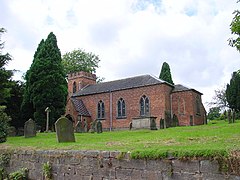
 St Nicholas Church | |
 Fulford Location within Staffordshire | |
| Area | 0.3025 km2 (0.1168 sq mi) |
| Population | 650 (2011 census) |
| • Density | 2,149/km2 (5,570/sq mi) |
| Civil parish |
|
| District |
|
| Shire county |
|
| Region |
|
| Country | England |
| Sovereign state | United Kingdom |
| Post town | Stoke-on-Trent |
| Postcode district | ST11 |
| Dialling code | 01782 |
| Website | http://www.fulfordvillage.com/ |
Features
Fulford has a church dedicated to St Nicholas, which is Grade II listed and was built in the Gothic style in 1825 by C. H. Winks,[8] a primary school[9] and village hall on Fulford Road[10] and a pub called the Shoulder of Mutton, on Meadow Lane.[11] There are 9 listed buildings in Fulford, all Grade II listed.[12]
History
The name "Fulford" means "the dirty ford".[13] Fulford was recorded in the Domesday Book as Fuleford.[14] The village is one of the possible sources of the surname Fulford.[15]
Civil parish
Fulford | |
|---|---|
Civil parish | |
 St Nicholas Church | |
| Coordinates: 52.939897°N 2.0717819°W | |
| Country | England |
| Primary council | Stafford |
| County | Staffordshire |
| Region | West Midlands |
| Status | Parish |
| Settlements | Fulford, Crossgate, Leadendale, Meir Heath, Mossgate, Rough Close, Saverley Green, Stallington, Townend and part of Blythe Bridge |
| Area | |
| • Total | 14.9 km2 (5.8 sq mi) |
| Population (2011) | |
| • Total | 5,931 |
| • Density | 400/km2 (1,000/sq mi) |
| Website | http://www.fulford-parish-council.org/ |
Formerly a township and chapelry,[16] Fulford became a civil parish on 1 April 1897. The parish was created from part of Stone Rural parish, which itself had been split from Stone parish in 1894.[17][18]
References
- "History of Fulford, in Stafford and Staffordshire". A Vision of Britain through Time. Retrieved 17 January 2019.
- UK Census (2011). "Local Area Report – Fulford BUA Built-up area sub division (1119880911)". Nomis. Office for National Statistics. Retrieved 17 January 2019.
- UK Census (2011). "Local Area Report – Fulford Parish (1170218446)". Nomis. Office for National Statistics. Retrieved 17 January 2019.
- "Chapter 1 - A Historical Account of Fulford Village". Fulford Parish Council. Retrieved 25 January 2019.
- "Fulford Parish Profile". Fulford Parish Council. Retrieved 25 January 2019.
- "Fulford". Ordnance Survey. Retrieved 17 January 2019.
- "Fulford Conservation Area Appraisal" (PDF). Stafford Borough Council. Retrieved 25 January 2019.
- "CHURCH OF ST NICHOLAS". Historic England. Retrieved 20 January 2019.
- "Contact Us". Fulford Primary School. Retrieved 20 January 2019.
- "Contact Us". Fulford Village Hall. Retrieved 25 January 2019.
- "The Shoulder of Mutton Fulford". The Shoulder of Mutton Fulford. Retrieved 25 January 2019.
- "Listed Buildings in Fulford, Stafford, Staffordshire". British Listed Buildings. Retrieved 25 January 2019.
- "Fulford Key to English Place-names". The University of Nottingham. Retrieved 26 January 2019.
- "Staffordshire D-P". The Domesday Book Online. Retrieved 17 January 2019.
- "Last name: Fulford". SurnameDB. Retrieved 18 January 2019.
- "Fulford". GENUKI. Retrieved 20 January 2019.
- "Fulford Ch/CP through time Relationships and changes". A Vision of Britain through Time. Retrieved 17 January 2019.
- "Stone Registration District". UKBMD. Retrieved 19 January 2019.
External links
Другой контент может иметь иную лицензию. Перед использованием материалов сайта WikiSort.org внимательно изучите правила лицензирования конкретных элементов наполнения сайта.
WikiSort.org - проект по пересортировке и дополнению контента Википедии