world.wikisort.org - United_Kingdom
Carlops (Scottish Gaelic: Leum na Caillich) is a small village in the Pentland Hills, within the Scottish Borders area of Scotland, close to the boundary with Midlothian. It lies between West Linton and Penicuik.
Carlops
| |
|---|---|
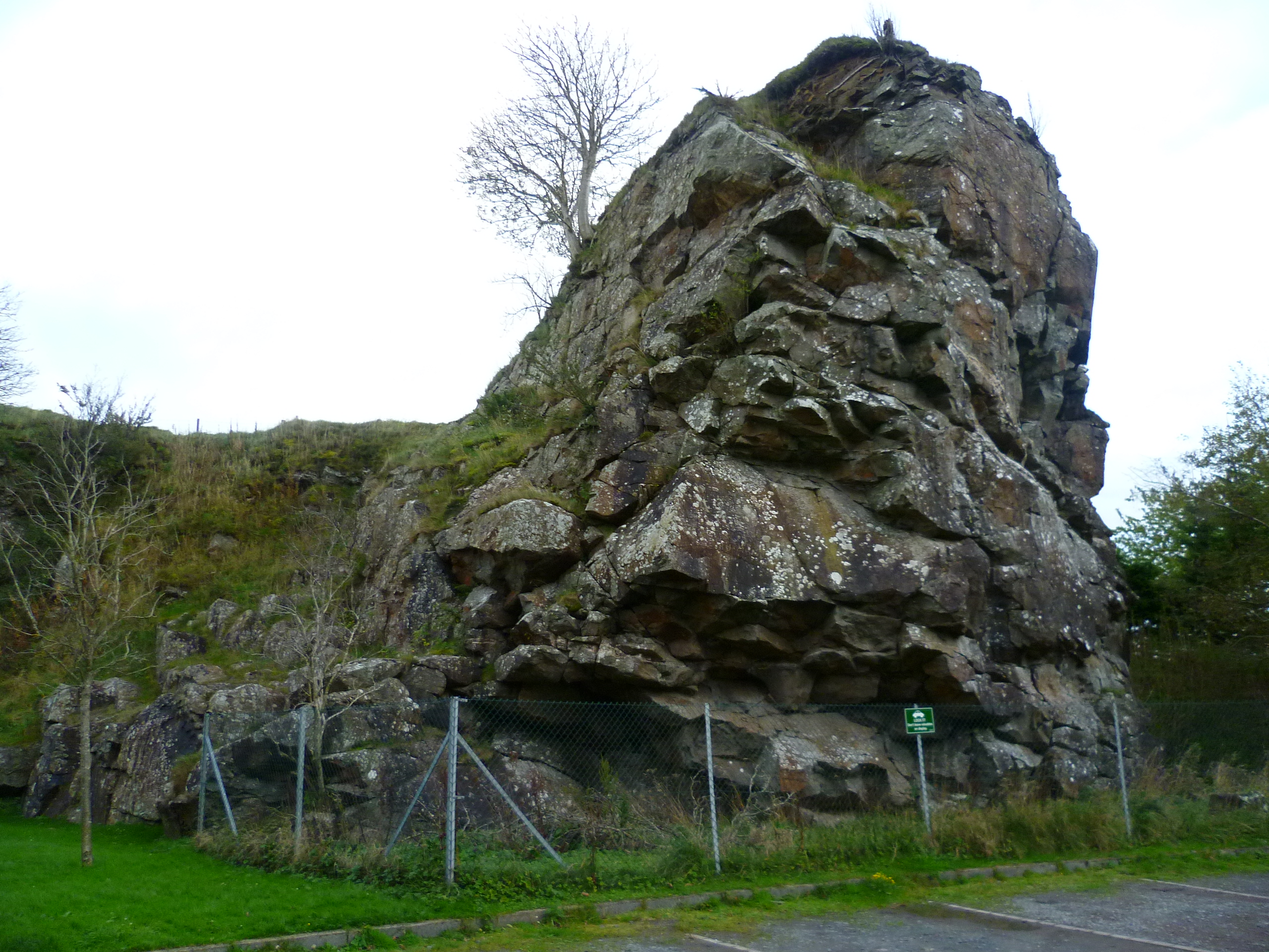 The Carlins Lowp | |
 Carlops Location within the Scottish Borders | |
| OS grid reference | NT162561 |
| Council area | |
| Lieutenancy area |
|
| Country | Scotland |
| Sovereign state | United Kingdom |
| Post town | PENICUIK |
| Postcode district | EH26 |
| Dialling code | 01968 |
| Police | Scotland |
| Fire | Scottish |
| Ambulance | Scottish |
| UK Parliament |
|
| Scottish Parliament |
|
The village was founded in 1784 and developed cotton weaving, coalmining and limestone mining.
The name derives from the Scots "Carlins Lowp" (English: "Witches' Leap"), since near the south of the village there are two exposed rock faces about 20 m (66 ft) high facing each other, with a similar distance between them. Folklore maintained that witches would leap from one face to the other, over the chasm, for entertainment of an evening.
Notable residents
- C. T. R. Wilson (1869-1959), winner of the Nobel Prize for Physics in 1927, retired to Carlops and died there in 1959.
- Dr Archibald "Archie" Lamont FRSE FGS (21 October 1907 – 16 March 1985), Scottish geologist, palaeontologist, Scottish Nationalist, writer, poet and politician, retired to Carlops and lived in Jess Cottage.
See also
- List of places in the Scottish Borders
- List of places in Scotland
External links
Wikimedia Commons has media related to Carlops.
- RCAHMS record for Carlops, Spittal
- RCAHMS record for Carlops Hill
- SCRAN image: Allan Ramsay Hotel, Main Street, Carlops
- Geological Conservation Review / JNCC: Subglacial meltwater
Текст в блоке "Читать" взят с сайта "Википедия" и доступен по лицензии Creative Commons Attribution-ShareAlike; в отдельных случаях могут действовать дополнительные условия.
Другой контент может иметь иную лицензию. Перед использованием материалов сайта WikiSort.org внимательно изучите правила лицензирования конкретных элементов наполнения сайта.
Другой контент может иметь иную лицензию. Перед использованием материалов сайта WikiSort.org внимательно изучите правила лицензирования конкретных элементов наполнения сайта.
2019-2026
WikiSort.org - проект по пересортировке и дополнению контента Википедии
WikiSort.org - проект по пересортировке и дополнению контента Википедии