world.wikisort.org - United_Kingdom
Brownhill is a suburb of Blackburn, in the unitary borough of Blackburn with Darwen, in Lancashire, England. It is situated to the north-east of the town centre, in the Roe Lee ward which has an estimated population of around 5948.[1] Other nearby places include Ramsgreave, Wilpshire and Sunnybower.
| Brownhill | |
|---|---|
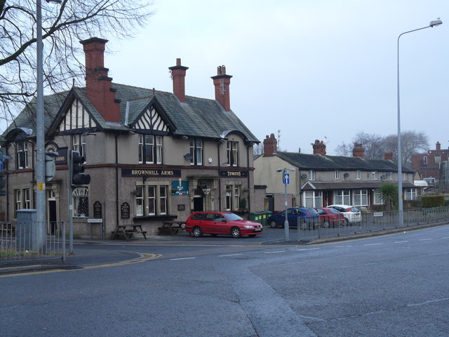 Brownhill Arms | |
 Brownhill Shown within Blackburn 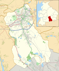 Brownhill Shown within Blackburn with Darwen  Brownhill Location within Lancashire | |
| Population | 5,948 |
| OS grid reference | SD685310 |
| Unitary authority |
|
| Ceremonial county |
|
| Region |
|
| Country | England |
| Sovereign state | United Kingdom |
| Post town | BLACKBURN |
| Postcode district | BB1 |
| Dialling code | 01254 |
| Police | Lancashire |
| Fire | Lancashire |
| Ambulance | North West |
| UK Parliament |
|
Brownhill sports a number of local businesses including Brownhill Pharmacy, Brownhill Post Office, Brownhill Arms (situated approximately 0.3 mi (0.48 km) from Ramsgreave and Wilpshire railway station[2]) and Videorama.
In the centre of Brownhill is the junction of the A666 Whalley New Road and A6119 Blackburn Ring Road; when the ring road was built in the 1920s[citation needed] it was a roundabout with the Blackburn to Wilpshire tram route through the middle.[3]
Brownhill has three churches: Holy Souls (Roman Catholic), St Gabriel's (Church of England) and Trinity (Congregational). St Gabriel's is located on Brownhill Drive, and was built in 1933[4] to replace the original St Gabriel's Church, which was situated on Pearl Street. St Gabriel's is now somewhat of a famous Blackburnian landmark due to its 'light-up' red cross, which was installed in 1964,[5] can be seen as far away as Clayton-le-Moors (approximately 8 mi (13 km)).
The BP garage in Brownhill offers 24-hour fuel, off licence and grocery services.
References
- "Blackburn with Darwen Borough Council".
- "Streetmap.co.uk". Archived from the original on 9 April 2008.
- Holden, Duncan. "Tramway history: Chapter 11". Blackburn Transport Net. Archived from the original on 21 September 2007. Retrieved 11 April 2008.
- "St Gabriel's Church Website: About Us". Retrieved 13 March 2008. [dead link]
- Smith, Ray. "Blackburn Encyclopaedia S". Blackburn with Darwen Borough Council. Archived from the original on 25 September 2005. Retrieved 13 March 2008.
This Lancashire location article is a stub. You can help Wikipedia by expanding it. |
Другой контент может иметь иную лицензию. Перед использованием материалов сайта WikiSort.org внимательно изучите правила лицензирования конкретных элементов наполнения сайта.
WikiSort.org - проект по пересортировке и дополнению контента Википедии