world.wikisort.org - United_Kingdom
Brabourne Lees is a village in the civil parish of Brabourne, within the Ashford borough of Kent, England.[1] [2] The village (centre) is just under 5 miles (8 km) east of Ashford town centre itself geographically. By road this is a journey of about 6 miles (10 km).
| Brabourne Lees | |
|---|---|
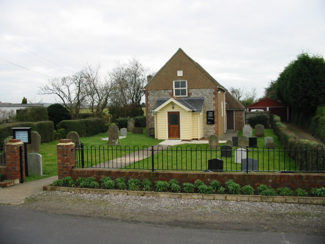 Zion Strict Baptist Chapel | |
 Brabourne Lees Location within Kent | |
| Population | 1,442 (Parish) |
| OS grid reference | TR085405 |
| Civil parish |
|
| District |
|
| Shire county |
|
| Region | |
| Country | England |
| Sovereign state | United Kingdom |
| Post town | TONBRIDGE |
| Postcode district | TN25 |
| Dialling code | 01303 |
| Police | Kent |
| Fire | Kent |
| Ambulance | South East Coast |
| UK Parliament |
|
The village was built on former pasture land ("lees") at the foot of the North Downs. Brabourne Baptist Church is at the junction of Calland and Plain Road; there is also a Zion Strict Baptist Chapel to the northeast of the village, on Canterbury Road.
See also
- Smeeth - village immediately to the south
- Lilyvale, Kent - hamlet to the east
References
- Ordnance Survey: Landranger map sheet 179 Canterbury & East Kent (Dover & Margate) (Map). Ordnance Survey. 2013. ISBN 9780319228784.
- "Ordnance Survey: 1:50,000 Scale Gazetteer" (csv (download)). www.ordnancesurvey.co.uk. Ordnance Survey. 1 January 2016. Retrieved 30 January 2016.
External links
![]() Media related to Brabourne Lees at Wikimedia Commons
Media related to Brabourne Lees at Wikimedia Commons
This Kent location article is a stub. You can help Wikipedia by expanding it. |
Текст в блоке "Читать" взят с сайта "Википедия" и доступен по лицензии Creative Commons Attribution-ShareAlike; в отдельных случаях могут действовать дополнительные условия.
Другой контент может иметь иную лицензию. Перед использованием материалов сайта WikiSort.org внимательно изучите правила лицензирования конкретных элементов наполнения сайта.
Другой контент может иметь иную лицензию. Перед использованием материалов сайта WikiSort.org внимательно изучите правила лицензирования конкретных элементов наполнения сайта.
2019-2025
WikiSort.org - проект по пересортировке и дополнению контента Википедии
WikiSort.org - проект по пересортировке и дополнению контента Википедии