world.wikisort.org - United_Kingdom
Barkerend is an inner-city area in the Bowling and Barkerend ward of the Bradford district, in the English county of West Yorkshire. Barkerend is located to the east of Bradford city centre. The Barkerend area is not easy to define but it is surrounded by Undercliffe, and Undercliffe Cemetery, Bradford Moor, Laisterdyke, Bowling, Broomfields, Little Germany and the Shipley Airedale Road, and Wapping but includes an area of new and modern housing known as Pollard Park.[1]
| Barkerend | |
|---|---|
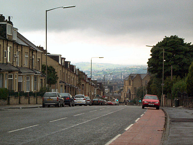 Barkerend Road looking towards the city centre | |
 Barkerend Location within West Yorkshire | |
| OS grid reference | SE1733 |
| Metropolitan borough |
|
| Metropolitan county | |
| Region |
|
| Country | England |
| Sovereign state | United Kingdom |
| Post town | BRADFORD |
| Postcode district | BD3 |
| Dialling code | 01274 |
| Police | West Yorkshire |
| Fire | West Yorkshire |
| Ambulance | Yorkshire |
History

Off Barkerend roundabout was the now partially demolished Barkerend Mills. These mills were established in 1815 as a steam powered worsted spinning mill. The street front buildings being warehouses with an arched gateway into the mill complex behind. More mills were added in 1852 and the last block (seen on the image left with chimney) still remains today, disused and minus the chimney.[2][3]
The area had a number of cinemas including The Hippodrome Picturehouse / Roxy on Barkerend Road.[4]
Geography
The majority of Barkerend's population are of South Asian origin in particular Pakistani, Bangladeshi & some Afghan and the area has high levels of unemployment, and social and economic deprivation.[5]
Landmarks
Barkerend has a post office,[6] community health centre,[7] the Karmand Community Centre,[8] and a Lidl supermarket.[9] The Karmand Community Centre offers advice, education, training and recreational activities to the local community.[10] Training is also offered by the Appleton House Training Centre on Barkerend Road.[11]
There are a number of mosques in Barkerend including the Barkerend Road Mosque (Jamiyat Tabligh-ul-Islam) that was once the Hippodrome Picturehouse and Roxy.[12] The imposing former Hanson Grammar School* on Barkerend Road[13] were later to be occupied by Carlton Bolling School,[14] and Pollard Park Middle School. These buildings are now the Byron Halls luxury flats. Hanson School itself moved to the Swain House area of Bradford between Bolton and Five Lane Ends,[15] while Carlton Bolling became a college after moving to new premises in the north of Barkerend. Designed by Edward Prioleau Warren and built 1892–1894 in a neo-Gothic style with an octagonal corner clock turret, the grade II star listed St. Clement's Church* on Barkerend Road is most notable for its ceiling decoration by Morris & Co.[16]
The area has lost all but one of its public houses including the eponymous Barkerend on Barkerend Road[17] and the historic Cock and Bottle pub.[18] Listed buildings on Barkerend Road are the aforementioned Cock and Bottle public house,[19] the Church of St. Mary and Presbytery, Barkerend Mills, Butler House, the Church of St. Clement, and numbers 181 and 214.[20] On Byron Street is Boldshay Hall, Byron Halls and School House, Byron School and Olive School[21] and on Hendford Drive there is Barkerend School and rear range.[22]
 The historic Cock and Bottle* pub
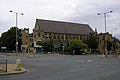 Church of St. Mary and Presbytery*
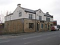 The former Barkerend pub
 Barkerend Road Mosque
 Byron Halls* - Luxury flats
 St. Clement's Church*
 The Karmand Community Centre


Transport
The A658 New Otley Road, A647 Leeds Road, and B6381 Barkerend Road run through Barkerend[23] and the area is served by FirstGroup's Bradford X11, 611 and 670 bus services connecting Barkerend to surrounding areas.[24]
Education

Barkerend Primary Leadership Academy is located in Hendford Drive and takes pupils in the age range 3–11.[25][26] The school was established in 1873, and Barkerend Primary School was renamed Barkerend Academy in 2016 when it was taken over by Wakefield City Academies Trust. The school is now sponsored by Star Academies.
A newer building has been added to accommodate growing pupil numbers while the original building is grade II listed.[26] To the east is Byron Primary School in new premises on Barkerend Road.[27] The original Byron Primary premises are occupied by Olive Secondary School.
To the north of the Pollard Park area is Carlton Bolling College an 11–19 college specialising in maths and computing.[28]
Sport
To the east of Barkerend is the landscaped Myra Shay sports ground opened in 2006, a development by Regen 2000.[29] Myra Shay has three football pitches, two five-a-side football pitches, a cricket pitch, kabaddi court, changing facilities and a play area.[29][30] Myra Shay takes its name from a manor house that used to occupy the area.[31]
See also
- Listed buildings in Bradford (Bowling and Barkerend Ward)
References
- "Pollard Park in 1977". Telegraph and Argus. Bradford. 27 November 2008. Retrieved 21 April 2011.
- Allen, Chris (9 April 2008). "Barkerend Mills". Geograph. Retrieved 21 April 2011.
- "List Descriptions of grade II listed buildings in Bradford" (PDF). Archived from the original (PDF) on 12 January 2011. Retrieved 23 April 2011.
- Sutton, Colin (1980). "Bradford - Hippodrome/Roxy". Bradford Timeline. Retrieved 25 June 2015.
- "Barkerend". Avicenna. Archived from the original on 12 August 2011. Retrieved 21 April 2011.
- "Barkerend Road Post Office". inuklocal. Retrieved 17 April 2011.
- "Barkerend Community Health Centre". enQuira UK. Retrieved 17 April 2011.
- "Karmand Community Centre". BradfordOnline. Retrieved 17 April 2011.
- "Lidl Stores, Bradford". findsupermarkets.co.uk. Archived from the original on 23 March 2012. Retrieved 21 April 2011.
- "Karmand Community Centre". karmand.org.uk. Retrieved 20 April 2011.
- "Appleton House Training centre". localtrainingcentres.co.uk. Retrieved 23 April 2011.
- "Mosques in Barkerend". muslimsinbritain.org. Retrieved 24 May 2011.
- Mead, Helen (26 October 2009). "Old school friends are still reuniting". Telegraph and Argus. Bradford. Retrieved 20 April 2011.
- "Carlton-Bolling School". British Listed Buildings. Retrieved 22 April 2011.
- "Hanson School". Hanson School. Archived from the original on 9 October 2011. Retrieved 20 April 2011.
- "Church of St Clement". British Listed Buildings. Retrieved 23 April 2011.; Meneaud, Marc (18 February 2010). "Heritage grant will help maintain Bradford places of worship". Telegraph and Argus. Bradford. Retrieved 21 April 2011.
- "The Barkerend". The Lost Pubs Project. Retrieved 19 April 2011.
- "Cock & Bottle, Bradford". The Lost Pubs Project. Retrieved 25 June 2015.
- "The Cock and Bottle Public House". British Listed Buildings. Retrieved 22 April 2011.
- "Cock and Bottle".; "Church of St. Mary and presbytery".; "Barkerend Mills".; "Butler House".; "Church of St. Clement".; "214". and "181". British Listed Buildings. Retrieved 22 April 2011.
- "Boldshay Hall".; "Byron Hall"., the "former school craft block". and "school house"., "Byron Primary School House".; and "Olive School". British Listed Buildings. Retrieved 19 April 2011.
- "Barkerend School". and "rear range". British Listed Buildings. Retrieved 19 April 2011.
- A-Z Leeds & Bradford (2 ed.). Geographers' A-Z Company Limited. 2006. ISBN 1-84348-209-6.
- "Bus timetables: Services 600 to 699". Metro. Retrieved 17 April 2011.[permanent dead link]; "Current Timetables". FirstGroup plc. Archived from the original on 6 April 2012. Retrieved 21 April 2011.
- "Barkerend Academy". EduBase, Department of Education. Retrieved 24 November 2016.
- "Barkerend School and Attached Shed and Boundary Wall". British Listed Buildings. Retrieved 19 April 2011.; "Barkerend School Rear Range". British Listed Buildings. Retrieved 19 April 2011.
- "Byron Primary School, Bradford". Schoolsnet. Retrieved 21 April 2011.
- "Carlton Bolling College". eteach.com. Archived from the original on 1 October 2011. Retrieved 21 April 2011.
- Rush, James (14 July 2008). "'Regeneration plan is a huge success'". Telegraph and Argus. Bradford. Retrieved 21 April 2011.
- "New Recreation Grounds". Bradford Parks & Landscape Service. 2016. Retrieved 14 May 2016.
- Priestley, Mike (3 June 2006). "An unusual Barkerend house and rumours of a tunnel". Telegraph and Argus. Retrieved 23 April 2011.
External links
- Schools & Colleges: Barkerend Primary, Carlton Bolling College, Olive Secondary
- Karmand Community Centre
| ||||||||||||||||||||||||||||||||||||||||||||||||||||||||||||||||||||||||||||||||||||||||||||||
Другой контент может иметь иную лицензию. Перед использованием материалов сайта WikiSort.org внимательно изучите правила лицензирования конкретных элементов наполнения сайта.
WikiSort.org - проект по пересортировке и дополнению контента Википедии