world.wikisort.org - United_Kingdom
Altnagelvin (from Irish: Alt na nGealbhán, meaning 'Glen/height of the sparrows')[5] is a townland in County Londonderry, Northern Ireland. It is also the name of an electoral ward in Derry and Strabane district. Formerly a small village, it has been absorbed into the Waterside neighbourhood of Derry. Within Altnagelvin is Altnagelvin Area Hospital, a large hospital which serves the most of the county.
This article needs additional citations for verification. (September 2010) |
Altnagelvin
| |
|---|---|
townland | |
| Irish transcription(s) | |
| • Derivation: | Alt na nGealbhán |
| • Meaning: | "Glen/height of the sparrows" |
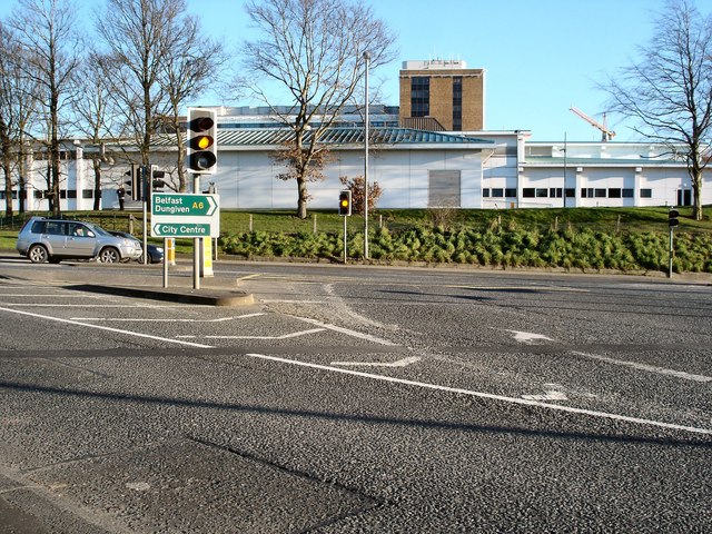 Altnagelvin Junction, which in 2004 saw 12930 vehicles pass through every day.[3] Altnagelvin Area Hospital is in the background. | |
 Altnagelvin Altnagelvin shown within Northern Ireland  Altnagelvin Altnagelvin (the United Kingdom) | |
| Coordinates: 54°58′52″N 7°17′17″W | |
| Sovereign state | United Kingdom |
| Country | Northern Ireland |
| County | Londonderry |
| Barony | Tirkeeran |
| Civil parish | Clondermot |
| Settlements | Derry |
| Government | |
| • Council | Derry and Strabane |
| • Ward | Altnagelvin |
| Area | |
| • Total | 293.30 acres (118.69 ha) |
The busy A6 road from Belfast to Derry passes through the townland.
Demographics
On Census Day 29 April 2001 the resident population of Altnagelvin ward was 4477.[6] Of these:
- 26.6% were under 16 years old and 11.0% were aged 60 and above [6]
- 48.3% of the population were male and 51.7% were female [6]
- 38.0% were from a Roman Catholic background and 59.7% were from a Protestant background [6]
- 5.2% of those aged 16–74 were unemployed [6]
References
- Logainm - Placenames Database of Ireland
- Northern Ireland Roads Site - Derry to Dungiven road
- Northern Ireland Roads Site - Derry to Dungiven road
- Northern Ireland Environment Agency. "NIEA Map Viewer". Archived from the original on 24 November 2011. Retrieved 27 January 2012.
- "Placenames NI website".[permanent dead link]
- "Altnagelvin Ward statistics". NINIS. 31 May 2007. Retrieved 2 February 2008.
Places in County Londonderry | ||
|---|---|---|
List of places in County Londonderry | ||
| Cities |
|  |
| Towns |
| |
| Villages, parishes, and townlands |
| |
| Landforms |
| |
| Baronies | ||
| ||
This article related to the geography of County Londonderry, Northern Ireland is a stub. You can help Wikipedia by expanding it. |
Текст в блоке "Читать" взят с сайта "Википедия" и доступен по лицензии Creative Commons Attribution-ShareAlike; в отдельных случаях могут действовать дополнительные условия.
Другой контент может иметь иную лицензию. Перед использованием материалов сайта WikiSort.org внимательно изучите правила лицензирования конкретных элементов наполнения сайта.
Другой контент может иметь иную лицензию. Перед использованием материалов сайта WikiSort.org внимательно изучите правила лицензирования конкретных элементов наполнения сайта.
2019-2025
WikiSort.org - проект по пересортировке и дополнению контента Википедии
WikiSort.org - проект по пересортировке и дополнению контента Википедии