world.wikisort.org - Vereinigtes_Königreich
Great Waldingfield ist ein Dorf und civil parish im District Babergh in der Grafschaft Suffolk, England. Im Jahr 2001 hatte es eine Bevölkerung von 1.457.[1]
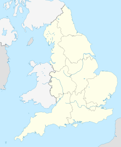
| Great Waldingfield | |||
|---|---|---|---|
 | |||
| Koordinaten | 52° 3′ N, 0° 47′ O | ||
| OS National Grid | TL9043 | ||
| |||
| Traditionelle Grafschaft | Suffolk | ||
| Einwohner | 1457 (Stand: 2001) | ||
| Verwaltung | |||
| Post town | SUDBURY | ||
| Postleitzahlenabschnitt | CO10 | ||
| Vorwahl | 01787 | ||
| Landesteil | England | ||
| Region | East of England | ||
| Shire county | Suffolk | ||
| District | Babergh | ||
| Civil Parish | Great Waldingfield | ||
Einzelnachweise
Weblinks
Commons: Great Waldingfield – Sammlung von Bildern, Videos und Audiodateien
На других языках
- [de] Great Waldingfield
[en] Great Waldingfield
Great Waldingfield is a village and civil parish in the Babergh district of Suffolk, England about two miles (3 km) north-east of Sudbury and two miles (3 km) south-west of its sister village, Little Waldingfield. The village is split into two separate parts; the older and smaller part around the St. Lawrence Church, and the newer and larger section along the B1115 road between Sudbury and Hadleigh. Most of the houses in the newer section were built after World War II, including much council housing. The parish also includes the hamlets of Upsher Green and part of Washmere Green.[1] The population is estimated to be 1,460, reducing to 1,431 at the 2011 Census.[2]Текст в блоке "Читать" взят с сайта "Википедия" и доступен по лицензии Creative Commons Attribution-ShareAlike; в отдельных случаях могут действовать дополнительные условия.
Другой контент может иметь иную лицензию. Перед использованием материалов сайта WikiSort.org внимательно изучите правила лицензирования конкретных элементов наполнения сайта.
Другой контент может иметь иную лицензию. Перед использованием материалов сайта WikiSort.org внимательно изучите правила лицензирования конкретных элементов наполнения сайта.
2019-2025
WikiSort.org - проект по пересортировке и дополнению контента Википедии
WikiSort.org - проект по пересортировке и дополнению контента Википедии