world.wikisort.org - Ukraine
Yaremche (Ukrainian: Яре́мче, romanized: Jaremče, Polish: Jaremcze or Jaremcza) is a city in Nadvirna Raion, Ivano-Frankivsk Oblast (province) of west Ukraine. The city is located at the altitude of around 580 metres (1,900 ft) above mean sea level. Yaremche hosts the administration of Yaremche urban hromada, one of the hromadas of Ukraine.[1] Population: 8,004 (2021 est.)[2].
This article has multiple issues. Please help improve it or discuss these issues on the talk page. (Learn how and when to remove these template messages)
|
Yaremche
Яремчe Jaremče | |
|---|---|
City | |
    | |
 Flag  Coat of arms | |
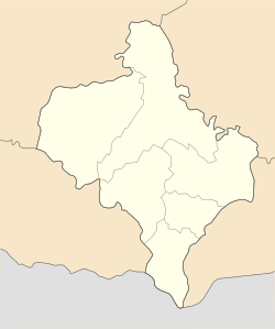 Yaremche Location of Yaremche, Ukraine  Yaremche Yaremche (Ukraine) | |
| Coordinates: 48°27′37″N 24°33′31″E | |
| Country | |
| Oblast | |
| Raion | Nadvirna Raion |
| Established | 1787 |
| Area | |
| • Total | 657 km2 (254 sq mi) |
| Elevation | 585 m (1,919 ft) |
| Population (2021) | |
| • Total | 8,004 |
| • Density | 12/km2 (32/sq mi) |
| Time zone | UTC+2 (EET) |
| • Summer (DST) | UTC+3 (EEST) |
| Postal index | 78500 |
| Area code | +380-3434 |
Yaremche hosts the headquarters of the nearby Carpathian National Nature Park.
History
| Year | Pop. | ±% |
|---|---|---|
| 2007 | 11,926 | — |
| 2008 | 11,956 | +0.3% |
| 2009 | 12,007 | +0.4% |
| 2010 | 12,091 | +0.7% |
| 2016 | 12,478 | +3.2% |
| Note: Population of Vorokhta included 2010 data is valid thru October Source: Regional Statistics Office | ||
A possible root of the word "Yaremche" comes from the Turkish. In Turkic languages "yarım" means "half" and "yarımca" means "little half".[3] It was founded in 1787 and received city status on December 30, 1977. In the interwar period (1918–1939) it belonged to Poland and was the most popular tourist center in eastern part of the Carpathian Mountains (in the late 1920s more than 6 000 guests came there yearly). Yaremche was growing year by year in importance and number of tourists. According to some, it had the chance to achieve same importance as other key Polish mountain spas, Zakopane and Krynica. However, in September 1939 it was captured by Soviet troops and became a part of Soviet Union as part of the Ukrainian SSR. During the World War II it was part of the Distrikt Galizien and was liberated by the Soviet forces in 1944. On December 30, 1977, the city of Yaremcha became a municipality within Ivano-Frankivsk Oblast. Since 1991 it has been a part of independent Ukraine.
There are a number of interesting houses with long sloping roofs. There is a wooden Orthodox church and an impressive rail viaduct, located over the Prut valley at the height of 30 meters (98 feet). Next to this there is a swinging pedestrian toll bridge.
On December 14, 2006, the Parliament of Ukraine, officially renamed the city from Yaremcha to "Yaremche". The decision was based on the results of a city referendum, as well as the recommendations of City Council, and Ivano-Frankivsk Oblast Council.
Until 18 July 2020, Yaremche was incorporated as a city of oblast significance and was the center of Yaremche Municipality which also included the urban-type settlement of Vorokhta, a ski resort, and five other villages: Mykulychyn, Polianytsia, Tatariv, Voronenko, and Yablunytsia.[4] The municipality was abolished in July 2020 as part of the administrative reform of Ukraine, which reduced the number of raions of Ivano-Frankivsk Oblast to six. The area of Yaremche Municipality was merged into Nadvirna Raion.[5][6]
Gallery

 Greek-Catholic church
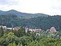 Panorama
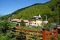
 Prut river in Yaremche


Location
- Local orientation
Places adjacent to Yaremche | ||||||||||||||||
|---|---|---|---|---|---|---|---|---|---|---|---|---|---|---|---|---|
| ||||||||||||||||
- Regional orientation
Places adjacent to Yaremche | ||||||||||||||||
|---|---|---|---|---|---|---|---|---|---|---|---|---|---|---|---|---|
| ||||||||||||||||
References
- "Яремчанская громада" (in Russian). Портал об'єднаних громад України.
- Чисельність наявного населення України на 1 січня 2021 [Number of Present Population of Ukraine, as of January 1, 2021] (PDF) (in Ukrainian and English). Kyiv: State Statistics Service of Ukraine.
- https://web.archive.org/web/20140304122019/www.tdk.gov.tr/index.php?option=com_gts&arama=gts&guid=TDK.GTS.53159a592075b4.85131632. Archived from the original on 2014-03-04.
{{cite web}}: Missing or empty|title=(help) - Yaremche at Verkhovna Rada web-site
- "Про утворення та ліквідацію районів. Постанова Верховної Ради України № 807-ІХ". Голос України (in Ukrainian). 2020-07-18. Retrieved 2020-10-03.
- "Нові райони: карти + склад" (in Ukrainian). Міністерство розвитку громад та територій України. 17 July 2020.
External links
- The Parliament renamed Yaremcha
- Yaremche - photographs
- Yaremche
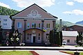
Administrative center: Yaremche | ||
| Cities |  | |
| Settlements | ||
Administrative center: Ivano-Frankivsk | ||
| Raions | ||
| Hromadas |
| |
| Cities | ||
| Urban-type settlements |
| |
Authority control | |
|---|---|
| General |
|
| National libraries | |
На других языках
[de] Jaremtsche
Jaremtsche (ukrainisch Яремче; russisch Яремча .mw-parser-output .Latn{font-family:"Akzidenz Grotesk","Arial","Avant Garde Gothic","Calibri","Futura","Geneva","Gill Sans","Helvetica","Lucida Grande","Lucida Sans Unicode","Lucida Grande","Stone Sans","Tahoma","Trebuchet","Univers","Verdana"}Jaremtscha, polnisch Jaremcze – seltener auch Jaremcza oder älter Jaremze) ist eine Stadt und ein Kurort in der westukrainischen Oblast Iwano-Frankiwsk mit etwa 7500 Einwohnern. Sie liegt am Oberlauf des Flusses Pruth auf der Nordseite des Karpatenbogens, etwa 54 Kilometer südlich von Iwano-Frankiwsk. Zum Stadtgemeindegebiet (Einwohner: 20 821) zählen neben der eigentlichen Stadt noch die Siedlung städtischen Typs Worochta sowie die fünf Dörfer Woronenko (Вороненко), Mykulytschyn, Poljanyzja, Tatariw und Jablunyzja. Das Gebiet liegt vollständig innerhalb des Rajons Nadwirna.- [en] Yaremche
[es] Yaremche
Yaremche (en ucraniano: Яремче) es una ciudad de importancia regional de Ucrania perteneciente a la óblast de Ivano-Frankivsk.[ru] Яремче
Яре́мче (укр. Яре́мче; до 2006 года — Яремча) — город в Надворнянском районе Ивано-Франковской области Украины. Административный центр Яремчанской городской общины, куда кроме города входит также село Микуличин.Другой контент может иметь иную лицензию. Перед использованием материалов сайта WikiSort.org внимательно изучите правила лицензирования конкретных элементов наполнения сайта.
WikiSort.org - проект по пересортировке и дополнению контента Википедии