world.wikisort.org - Ukraine
Oleksandrivka (Ukrainian: Олександрівка, Russian: Александровка) is an urban-type settlement in Voznesensk Raion, Mykolaiv Oblast, Ukraine. It hosts the administration of Oleksandrivka settlement hromada, one of the hromadas of Ukraine.[2] Population: 5,095 (2021 est.)[1]
Oleksandrivka
Олександрівка | |
|---|---|
Urban-type settlement | |
 | |
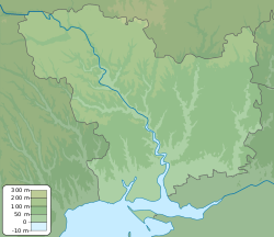 Oleksandrivka Location of Oleksandrivka in Mykolaiv Oblast | |
| Coordinates: 47°41′31″N 31°16′8″E | |
| Country | |
| Oblast | Mykolaiv Oblast |
| Raion | Voznesensk Raion |
| Population (2021)[1] | |
| • Total | 5,095 |
| Time zone | UTC+2 (EET) |
| • Summer (DST) | UTC+3 (EEST) |
 | |
The settlement is located on the left bank of the Southern Bug, between Yuzhnoukrainsk and Voznesensk (the raion center) approximately 5 kilometres (3.1 mi) north of it.
History
In 1923, uyezds in Ukrainian Soviet Socialist Republic were abolished, and the governorates were divided into okruhas. In 1923, Voznesensk Raion with the administrative center located in Voznesensk was established. It belonged to Mykolaiv Okruha of Odessa Governorate. Oleksandrivka was included in Voznesensk Raion.[3] In 1925, the governorates were abolished, and okruhas were directly subordinated to Ukrainian SSR. In 1930, okruhas were abolished, and on 27 February 1932, Odessa Oblast was established, and Voznesensk Raion was included into Odessa Oblast. In 1968, Olexandrivka was granted urban-type settlement status.[4]


Economy
The town has a dam and hydroelectric power station, Oleksandrivka HES, operated by Energoatom. The station is part of the South Ukraine Energy Complex, which includes the Tashlyk Pumped-Storage Power Plant and the South Ukraine Nuclear Power Plant in Yuzhnoukrainsk. The water reservoir created by the dam is part of the National nature park "Buh Gard" (formerly known as Granite-steppe lands of Buh).
Transportation
Olexandrivka railway station is several kilometers south of the settlement, but the closest railway station is in Trykratne, 3 kilometres (1.9 mi) from Oleksandrivka.[5] Both stations are on the railway line connecting Tokarivka and Pomichna.
References
- Чисельність наявного населення України на 1 січня 2021 [Number of Present Population of Ukraine, as of January 1, 2021] (PDF) (in Ukrainian and English). Kyiv: State Statistics Service of Ukraine.
- "Александровская громада" (in Russian). Портал об'єднаних громад України.
- "Николаевская область" (in Russian). Николаевская область. Электронная историческая энциклопедия. Retrieved 10 March 2016.
- "Районы Николаевской области" (in Russian). Николаевская область. Электронная историческая энциклопедия. Retrieved 10 March 2016.
- Украинская ССР - Административно-территориальное деление на 1 января 1979 года. Kiev: Ukrainian Soviet Encyclopedia. 1979.
Administrative center: Mykolaiv | ||
| Raions | ||
| Hromadas | ||
| Cities |
| |
| Urban-type settlements | ||
На других языках
[de] Oleksandriwka (Wosnessensk)
Oleksandriwka (ukrainisch Олександрівка; russisch Александровка .mw-parser-output .Latn{font-family:"Akzidenz Grotesk","Arial","Avant Garde Gothic","Calibri","Futura","Geneva","Gill Sans","Helvetica","Lucida Grande","Lucida Sans Unicode","Lucida Grande","Stone Sans","Tahoma","Trebuchet","Univers","Verdana"}Alexandrowka) ist eine Siedlung städtischen Typs in der ukrainischen Oblast Mykolajiw mit etwa 5300 Einwohnern (2014).[1]- [en] Oleksandrivka, Oleksandrivka settlement hromada, Voznesensk Raion, Mykolaiv Oblast
[ru] Александровка (Вознесенский район)
Алекса́ндровка[3] (укр. Олекса́ндрівка) — посёлок городского типа в Вознесенском районе Николаевской области Украины.Другой контент может иметь иную лицензию. Перед использованием материалов сайта WikiSort.org внимательно изучите правила лицензирования конкретных элементов наполнения сайта.
WikiSort.org - проект по пересортировке и дополнению контента Википедии