 Dytiatky's main road with
the checkpoint in background A rural house
world.wikisort.org - Ukraine
Dytiatky (Ukrainian: Дитятки, Russian: Дитятки, also spelled Dytyatky or Dityatki) is a Ukrainian village in Vyshhorod Raion, Kyiv Oblast. It belongs to Ivankiv settlement hromada, one of the hromadas of Ukraine.[2] As of 2001, Dytiatky had a population of 571.[1]
Dytiatky
Дитятки | |
|---|---|
Village | |
 Dytiatky Checkpoint | |
 Dytiatky Location of Hornostapil in Ukraine  Dytiatky Dytiatky (Ukraine) | |
| Coordinates: 51°6′45″N 30°8′43″E | |
| Country | |
| Oblast | |
| Raion | Chernobyl Raion (1923–1988) |
| Founded | 1864 |
| Area | |
| • Total | 2.1 km2 (0.8 sq mi) |
| Elevation | 126 m (413 ft) |
| Population (2001)[1] | |
| • Total | 571 |
| Postal code | 07220 |
| Area code | +380 4591 |

History
The village was first mentioned in 1864. On 25 August 1941, it was occupied by Nazi German troops, and the population that left the occupied area subsequently resisted the German army. 154 villagers received Soviet orders and medals.
The village was part of the former Chernobyl Raion until 1988, when it was disestablished after the 1986 nuclear accident, and was one of the few villages in the raion that remained outside the Chernobyl Exclusion Zone.[3]
Until 18 July 2020, Dytiatky belonged to Ivankiv Raion. The raion was abolished that day as part of the administrative reform of Ukraine, which reduced the number of raions of Kyiv Oblast to seven. The area of Ivankiv Raion was merged into Vyshhorod Raion.[4][5]
From February to April 2022, Dytiatky was occupied by Russia as a result of the 2022 invasion.
Geography
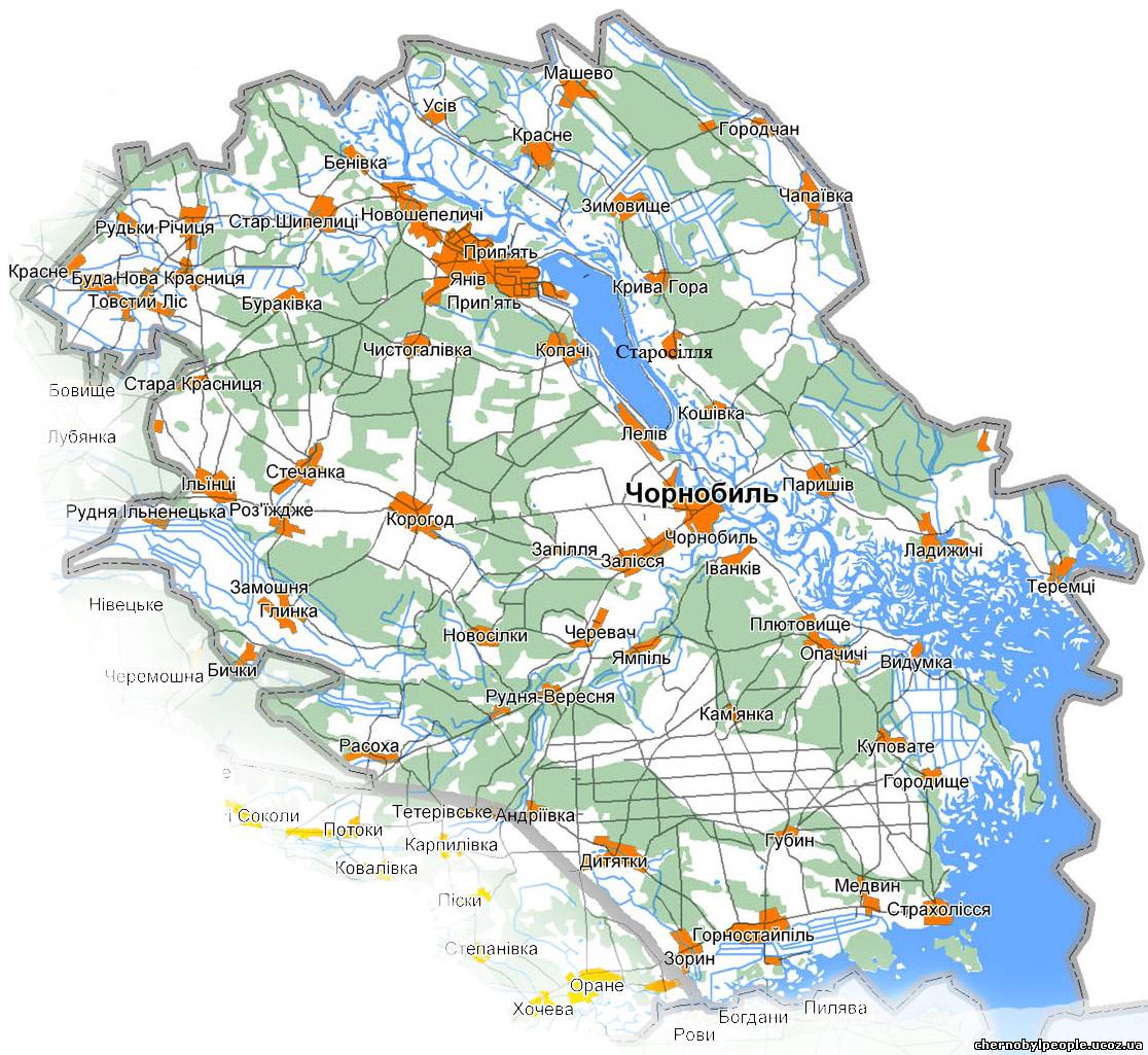
Dytiatky is located between Ivankiv (32 km) and Chernobyl (23 km), on a branch of the P02 road. It is the seat of one of the busiest checkpoints (Ukrainian: КПП Дитятки - KPP Dytyatky) to the Chernobyl Exclusion Zone, being on the main tourist route to the area and the Chernobyl Nuclear Power Plant (40 km).[6]
The village is 10 km far from Hornostaipil, 41 from Pripyat and 115 from Kyiv. It is the seat of the homonym rural council, that includes the villages of Fruzynivka and Zoryn, has an area of 38 km² and a population of 1,011.[7]
Gallery


See also
- Chernobyl disaster
References
- (in Ukrainian) Dytiatky Archived December 9, 2015, at the Wayback Machine on Verkhovna Rada website
- "Иванковская громада". Gromada.info (in Russian). Retrieved 16 June 2022.
- "Map of the Chernobyl Raion" (in Ukrainian). Chernobyl & Chernobylyane. Retrieved 3 December 2015.
- "Про утворення та ліквідацію районів. Постанова Верховної Ради України № 807-ІХ". Голос України (in Ukrainian). 2020-07-18. Retrieved 2020-10-03.
- "Нові райони: карти + склад" (in Ukrainian). Міністерство розвитку громад та територій України.
- "Securing the Chornobyl exclusion zone against illegal movement of radioactive materials" (IRPA)
- (in Ukrainian) Dytiatky Rural Council on Verkhovna Rada website
External links
![]() Media related to Dytiatky at Wikimedia Commons
Media related to Dytiatky at Wikimedia Commons
Administrative center: Kyiv | ||
| Raions | ||
| Hromadas |
| |
| Cities | ||
| Urban-type settlements |
| |
На других языках
[de] Dytjatky
Dytjatky (ukrainisch Дитятки, russisch Дитятки .mw-parser-output .Latn{font-family:"Akzidenz Grotesk","Arial","Avant Garde Gothic","Calibri","Futura","Geneva","Gill Sans","Helvetica","Lucida Grande","Lucida Sans Unicode","Lucida Grande","Stone Sans","Tahoma","Trebuchet","Univers","Verdana"}Ditjatki) ist ein Dorf im Norden der ukrainischen Oblast Kiew mit etwa 570 Einwohnern (2001).[1]- [en] Dytiatky
[ru] Дитятки
Дитя́тки (укр. Дитятки) — село, входит в Иванковский район Киевской области Украины.Текст в блоке "Читать" взят с сайта "Википедия" и доступен по лицензии Creative Commons Attribution-ShareAlike; в отдельных случаях могут действовать дополнительные условия.
Другой контент может иметь иную лицензию. Перед использованием материалов сайта WikiSort.org внимательно изучите правила лицензирования конкретных элементов наполнения сайта.
Другой контент может иметь иную лицензию. Перед использованием материалов сайта WikiSort.org внимательно изучите правила лицензирования конкретных элементов наполнения сайта.
2019-2025
WikiSort.org - проект по пересортировке и дополнению контента Википедии
WikiSort.org - проект по пересортировке и дополнению контента Википедии