world.wikisort.org - Ukraine
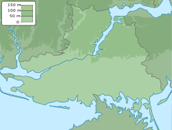
Davydiv Brid (Ukrainian: Давидів Брід, pronounced [dɐˈwɪd⁽ʲ⁾iu̯ br⁽ʲ⁾id]; Russian: Давыдов Брод; literally David's Ford) is a village in Beryslav Raion, Kherson Oblast, southern Ukraine, about 76 kilometres (47 mi) northeast of the centre of Kherson city. It belongs to the Velyka Oleksandrivka settlement hromada, one of the hromadas of Ukraine. The village lies besides the Inhulets river.[2][3] The border of Kherson Oblast with Mykolaiv Oblast runs on the north-west side of the village.
This article may be expanded with text translated from the corresponding article in Ukrainian. (July 2022) Click [show] for important translation instructions.
|
Davydiv Brid
Давидів Брід | |
|---|---|
Village | |
 | |
 Davydiv Brid Location of Davydiv Brid within Ukraine  Davydiv Brid Davydiv Brid (Ukraine) | |
| Coordinates: 47.241667°N 33.191111°E | |
| Country | |
| Oblast | Kherson Oblast |
| Raion | Beryslav Raion |
| Hromada | Velyka Oleksandrivka |
| Founded | 1795 |
| Area | |
| • Total | 2.045 km2 (0.790 sq mi) |
| Elevation | 9 m (30 ft) |
| Population (2001 census)[1] | |
| • Total | 1,223 |
| • Density | 600/km2 (1,500/sq mi) |
| Time zone | UTC+2 (EET) |
| • Summer (DST) | UTC+3 (EEST) |
| Postal code | 74120 |
| Area code | +380 5532 |
 | |
History
During the Russian Empire, Davydiv Brid was the administrative center of the Davydobrodska Volost, one of the volosts of Khersonskiy Uyezd.
In 1886, the village had a population of 683.[4]
At least 144 residents of Davydiv Brid died during the Holodomor.[citation needed]
Davydiv Brid was captured by Russian forces during its 2022 invasion of Ukraine, and was later the center of fighting during the battle of Davydiv Brid. Davydiv Brid was liberated by Ukrainian forces on October 4.[5]
Demographics
According to the 2001 Ukrainian Census, the village had 1223 inhabitants.[1]
The native language of the village as of 2001 were:[1]
| Language | People | %% |
|---|---|---|
| Ukrainian | 1177 | 96.24% |
| Russian | 40 | 3.27% |
| Moldovan (Romanian) | 2 | 0.16% |
| Belarusian | 1 | 0.08% |
| Hungarian | 1 | 0.08% |
| Others | 2 | 0.17% |
References
- "Офіційна сторінка Всеукраїнського перепису населення | Банк даних" [All-Ukrainian population census | Database]. ukrcensus.gov.ua (in Ukrainian). Retrieved 15 October 2022.
- "Invaders mining Inhulets River coast to hold off Ukrainian troops". ukrinform.net. 31 May 2022. Retrieved 2 June 2022.
"In the Southern Buh direction, the enemy is defending and mining the coast of the Inhulets River in areas where units of our troops may be operating. It is also engaged in counter-battery combat, inflicting air strikes with the involvement of army aircraft in the area of the settlement of Davydiv Brid, Kherson region,” the statement reads.
- "Russian Offensive Campaign Assessment, June 1". understandingwar.org. ISW. 1 June 2022. Retrieved 2 June 2022.
Russian troops reportedly destroyed Ukrainian-built bridges over the Inhulets River near Davydiv Brid in response to Ukrainian counteroffensive pressure.
- Інгульський степ. Збірник Archived 2022-01-20 at the Wayback Machine / Упорядник В. А. Сердюк. — К.: Ярославів Вал, 2019. — с. 61.
- "Russian Offensive Campaign Assessment, October 4". Institute for the Study of War. Retrieved 23 October 2022.
Administrative center: Beryslav | ||
| Cities |  | |
| Settlements | ||
| Villages |
| |
This article about a location in Kherson Oblast is a stub. You can help Wikipedia by expanding it. |
На других языках
[de] Dawydiw Brid
Dawydiw Brid (ukrainisch Давидів Брід, russisch Давыдов Брод .mw-parser-output .Latn{font-family:"Akzidenz Grotesk","Arial","Avant Garde Gothic","Calibri","Futura","Geneva","Gill Sans","Helvetica","Lucida Grande","Lucida Sans Unicode","Lucida Grande","Stone Sans","Tahoma","Trebuchet","Univers","Verdana"}Dawydow Brod) ist ein Dorf im Rajon Beryslaw der ukrainischen Oblast Cherson. Es wurde 2001 von 1223 Menschen bewohnt.[1]- [en] Davydiv Brid
[ru] Давыдов Брод
Давыдов Брод (укр. Давидів Брід) — село в Великоалександровском районе Херсонской области Украины.Другой контент может иметь иную лицензию. Перед использованием материалов сайта WikiSort.org внимательно изучите правила лицензирования конкретных элементов наполнения сайта.
WikiSort.org - проект по пересортировке и дополнению контента Википедии