world.wikisort.org - Turkey
The Marmara Region (Turkish: Marmara Bölgesi) is a geographical region of Turkey.
Marmara
Marmara Bölgesi | |
|---|---|
Region of Turkey | |
 | |
| Coordinates: 41°00′N 29°00′E | |
| Country | Turkey |
| Capital | Istanbul |
| Provinces | |
| Government | |
| • İstanbul Mayor | Ekrem İmamoğlu |
| Area | |
| • Total | 67,000 km2 (26,000 sq mi) |
| • Rank | 6th |
| Population (Jan. 2021)(INSEE) | |
| • Total | 26,650,405 |
| • Rank | 1st |
| Demonym | Turkish: Marmaralı |
| Time zone | UTC+03:00 (CET) |
| • Summer (DST) | UTC+03:00 (CEST) |
| ISO 3166 code | TR-IDF |
| GRP[1] | Ranked 1st |
| –Total | $582 billion / 1,405,514 milion (GDP PPP) in 2018 |
| –Per capita | €60,100 ($71,900) |
| NUTS Region | TR1 |
| Website | marmara |
Located in northwestern Turkey, it is bordered by Greece and the Aegean Sea to the west, Bulgaria and the Black Sea to the north, the Black Sea Region to the east, and the Aegean Region to the south. At the center of the region is the Sea of Marmara, which gives the region its name. The largest city in the region is Istanbul. Other big cities are Bursa, İzmit, Balıkesir, Tekirdağ, Çanakkale and Edirne.
Among the seven geographical regions, the Marmara Region has the second-smallest area, yet the largest population; it is the most densely populated region in the country.


Subdivision
- Çatalca - Kocaeli Section (Turkish: Çatalca - Kocaeli Bölümü)
- Ergene Section (Turkish: Ergene Yöresi)
- Southern Marmara Section (Turkish: Güney Marmara Bölümü)
- Yıldız Section (Turkish: Yıldız Bölümü)
Ecoregions
Terrestrial
Palearctic
Temperate broadleaf and mixed forests
- Balkan mixed forests
- Euxine-Colchic deciduous forests
Temperate coniferous forests
Mediterranean forests, woodlands, and scrub
- Aegean and Western Turkey sclerophyllous and mixed forests
- Anatolian conifer and deciduous mixed forests
Provinces

Provinces that are entirely in the Marmara Region:
- Edirne
- İstanbul
- Kırklareli
- Kocaeli
- Tekirdağ
- Yalova
Provinces that are mostly in the Marmara Region:

Geography
| İzmit | ||||||||||||||||||||||||||||||||||||||||||||||||||||||||||||
|---|---|---|---|---|---|---|---|---|---|---|---|---|---|---|---|---|---|---|---|---|---|---|---|---|---|---|---|---|---|---|---|---|---|---|---|---|---|---|---|---|---|---|---|---|---|---|---|---|---|---|---|---|---|---|---|---|---|---|---|---|
| Climate chart (explanation) | ||||||||||||||||||||||||||||||||||||||||||||||||||||||||||||
| ||||||||||||||||||||||||||||||||||||||||||||||||||||||||||||
| ||||||||||||||||||||||||||||||||||||||||||||||||||||||||||||
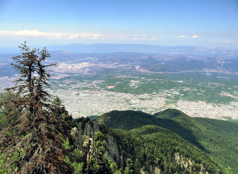
The Yıldız Mountains and Uludağ are in the Marmara Region. Islands in the Aegean Sea are Gökçeada and Bozcaada, and in the Sea of Marmara are Marmara Island, Avşa, Paşalimanı, İmralı and the Princes Islands of Istanbul.
Climate
The Marmara region has a hybrid mediterranean climate/humid subtropical climate on the Aegean Sea coast and the south Marmara Sea coast, an oceanic climate on the Black Sea coast and a humid continental climate in the interior. Summers are warm to hot and moderately dry whereas winters are cold and wet and sometimes snowy. The coastal climate keeps the temperatures relatively mild.
See also
- East Thrace
- Sea of Marmara
- Dardanelles
- Bosporus
- Turkish Straits
- Geographical regions of Turkey
- Provinces of Turkey
References
- "Database - Regions - Eurostat".
- Turkish State Meteorology Archived 2011-03-13 at the Wayback Machine
External links
- Golyaka Village, Bursa (in Turkish)
Geographical regions of Turkey | ||
|---|---|---|
| Authority control |
|
|---|
Другой контент может иметь иную лицензию. Перед использованием материалов сайта WikiSort.org внимательно изучите правила лицензирования конкретных элементов наполнения сайта.
WikiSort.org - проект по пересортировке и дополнению контента Википедии