world.wikisort.org - Thailand
Wiang Nong Long (Thai: เวียงหนองล่อง, pronounced [wīa̯ŋ nɔ̌ːŋ lɔ̂ŋ]) is a district (amphoe) of Lamphun province, northern Thailand.
Wiang Nong Long
เวียงหนองล่อง | |
|---|---|
Amphoe | |
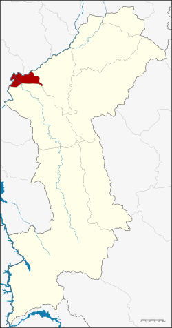 Amphoe location in Lamphun province | |
| Coordinates: 18°23′36″N 98°43′6″E | |
| Country | Thailand |
| Province | Lamphun |
| Area | |
| • Total | 49.4 km2 (19.1 sq mi) |
| Population (2015) | |
| • Total | 17,739 |
| • Density | 377.8/km2 (978/sq mi) |
| Time zone | UTC+7 (ICT) |
| Postal code | 51120 |
| Geocode | 5108 |
History
The minor district (king amphoe) was split off from Pa Sang district becoming effective on 1 April 1995.[1]
On 15 May 2007, all 81 minor districts were upgraded to full districts.[2] With publication in the Royal Gazette on 24 August, the upgrade became official.[3]
Geography
Neighboring districts are (from the east clockwise) Pa Sang and Ban Hong of Lamphun Province, Chom Thong and Doi Lo of Chiang Mai province.
Administration
Central administration
The district Wiang Nong Long is divided into three sub-districts (tambon), which are further subdivided into 25 administrative villages (Muban).
| No. | Name | Thai | Villages | Pop.[4] |
|---|---|---|---|---|
| 1. | Nong Long | หนองล่อง | 9 | 5,887 |
| 2. | Nong Yuang | หนองยวง | 5 | 3,801 |
| 3. | Wang Phang | วังผาง | 11 | 8,051 |
Local administration
There are three sub-district municipalities (Thesaban Tambon) in the district:
- Wang Phang (Thai: เทศบาลตำบลวังผาง) consisting of sub-district Wang Phang.
- Nong Yuang (Thai: เทศบาลตำบลหนองยวง) consisting of sub-district Nong Yuang.
- Nong Long (Thai: เทศบาลตำบลหนองล่อง) consisting of sub-district Nong Long.
References
- ประกาศกระทรวงมหาดไทย เรื่อง แบ่งเขตท้องที่อำเภอป่าซาง จังหวัดลำพูน ตั้งเป็นกิ่งอำเภอเวียงหนองล่อง (PDF). Royal Gazette (in Thai). 112 (Special 9 ง): 62. March 22, 1995.
- แถลงผลการประชุม ครม. ประจำวันที่ 15 พ.ค. 2550 (in Thai). Manager Online.
- พระราชกฤษฎีกาตั้งอำเภอฆ้องชัย...และอำเภอเหล่าเสือโก้ก พ.ศ. ๒๕๕๐ (PDF). Royal Gazette (in Thai). 124 (46 ก): 14–21. August 24, 2007.
- "Population statistics 2015" (in Thai). Department of Provincial Administration. Retrieved 2016-04-21.
This Lamphun Province location article is a stub. You can help Wikipedia by expanding it. |
Другой контент может иметь иную лицензию. Перед использованием материалов сайта WikiSort.org внимательно изучите правила лицензирования конкретных элементов наполнения сайта.
WikiSort.org - проект по пересортировке и дополнению контента Википедии