world.wikisort.org - Thailand
Tron (Thai: ตรอน, pronounced [trɔ̄ːn]) is a district (amphoe) of Uttaradit province, northern Thailand.
Tron
ตรอน | |
|---|---|
District | |
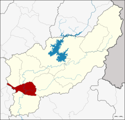 District location in Uttaradit province | |
| Coordinates: 17°28′56″N 100°6′47″E | |
| Country | Thailand |
| Province | Uttaradit |
| Seat | Wang Daeng |
| Area | |
| • Total | 314.501 km2 (121.430 sq mi) |
| Population (2008) | |
| • Total | 35,036 |
| • Density | 113.6/km2 (294/sq mi) |
| Time zone | UTC+7 (ICT) |
| Postal code | 53140 |
| Geocode | 5302 |
Geography
Neighboring districts are (from the north clockwise) Laplae, Mueang Uttaradit, Thong Saen Khan, Phichai, of Uttaradit Province, Si Nakhon and Si Satchanalai of Sukhothai province
Administration
The district is divided into five sub-districts (tambons), which are further subdivided into 47 villages (mubans). There are two sub-district municipalities (thesaban tambon): Tron covers parts of tambon Wang Daeng, and Ban Kaeng covers parts of the same-named tambon. There are a further five tambon administrative organizations (TAO).
| No. | Name | Thai | Villages | Pop.[1] |
|---|---|---|---|---|
| 1. | Wang Daeng | วังแดง | 12 | 11,091 |
| 2. | Ban Kaeng | บ้านแก่ง | 10 | 7,567 |
| 3. | Hat Song Khwae | หาดสองแคว | 7 | 4,148 |
| 4. | Nam Ang | น้ำอ่าง | 10 | 7,975 |
| 5. | Khoi Sung | ข่อยสูง | 8 | 4,255 |
References
- "Population statistics 2008". Department of Provincial Administration. Archived from the original on 2009-08-20.
External links
- amphoe.com (Thai)
This Uttaradit province location article is a stub. You can help Wikipedia by expanding it. |
Текст в блоке "Читать" взят с сайта "Википедия" и доступен по лицензии Creative Commons Attribution-ShareAlike; в отдельных случаях могут действовать дополнительные условия.
Другой контент может иметь иную лицензию. Перед использованием материалов сайта WikiSort.org внимательно изучите правила лицензирования конкретных элементов наполнения сайта.
Другой контент может иметь иную лицензию. Перед использованием материалов сайта WikiSort.org внимательно изучите правила лицензирования конкретных элементов наполнения сайта.
2019-2026
WikiSort.org - проект по пересортировке и дополнению контента Википедии
WikiSort.org - проект по пересортировке и дополнению контента Википедии