world.wikisort.org - Thailand
Rattaphum (Thai: รัตภูมิ, pronounced [rát.tā.pʰūːm]) is a district (amphoe) of Songkhla province, southern Thailand.
Rattaphum
รัตภูมิ | |
|---|---|
District | |
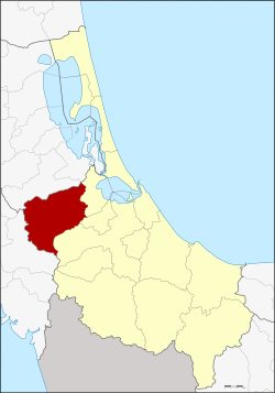 District location in Songkhla province | |
| Coordinates: 7°8′6″N 100°16′24″E | |
| Country | Thailand |
| Province | Songkhla |
| Seat | Kamphaeng Phet |
| Subdistricts | 5 |
| Mubans | 63 |
| Area | |
| • Total | 591.8 km2 (228.5 sq mi) |
| Population (2014) | |
| • Total | 73,744 |
| • Density | 114.8/km2 (297/sq mi) |
| Time zone | UTC+7 (ICT) |
| Postal code | 90180 |
| Geocode | 9009 |
Geography
Neighboring districts are (from the east clockwise): Khuan Niang, Bang Klam, and Hat Yai of Songkhla Province; Khuan Kalong of Satun province; and Pa Bon of Phatthalung province.
History
The district was renamed from Kamphaeng Phet to Rattaphum in 1939.[1]
Administration
Central administration
Rattaphum is divided into five sub-districts (tambons), which are further subdivided into 63 administrative villages (mubans).
| No. | Name | Thai | Villages | Pop.[2] |
|---|---|---|---|---|
| 1. | Kamphaeng Phet | กำแพงเพชร | 13 | 21,302 |
| 2. | Tha Chamuang | ท่าชะมวง | 15 | 17,674 |
| 3. | Khuha Tai | คูหาใต้ | 14 | 11,923 |
| 4. | Khuan Ru | ควนรู | 9 | 6,041 |
| 9. | Khao Phra | เขาพระ | 12 | 16,804 |
Missing numbers are tambon which now form Khuan Niang District.
Local administration
There is one town (Thesaban Mueang) in the district:
- Kamphaeng Phet (Thai: เทศบาลเมืองกำแพงเพชร) consisting of parts of sub-district Kamphaeng Phet.
There are three sub-district municipalities (thesaban tambon) in the district:
- Kamphaeng Phet (Thai: เทศบาลตำบลกำแพงเพชร) consisting of parts of sub-district Kamphaeng Phet.
- Na Si Thong (Thai: เทศบาลตำบลนาสีทอง) consisting of parts of sub-district Khao Phra.
- Khuha Tai (Thai: เทศบาลตำบลคูหาใต้) consisting of sub-district Khuha Tai.
There are three sub-district administrative organizations (SAO) in the district:
- Tha Chamuang (Thai: องค์การบริหารส่วนตำบลท่าชะมวง) consisting of sub-district Tha Chamuang.
- Khuan Ru (Thai: องค์การบริหารส่วนตำบลควนรู) consisting of sub-district Khuan Ru.
- Khao Phra (Thai: องค์การบริหารส่วนตำบลเขาพระ) consisting of parts of sub-district Khao Phra.
References
- พระราชกฤษฎีกาเปลี่ยนนามอำเภอ กิ่งอำเภอ และตำบลบางแห่ง พุทธศักราช ๒๔๘๒ (PDF). Royal Gazette (in Thai). 56 (ก): 354–364. April 17, 1939.
- "Population statistics 2014" (in Thai). Department of Provincial Administration. Retrieved 2015-06-10.
External links
Authority control | |
|---|---|
| General |
|
| National libraries | |
This Songkhla Province location article is a stub. You can help Wikipedia by expanding it. |
Другой контент может иметь иную лицензию. Перед использованием материалов сайта WikiSort.org внимательно изучите правила лицензирования конкретных элементов наполнения сайта.
WikiSort.org - проект по пересортировке и дополнению контента Википедии