world.wikisort.org - Thailand
Nong Hi (Thai: หนองฮี, pronounced [nɔ̌ːŋ hīː]) is a district (amphoe) of Roi Et province, Thailand.
Nong Hi
หนองฮี | |
|---|---|
District | |
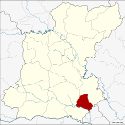 District location in Roi Et province | |
| Coordinates: 15°36′37″N 103°59′26″E | |
| Country | Thailand |
| Province | Roi Et |
| Seat | Nong Hi |
| Area | |
| • Total | 132.0 km2 (51.0 sq mi) |
| Population (2005) | |
| • Total | 25,696 |
| • Density | 5.14/km2 (13.3/sq mi) |
| Time zone | UTC+7 (ICT) |
| Postal code | 45140 |
| Geocode | 4519 |
Geography
Neighboring districts are (from the south clockwise): Phon Sai, Suwannaphum, and Phanom Phrai of Roi Et Province, and Sila Lat of Sisaket province.
History
The minor district (king amphoe) was created on 1 April 1995, when the three tambons Nong Hi, Sao Hae, and Duk Ueng were split off from Phanom Phrai district.[1]
The Thai government on 15 May 2007, upgraded all 81 minor districts to full districts.[2] With publication in the Royal Gazette on 24 August, the upgrade became official.[3]
Administration
The district is divided into four sub-districts (tambons), which are further subdivided into 54 villages (mubans). There are no municipal (thesaban) areas. There are four tambon administrative organization (TAO).
| No. | Name | Thai name | Villages | Pop. | |
|---|---|---|---|---|---|
| 1. | Nong Hi | หนองฮี | 17 | 6,477 | |
| 2. | Sao Hae | สาวแห | 7 | 3,156 | |
| 3. | Duk Ueng | ดูกอึ่ง | 17 | 8,688 | |
| 4. | Den Rat | เด่นราษฎร์ | 13 | 7,375 |
References
- ประกาศกระทรวงมหาดไทย เรื่อง แบ่งเขตท้องที่อำเภอพนมไพร จังหวัดร้อยเอ็ด ตั้งเป็นกิ่งอำเภอหนองฮี (PDF). Royal Gazette (in Thai). 112 (Special 9 ง): 56. March 22, 1995.
- แถลงผลการประชุม ครม. ประจำวันที่ 15 พ.ค. 2550 (in Thai). Manager Online.
- พระราชกฤษฎีกาตั้งอำเภอฆ้องชัย...และอำเภอเหล่าเสือโก้ก พ.ศ. ๒๕๕๐ (PDF). Royal Gazette (in Thai). 124 (46 ก): 14–21. August 24, 2007.
External links
Другой контент может иметь иную лицензию. Перед использованием материалов сайта WikiSort.org внимательно изучите правила лицензирования конкретных элементов наполнения сайта.
WikiSort.org - проект по пересортировке и дополнению контента Википедии