world.wikisort.org - Thailand
Nong Chik (Thai: หนองจิก, pronounced [nɔ̌ːŋ t͡ɕìk]) is a district (amphoe) in Pattani province, southern Thailand.
Nong Chik
หนองจิก | |
|---|---|
District | |
 Bangtawa in 2015. | |
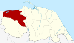 District location in Pattani province | |
| Coordinates: 6°50′40″N 101°10′43″E | |
| Country | Thailand |
| Province | Pattani |
| Seat | Tuyong |
| Area | |
| • Total | 231.5 km2 (89.4 sq mi) |
| Population (2014) | |
| • Total | 76,630 |
| • Density | 296.6/km2 (768/sq mi) |
| Time zone | UTC+7 (ICT) |
| Postal code | 94170 |
| Geocode | 9403 |
History
Nong Chik was one of the seven states (mueang) into which the Pattani Kingdom was split in the early-19th century to diminish the power of the often rebellious tributary kingdom. The capital was put in tambon Nong Mai (Yarang District). In 1901 the district office was moved to Tu Yong, where it remains.
Due to the district office location in Tu Yong, the district was renamed "Tu Yong" in 1917.[1] In 1938 it was again renamed "Nong Chik".[2]
Geography
Neighboring districts are (from the east clockwise): Mueang Pattani, Yarang, Mae Lan, and Khok Pho of Pattani Province; and Thepha of Songkhla province. To the north is the Gulf of Thailand.
Economy
Nong Chik is the center of the two year-old Orangpantai Fishing Enterprise (literally, 'sea gypsy company'). It is a cooperative that specializes in the catch, preparation, and sale of preserved fish.[3] Its specialty is salted four-finger threadfins, locally known as plaa kulao, as well as salted spotted mackerel or plaa insee, dried squid, and smooth-textured shrimp paste.
The majority of its members belong to the Pattani Provincial Small-Scale Fisher Network Association, which works with local fishermen to conserve marine resources. Association members have one important rule—they must refrain from using destructive fishing gear and nets that trap juvenile fish as by-catch. The enforcement of this rule has caused fish stocks in the area to rebound.[4]
Administration
Central administration
Nong Chik is divided into 12 sub-districts (tambons), which are further subdivided into 76 administrative villages (mubans).
| No. | Name | Thai | Villages | Pop.[5] |
|---|---|---|---|---|
| 1. | Ko Po | เกาะเปาะ | 3 | 3,712 |
| 2. | Kholo Tanyong | คอลอตันหยง | 8 | 5,788 |
| 3. | Don Rak | ดอนรัก | 7 | 5,362 |
| 4. | Dato | ดาโต๊ะ | 5 | 2,799 |
| 5. | Tuyong | ตุยง | 8 | 12,751 |
| 6. | Tha Kamcham | ท่ากำชำ | 7 | 7,159 |
| 7. | Bo Thong | บ่อทอง | 9 | 12,991 |
| 8. | Bang Khao | บางเขา | 7 | 7,866 |
| 9. | Bang Tawa | บางตาวา | 2 | 3,574 |
| 10. | Pulo Puyo | ปุโละปุโย | 9 | 7,570 |
| 11. | Yabi | ยาบี | 6 | 3,760 |
| 12. | Lipa Sa-ngo | ลิปะสะโง | 5 | 3,298 |
Local administration
There are two sub-district municipalities (thesaban tambons) in the district:
- Bo Thong (Thai: เทศบาลตำบลบ่อทอง) consisting of sub-district Bo Thong and parts of sub-district Bang Khao.
- Nong Chik (Thai: เทศบาลตำบลหนองจิก) consisting of parts of sub-district Tuyong.
There are 11 subdistrict administrative organizations (SAO) in the district:
- Ko Po (Thai: องค์การบริหารส่วนตำบลเกาะเปาะ) consisting of sub-district Ko Po.
- Kholo Tanyong (Thai: องค์การบริหารส่วนตำบลคอลอตันหยง) consisting of sub-district Kholo Tanyong.
- Don Rak (Thai: องค์การบริหารส่วนตำบลดอนรัก) consisting of sub-district Don Rak.
- Dato (Thai: องค์การบริหารส่วนตำบลดาโต๊ะ) consisting of sub-district Dato.
- Tuyong (Thai: องค์การบริหารส่วนตำบลตุยง) consisting of parts of sub-district Tuyong.
- Tha Kamcham (Thai: องค์การบริหารส่วนตำบลท่ากำชำ) consisting of sub-district Tha Kamcham.
- Bang Khao (Thai: องค์การบริหารส่วนตำบลบางเขา) consisting of parts of sub-district Bang Khao.
- Bang Tawa (Thai: องค์การบริหารส่วนตำบลบางตาวา) consisting of sub-district Bang Tawa.
- Pulo Puyo (Thai: องค์การบริหารส่วนตำบลปุโละปุโย) consisting of sub-district Pulo Puyo.
- Yabi (Thai: องค์การบริหารส่วนตำบลยาบี) consisting of sub-district Yabi.
- Lipa Sa-ngo (Thai: องค์การบริหารส่วนตำบลลิปะสะโง) consisting of sub-district Lipa Sa-ngo.
References
- ประกาศกระทรวงมหาดไทย เรื่อง เปลี่ยนชื่ออำเภอ (PDF). Royal Gazette (in Thai). 34 (ก): 40–68. 1917-04-29.
- พระราชกฤษฎีกาเปลี่ยนนามจังหวัด และอำเภอบางแห่ง พุทธศักราช ๒๔๘๑ (PDF). Royal Gazette (in Thai). 55 (ก): 658–666. 1938-11-14.
- Kongrut, Anchalee (2 September 2019). "From Pattani seas to Bangkok plates". Bangkok Post. Retrieved 7 September 2019.
- Asadamongkoln, Supaporn (22 June 2019). "Hauling up hopes of local fishermen". Bangkok Post. Retrieved 22 June 2019.
- "Population statistics 2014" (in Thai). Department of Provincial Administration. Retrieved 2015-06-09.
External links
- amphoe.com (Thai)
- http://www.nongjik.blogspot.com/ Official blog of the district office
| Historical divisions |
| ||||
|---|---|---|---|---|---|
| Former provinces |
| ||||
| |||||
This Pattani Province location article is a stub. You can help Wikipedia by expanding it. |
Другой контент может иметь иную лицензию. Перед использованием материалов сайта WikiSort.org внимательно изучите правила лицензирования конкретных элементов наполнения сайта.
WikiSort.org - проект по пересортировке и дополнению контента Википедии