world.wikisort.org - Thailand
Na Yia (Thai: นาเยีย, pronounced [nāː jīa̯]) is a district (amphoe) in the central part of Ubon Ratchathani province, northeastern Thailand.
Na Yia
นาเยีย | |
|---|---|
District | |
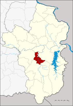 Districtlocation in Ubon Ratchathani province | |
| Coordinates: 15°3′34″N 105°3′37″E | |
| Country | Thailand |
| Province | Ubon Ratchathani |
| Seat | Na Yia |
| Area | |
| • Total | 227.0 km2 (87.6 sq mi) |
| Population (2005) | |
| • Total | 24,970 |
| • Density | 110.0/km2 (285/sq mi) |
| Time zone | UTC+7 (ICT) |
| Postal code | 34160 |
| Geocode | 3429 |
History
Na Yia was separated from Det Udom district to create a minor district (king amphoe) on 31 May 1993.[1]
On 15 May 2007, all 81 minor districts were upgraded to full districts.[2] On 24 August the upgrade became official.[3]
Geography
Neighboring districts are (from the north clockwise) Sawang Wirawong, Phibun Mangsahan, Det Udom and Warin Chamrap.
Administration
The district is divided into three sub-districts (tambons), which are further subdivided into 34 villages (mubans). Na Yia is a township (thesaban tambon) which covers parts of tambon Na Yia. There are a further three tambon administrative organizations (TAO).
| No. | Name | Thai name | Villages | Pop. | |
|---|---|---|---|---|---|
| 1. | Na Yia | นาเยีย | 12 | 11,750 | |
| 2. | Na Di | นาดี | 13 | 6,898 | |
| 3. | Na Rueang | นาเรือง | 9 | 6,322 |
References
- ประกาศกระทรวงมหาดไทย เรื่อง แบ่งเขตท้องที่อำเภอเดชอุดม จังหวัดอุบลราชธานี ตั้งเป็นกิ่งอำเภอนาเยีย (PDF). Royal Gazette (in Thai). 110 (74 ง): 17. June 8, 1993.
- แถลงผลการประชุม ครม. ประจำวันที่ 15 พ.ค. 2550 (in Thai). Manager Online.
- พระราชกฤษฎีกาตั้งอำเภอฆ้องชัย...และอำเภอเหล่าเสือโก้ก พ.ศ. ๒๕๕๐ (PDF). Royal Gazette (in Thai). 124 (46 ก): 14–21. August 24, 2007.
External links
This Ubon Ratchathani Province location article is a stub. You can help Wikipedia by expanding it. |
Другой контент может иметь иную лицензию. Перед использованием материалов сайта WikiSort.org внимательно изучите правила лицензирования конкретных элементов наполнения сайта.
WikiSort.org - проект по пересортировке и дополнению контента Википедии