world.wikisort.org - Thailand
Mueang Chonburi (Thai: เมืองชลบุรี, RTGS: Mueang Chon Buri, pronounced [mɯ̄a̯ŋ t͡ɕʰōn bū.rīː]) is the capital district (amphoe mueang) of Chonburi province, eastern Thailand.
Mueang Chonburi
เมืองชลบุรี | |
|---|---|
District | |
 The Khao Khiao Massif rising east of Chonburi | |
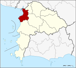 District location in Chonburi province | |
| Coordinates: 13°21′43″N 100°58′45″E | |
| Country | Thailand |
| Province | Chonburi |
| Seat | Bang Pla Soi |
| Area | |
| • Total | 228.8 km2 (88.3 sq mi) |
| Population (2015) | |
| • Total | 322,057 |
| • Density | 1,407.59/km2 (3,645.6/sq mi) |
| Time zone | UTC+7 (ICT) |
| Postal code | 20000[1] |
| Geocode | 2001 |
Geography
Neighbouring districts are (from the north clockwise) Bang Pakong of Chachoengsao province, Phan Thong, Ban Bueng and Si Racha. To the west is the Bay of Bangkok.
History
On 14 November 1938 the district's name was changed from Bang Pla Soi (บางปลาสร้อย) to Mueang Chonburi .[2]
Administration
Central administration
The district Mueang Chon Buri is subdivided into 18 subdistricts (Tambon), which are further subdivided into 122 administrative villages (Muban).
| No. | Name | Thai | Villages | Pop.[3] |
|---|---|---|---|---|
| 1. | Bang Pla Soi | บางปลาสร้อย | - | 14,962 |
| 2. | Makham Yong | มะขามหย่ง | - | 5,940 |
| 3. | Ban Khot | บ้านโขด | - | 6,155 |
| 4. | Saen Suk | แสนสุข | 15 | 38,469 |
| 5. | Ban Suan | บ้านสวน | 10 | 66,032 |
| 6. | Nong Ri | หนองรี | 14 | 15,857 |
| 7. | Na Pa | นาป่า | 12 | 39,716 |
| 8. | Nong Khang Khok | หนองข้างคอก | 7 | 7,990 |
| 9. | Don Hua Lo | ดอนหัวฬ่อ | 7 | 12,114 |
| 10. | Nong Mai Daeng | หนองไม้แดง | 7 | 12,815 |
| 11. | Bang Sai | บางทราย | 6 | 12,419 |
| 12. | Khlong Tamru | คลองตำหรุ | 6 | 8,050 |
| 13. | Mueang | เหมือง | 5 | 15,364 |
| 14. | Ban Puek | บ้านปึก | 7 | 8,797 |
| 15. | Huai Kapi | ห้วยกะปิ | 7 | 23,835 |
| 16. | Samet | เสม็ด | 8 | 35,323 |
| 17. | Ang Sila | อ่างศิลา | 5 | 5,838 |
| 18. | Samnak Bok | สำนักบก | 6 | 5,387 |
Local administration
There are 4 towns (Thesaban Mueang) in the district:
- Chon Buri (Thai: เทศบาลเมืองชลบุรี) consisting of the complete subdistrict Bang Pla Soi, Makham Yong, Ban Khot.
- Saen Suk (Thai: เทศบาลเมืองแสนสุข) consisting of the complete subdistrict Saen Suk and parts of the subdistricts Mueang, Huai Kapi.
- Ban Suan (Thai: เทศบาลเมืองบ้านสวน) consisting of the complete subdistrict Ban Suan and parts of the subdistricts Nong Ri, Nong Khang Khok.
- Ang Sila (Thai: เทศบาลเมืองอ่างศิลา) consisting of the complete subdistrict Ban Puek, Ang Sila and parts of the subdistricts Huai Kapi, Samet.
There are 8 subdistrict municipalities (Thesaban Tambon) in the district:
- Khlong Tamru (Thai: เทศบาลตำบลคลองตำหรุ) consisting of parts of the subdistrict Khlong Tamru.
- Bang Sai (Thai: เทศบาลตำบลบางทราย) consisting of the complete subdistrict Bang Sai.
- Nong Mai Daeng (Thai: เทศบาลตำบลหนองไม้แดง) consisting of the complete subdistrict Nong Mai Daeng.
- Na Pa (Thai: เทศบาลตำบลนาป่า) consisting of the complete subdistrict Na Pa.
- Huai Kapi (Thai: เทศบาลตำบลห้วยกะปิ) consisting of parts of the subdistrict Huai Kapi.
- Don Hua Lo (Thai: เทศบาลตำบลดอนหัวฬ่อ) consisting of the complete subdistrict Don Hua Lo.
- Samet (Thai: เทศบาลตำบลเสม็ด) consisting of parts of the subdistrict Samet.
- Mueang (Thai: เทศบาลตำบลเหมือง) consisting of parts of the subdistrict Mueang.
There are 4 subdistrict administrative organizations (SAO) in the district:
- Nong Ri (Thai: องค์การบริหารส่วนตำบลหนองรี) consisting of parts of the subdistrict Nong Ri.
- Nong Khang Khok (Thai: องค์การบริหารส่วนตำบลหนองข้างคอก) consisting of parts of the subdistrict Nong Khang Khok.
- Khlong Tamru (Thai: องค์การบริหารส่วนตำบลคลองตำหรุ) consisting of parts of the subdistrict Khlong Tamru.
- Samnak Bok (Thai: องค์การบริหารส่วนตำบลสำนักบก) consisting of the complete subdistrict Samnak Bok.
Economy
Ang Sila is a leading producer of granite mortars and pestles, essential in the preparation of Thai cuisine.[4]
References
- Tambon Ban Puk, Saen Suk, Mueang, muban 4 and 5 of Huai Kapi and muban 7 and 8 of Samet are handled by Bang Saen and have postal code 20130
- "พระราชกฤษฎีกา เปลี่ยนนามจังหวัด และอำเภอบางแห่ง พุทธศักราช ๒๔๘๑" [Royal Decree: Change name of Provinces and Districts] (PDF). Royal Thai Government Gazette. 55: 658–666. 14 November 1938. Retrieved 20 April 2020, page 660
{{cite journal}}: CS1 maint: postscript (link) - "Population statistics 2018" (in Thai). Department of Provincial Administration. Retrieved 2019-10-10.
- Sukphisit, Suthon (2019-03-24). "The enduring symbol of Thai cuisine". Bangkok Post. No. B. Magazine. Retrieved 2019-03-24.
External links
 Chonburi travel guide from Wikivoyage
This Chonburi Province location article is a stub. You can help Wikipedia by expanding it. |
Другой контент может иметь иную лицензию. Перед использованием материалов сайта WikiSort.org внимательно изучите правила лицензирования конкретных элементов наполнения сайта.
WikiSort.org - проект по пересортировке и дополнению контента Википедии