world.wikisort.org - Thailand
Krong Pinang (Thai: กรงปินัง, pronounced [krōŋ pī.nāŋ], Malay: Kampung Pinang, Patani Malay: کامڤوڠ ڤينڠ) is a district (amphoe) of Yala province, southern Thailand, established by the Royal Decree Establishing Amphoe Krong Pinang, Changwat Yala, BE 2547 (2004), which came into force on 8 October 2004.
Krong Pinang
กรงปินัง | |
|---|---|
District | |
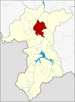 District location in Yala province | |
| Coordinates: 6°24′40″N 101°16′24″E | |
| Country | Thailand |
| Province | Yala |
| Seat | Sa-ae |
| Area | |
| • Total | 191.0 km2 (73.7 sq mi) |
| Population (2005) | |
| • Total | 22,411 |
| • Density | 117.3/km2 (304/sq mi) |
| Time zone | UTC+7 (ICT) |
| Postal code | 95000 |
| Geocode | 9508 |
Etymology
The name Krong Pinang is a Thai corruption of Kampung Pinang (Jawi: كامڤوڠ ڤينڠ, pronounced [kām.pōŋ.pī.nɛː]), its original Malay name means 'village of Pinang'. The word pinang means 'betel palm' or 'betel nut tree' (Areca catechu) in Malay.
History
The minor district (king amphoe) Krong Pinang was established on 30 April 1994, when four tambons were split off from Mueang Yala district.[1] It was upgraded to a full district on 8 October 2004.[2]
Geography
Neighboring districts are (from the east clockwise): Raman, Bannang Sata, Yaha, and Mueang Yala of Yala Province.
Administration
The district is divided into four sub-districts (tambons), which are further subdivided into 23 villages (mubans). There are no municipal (thesaban) areas. There are four tambon administrative organizations (TAO).
| No. | Name | Thai name | Villages | Pop. | |
|---|---|---|---|---|---|
| 1. | Krong Pinang | กรงปินัง | 9 | 9286 | |
| 2. | Sa-e | สะเอะ | 5 | 5757 | |
| 3. | Huai Krathing | ห้วยกระทิง | 4 | 3334 | |
| 4. | Purong | ปุโรง | 4 | 4034 |
References
- ประกาศกระทรวงมหาดไทย เรื่อง แบ่งเขตท้องที่อำเภอเมืองยะลา จังหวัดยะลา ตั้งเป็นกิ่งอำเภอกรงปินัง (PDF). Royal Gazette (in Thai). 111 (42 ง): 20. May 26, 1994.
- พระราชกฤษฎีกาตั้งอำเภอกรงปินัง จังหวัดยะลา พ.ศ. ๒๕๔๗ (PDF). Royal Gazette (in Thai). 121 (Special 60 ก): 1–2. October 7, 2004.
External links
This Yala Province, Thailand location article is a stub. You can help Wikipedia by expanding it. |
На других языках
[de] Amphoe Krong Pinang
Amphoe Krong Pinang (Thai: อำเภอ กรงปินัง) ist ein Landkreis (Amphoe – Verwaltungs-Distrikt) in der Provinz Yala. Die Provinz Yala liegt im äußersten Süden der Südregion von Thailand an der Landesgrenze nach Malaysia.- [en] Krong Pinang district
Другой контент может иметь иную лицензию. Перед использованием материалов сайта WikiSort.org внимательно изучите правила лицензирования конкретных элементов наполнения сайта.
WikiSort.org - проект по пересортировке и дополнению контента Википедии