world.wikisort.org - Thailand
Khwao Sinarin (Thai: เขวาสินรินทร์, pronounced [kʰwǎw sìʔ.náʔ.rīn], also locally [kʰwǎw sǐn.nā.rīn]) is a district (amphoe) of Surin province, northeastern Thailand.
Khwao Sinarin
เขวาสินรินทร์ | |
|---|---|
District | |
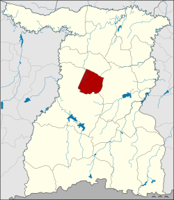 District location in Surin province | |
| Coordinates: 15°0′8″N 103°35′47″E | |
| Country | Thailand |
| Province | Surin |
| Seat | Khwao Sinarin |
| Area | |
| • Total | 189.7 km2 (73.2 sq mi) |
| Population (2005) | |
| • Total | 35,394 |
| • Density | 186.6/km2 (483/sq mi) |
| Time zone | UTC+7 (ICT) |
| Postal code | 32000 |
| Geocode | 3216 |
History
The minor district (king amphoe) was established on 15 July 1996 with area split from Mueang Surin district.[1]
On 15 May 2007, all 81 minor districts were upgraded to full districts.[2] On 24 August the upgrade became official.[3]
Geography
Neighboring districts are (from the north clockwise): Chom Phra, Sikhoraphum and Mueang Surin.
Administration
The district is divided into five sub-districts (tambons), which are further subdivided into 58 villages (mubans). There are no municipal (thesaban) areas. There are five tambon administrative organizations (TAO).
| No. | Name | Thai name | Villages | Pop. | |
|---|---|---|---|---|---|
| 1. | Khwao Sinarin | เขวาสินรินทร์ | 11 | 10,466 | |
| 2. | Bueng | บึง | 11 | 4,706 | |
| 3. | Ta Kuk | ตากูก | 10 | 7,156 | |
| 4. | Prasat Thong | ปราสาททอง | 13 | 6,543 | |
| 5. | Ban Rae | บ้านแร่ | 13 | 6,437 |
References
- ประกาศกระทรวงมหาดไทย เรื่อง แบ่งเขตท้องที่อำเภอเมืองสุรินทร์ จังหวัดสุรินทร์ ตั้งเป็นกิ่งอำเภอเขวาสินรินทร์ (PDF). Royal Gazette (in Thai). 113 (Special 18 ง): 30. June 26, 1996.
- แถลงผลการประชุม ครม. ประจำวันที่ 15 พ.ค. 2550 (in Thai). Manager Online.
- พระราชกฤษฎีกาตั้งอำเภอฆ้องชัย...และอำเภอเหล่าเสือโก้ก พ.ศ. ๒๕๕๐ (PDF). Royal Gazette (in Thai). 124 (46 ก): 14–21. August 24, 2007.
External links
This Surin Province location article is a stub. You can help Wikipedia by expanding it. |
Другой контент может иметь иную лицензию. Перед использованием материалов сайта WikiSort.org внимательно изучите правила лицензирования конкретных элементов наполнения сайта.
WikiSort.org - проект по пересортировке и дополнению контента Википедии