world.wikisort.org - Thailand
Khao Chamao (Thai: เขาชะเมา, pronounced [kʰǎw t͡ɕʰā.māw]) is a district (amphoe) of Rayong province, eastern Thailand.
Khao Chamao
เขาชะเมา | |
|---|---|
District | |
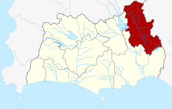 District location in Rayong province | |
| Coordinates: 12°58′30″N 101°41′6″E | |
| Country | Thailand |
| Province | Rayong |
| Seat | Huai Thap Mon |
| Area | |
| • Total | 269.95 km2 (104.23 sq mi) |
| Population (2005) | |
| • Total | 22,432 |
| • Density | 83.1/km2 (215/sq mi) |
| Time zone | UTC+7 (ICT) |
| Postal code | 21110 |
| Geocode | 2107 |
History
The minor district (king amphoe) was split off from Klaeng district on 31 May 1993.[1]
On 15 May 2007, all 81 minor districts were upgraded to full districts.[2] With publication in the Royal Gazette on 24 August the upgrade became official.[3]
Geography
Neighboring districts are (from the north clockwise) Bo Thong of Chonburi province, Kaeng Hang Maeo of Chanthaburi province, and Klaeng and Wang Chan of Rayong Province.
Administration
The district is divided into four sub-districts (tambons), which are further subdivided into 21 villages (mubans). There are no municipal (thesabans), but there are four tambon administrative organizations (TAO).
| No. | Name | Thai name | Villages | Pop. | |
|---|---|---|---|---|---|
| 1. | Nam Pen | น้ำเป็น | 7 | 7,025 | |
| 2. | Huai Thap Mon | ห้วยทับมอญ | 8 | 7,419 | |
| 3. | Cham Kho | ชำฆ้อ | 9 | 5,650 | |
| 4. | Khao Noi | เขาน้อย | 5 | 2,338 |
References
- ประกาศกระทรวงมหาดไทย เรื่อง แบ่งเขตท้องที่อำเภอแกลง จังหวัดระยอง ตั้งเป็นกิ่งอำเภอเขาชะเมา (PDF). Royal Gazette (in Thai). 110 (74 ง): 16. June 8, 1993.
- แถลงผลการประชุม ครม. ประจำวันที่ 15 พ.ค. 2550 (in Thai). Manager Online.
- พระราชกฤษฎีกาตั้งอำเภอฆ้องชัย...และอำเภอเหล่าเสือโก้ก พ.ศ. ๒๕๕๐ (PDF). Royal Gazette (in Thai). 124 (46 ก): 14–21. August 24, 2007.
Bibliography
- Khao Chamao - Khao Wong National Park(October 27, 2013).Retrieve October 27, 2013, from https://web.archive.org/web/20130911180508/http://www.dnp.go.th/parkreserve/asp/style1/default.asp?npid=108&lg=2
- Khao Chamao - Khao Wong National Park(October 27, 2013).Retrieve October 27, 2013, from http://www.naturethai.net/National-Park-in-Eastern-Thailand/Khao-Chamao-Khao-Wong-National-Park.html
External links
Текст в блоке "Читать" взят с сайта "Википедия" и доступен по лицензии Creative Commons Attribution-ShareAlike; в отдельных случаях могут действовать дополнительные условия.
Другой контент может иметь иную лицензию. Перед использованием материалов сайта WikiSort.org внимательно изучите правила лицензирования конкретных элементов наполнения сайта.
Другой контент может иметь иную лицензию. Перед использованием материалов сайта WikiSort.org внимательно изучите правила лицензирования конкретных элементов наполнения сайта.
2019-2026
WikiSort.org - проект по пересортировке и дополнению контента Википедии
WikiSort.org - проект по пересортировке и дополнению контента Википедии