world.wikisort.org - Thailand
Huai Thalaeng (Thai: ห้วยแถลง, pronounced [hûa̯j tʰā.lɛ̌ːŋ]) is a district (amphoe) in the eastern part of Nakhon Ratchasima province, northeastern Thailand.[1][2]
Huai Thalaeng
ห้วยแถลง | |
|---|---|
District | |
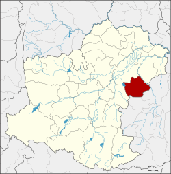 District location in Nakhon Ratchasima province | |
| Coordinates: 14°59′54″N 102°38′18″E | |
| Country | Thailand |
| Province | Nakhon Ratchasima |
| Seat | Huai Thalaeng |
| Area | |
| • Total | 495.2 km2 (191.2 sq mi) |
| Population (2000) | |
| • Total | 78,581 |
| • Density | 158.7/km2 (411/sq mi) |
| Time zone | UTC+7 (ICT) |
| Postal code | 30240 |
| Geocode | 3016 |
History
Huai Thalaeng village was controlled by Tambon Ngio (ตำบลงิ้ว), Amphoe Phimai. It was upgraded to Tambon Huai Thalaeng in 1961 and became a minor district (king amphoe) later. It was upgraded to a full district in 1963.[3]
Geography
Neighboring districts are (from the west clockwise): Chakkarat, Phimai, and Chum Phuang of Nakhon Ratchasima Province, and Lam Plai Mat and Nong Hong of Buriram province.[4][5]
Administration
The district is divided into 10 sub-districts (tambons). The township (thesaban tambon) Huai Thlaeng covers parts of tambons Huai Thalaeng and Thap Sawai.
| 1. | Huai Thalaeng | ห้วยแถลง | |
| 2. | Thap Sawai | ทับสวาย | |
| 3. | Mueang Phlapphla | เมืองพลับพลา | |
| 4. | Lung Takhian | หลุ่งตะเคียน | |
| 5. | Hin Dat | หินดาด | |
| 6. | Ngio | งิ้ว | |
| 7. | Kong Rot | กงรถ | |
| 8. | Lung Pradu | หลุ่งประดู่ | |
| 9. | Tako | ตะโก | |
| 10. | Huai Khaen | ห้วยแคน |
References
- "Huai Thalaeng (District, Nakhon Ratchasima, Thailand) - Population Statistics, Charts, Map and Location". citypopulation.de. Retrieved 2020-11-30.
- "Cybo". Cybo. Retrieved 2020-11-30.
- "Huai Thalaeng District Travel Guide: Travel Tips, Attractions, Transportation, Climate, Dining, Hotels – Indochina Travel Agency, Indochina Tours 2018 |Trans-Asia Discovery". www.transasiadiscovery.com. Retrieved 2020-11-30.
- "Weather in Amphoe Huai Thalaeng district". meteocast.net. Retrieved 2020-11-30.
- d.o.o, Yu Media Group. "Huai Thalaeng District, Thailand - Detailed weather forecast, long range monthly outlook and climate information". Weather Atlas. Retrieved 2020-11-30.
This Nakhon Ratchasima Province location article is a stub. You can help Wikipedia by expanding it. |
Другой контент может иметь иную лицензию. Перед использованием материалов сайта WikiSort.org внимательно изучите правила лицензирования конкретных элементов наполнения сайта.
WikiSort.org - проект по пересортировке и дополнению контента Википедии