world.wikisort.org - Thailand
Chanae (Thai: จะแนะ, pronounced [t͡ɕā.nɛ́ʔ]) is a district (amphoe) in the southern part of Narathiwat province, southern Thailand.
Chanae
จะแนะ | |
|---|---|
District | |
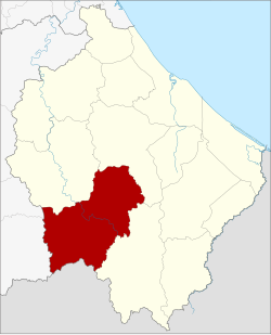 District location in Narathiwat province | |
| Coordinates: 6°5′54″N 101°41′36″E | |
| Country | Thailand |
| Province | Narathiwat |
| Seat | Chanae |
| Subdistricts | 4 |
| Mubans | 31 |
| District established | 15 July 1983 |
| Area | |
| • Total | 607.2 km2 (234.4 sq mi) |
| Population (2014) | |
| • Total | 37,034 |
| • Density | 51.6/km2 (134/sq mi) |
| Time zone | UTC+7 (ICT) |
| Postal code | 96220 |
| Geocode | 9612 |
History
Tambons Dusong Yo and Chanae were separated from Ra-ngae district to create Chanae minor district (king amphoe) on 15 July 1983.[1] It was upgraded to a full district on 1 January 1988.[2]
Chanae is the Malay name of a native Colocasia species.
Geography
Neighboring districts are (from the west clockwise): Betong, and Than To of Yala province; Sisakhon, Ra-ngae, and Sukhirin of Narathiwat province and the state Perak of Malaysia.
Demographics
In 1963, the Thai government launched the Nikhom Sang Ton Eng Pak Tai ('self-development community in the south') program to move families from Thailand's northeastern and central provinces to the Chanae and Sukhirin Districts of Narathiwat. A total of 5,633 families were relocated to Narathiwat, where each family was rewarded with 18 rai of land.[3]
Administration
Central administration
Chanae is divided into four sub-districts (tambons), which are further subdivided into 31 administrative villages (mubans).
| No. | Name | Thai | Villages | Pop.[4] |
|---|---|---|---|---|
| 1. | Chanae | จะแนะ | 10 | 13,387 |
| 2. | Dusongyo | ดุซงญอ | 8 | 9,885 |
| 3. | Phadung Mat | ผดุงมาตร | 6 | 6,350 |
| 4. | Chang Phueak | ช้างเผือก | 7 | 7,412 |
Local administration
There are four sub-district administrative organizations (SAO) in the district:
- Chanae (Thai: องค์การบริหารส่วนตำบลจะแนะ) consisting of sub-district Chanae.
- Dusongyo (Thai: องค์การบริหารส่วนตำบลดุซงญอ) consisting of sub-district Dusongyo.
- Phadung Mat (Thai: องค์การบริหารส่วนตำบลผดุงมาตร) consisting of sub-district Phadung Mat.
- Chang Phueak (Thai: องค์การบริหารส่วนตำบลช้างเผือก) consisting of sub-district Chang Phueak.
References
- ประกาศกระทรวงมหาดไทย เรื่อง แบ่งท้องที่อำเภอระแงะ จังหวัดนราธิวาส ตั้งเป็นกิ่งอำเภอจะแนะ (PDF). Royal Gazette (in Thai). 100 (114 ง): 2233. July 12, 1983.
- พระราชกฤษฎีกาตั้งอำเภอนามน อำเภอพระยืน อำเภอหนองบัวระเหว อำเภอบ้านเหลื่อม อำเภอจะแนะ อำเภอหนองหงส์ อำเภอนาโพธิ์ อำเภอเกาะยาว อำเภอแกดำ อำเภอสระโบสถ์ อำเภอโนนคูณ อำเภอควนโดน อำเภอไชยวาน อำเภอหนองแสง และอำเภอตาลสุม พ.ศ. ๒๕๓๐ (PDF). Royal Gazette (in Thai). 104 (278 ก special): 33–37. December 31, 1987.
- Karnjanatawe, Karnjana (5 September 2019). "Seeking fortune in paradise". Bangkok Post. Retrieved 7 September 2019.
- "Population statistics 2014" (in Thai). Department of Provincial Administration. Retrieved 2015-05-24.
External links
This Narathiwat Province location article is a stub. You can help Wikipedia by expanding it. |
Другой контент может иметь иную лицензию. Перед использованием материалов сайта WikiSort.org внимательно изучите правила лицензирования конкретных элементов наполнения сайта.
WikiSort.org - проект по пересортировке и дополнению контента Википедии