world.wikisort.org - Thailand
Chai Prakan (Thai: ไชยปราการ, pronounced [t͡ɕʰāj prāː.kāːn]) is a district (amphoe) in the northern part of Chiang Mai province in northern Thailand.
Chai Prakan
ไชยปราการ | |
|---|---|
District | |
 Fang River | |
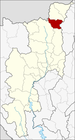 District location in Chiang Mai province | |
| Coordinates: 19°43′56″N 99°8′25″E | |
| Country | Thailand |
| Province | Chiang Mai |
| Seat | Pong Tam |
| Area | |
| • Total | 510.9 km2 (197.3 sq mi) |
| Population (2014) | |
| • Total | 44,760 |
| • Density | 93.8/km2 (243/sq mi) |
| Time zone | UTC+7 (ICT) |
| Postal code | 50320 |
| Geocode | 5021 |
Geography

Neighbouring districts are (from the south clockwise) Phrao, Chiang Dao, Fang of Chiang Mai Province and Mae Suai of Chiang Rai province.
The Khun Tan Range stretches from north to south along the eastern side of the district. The western tip of the district lies within the Daen Lao Range.
History
The minor district (king amphoe) Chai Prakarn was created on 1 January 1988, when four tambons were split off from Fang District.[1] It was upgraded to a full district on 4 July 1994.[2]
Administration
Central administration
Chai Prakan is divided into four sub-districts (tambons), which are further subdivided into 44 administrative villages (muban).
| No. | Name | Thai | Villages | Pop.[3] |
|---|---|---|---|---|
| 1. | Pong Tam | ปงตำ | 8 | 8,032 |
| 2. | Si Dong Yen | ศรีดงเย็น | 18 | 15,329 |
| 3. | Mae Thalop | แม่ทะลบ | 7 | 7,314 |
| 4. | Nong Bua | หนองบัว | 11 | 14,085 |
Local administration
There are two sub-district municipalities (thesaban tambon) in the district:
- Chai Prakan (Thai: เทศบาลตำบลไชยปราการ) consisting of sub-district Pong Tam and parts of sub-districts Si Dong Yen and Nong Bua.
- Nong Bua (Thai: เทศบาลตำบลหนองบัว) consisting of parts of sub-district Nong Bua.
There are two sub-district administrative organizations (SAO) in the district:
- Si Dong Yen (Thai: องค์การบริหารส่วนตำบลศรีดงเย็น) consisting of parts of sub-district Si Dong Yen.
- Mae Thalop (Thai: องค์การบริหารส่วนตำบลแม่ทะลบ) consisting of sub-district Mae Thalop.
References
- ประกาศกระทรวงมหาดไทย เรื่อง แบ่งเขตท้องที่อำเภอฝาง จังหวัดเชียงใหม่ ตั้งเป็นกิ่งอำเภอไชยปราการ (PDF). Royal Gazette (in Thai). 105 (5 ง): 107. January 7, 1988.
- พระราชกฤษฎีกาตั้งอำเภอเปือยน้อย ... และอำเภอศรีวิไล พ.ศ. ๒๕๓๗ (PDF). Royal Gazette (in Thai). 111 (21 ก): 32–35. June 3, 1994.
- "Population statistics 2014" (in Thai). Department of Provincial Administration. Retrieved 2015-02-18.
External links
This Chiang Mai province location article is a stub. You can help Wikipedia by expanding it. |
Другой контент может иметь иную лицензию. Перед использованием материалов сайта WikiSort.org внимательно изучите правила лицензирования конкретных элементов наполнения сайта.
WikiSort.org - проект по пересортировке и дополнению контента Википедии