world.wikisort.org - Thailand
Bang Sai (Thai: บางซ้าย, pronounced [bāːŋ sáːj]) is a district (amphoe) in the western part of Phra Nakhon Si Ayutthaya province, central Thailand. There is another district of Ayutthaya which shares the same romanization Bang Sai, but has a different spelling in Thai.
Bang Sai
บางซ้าย | |
|---|---|
District | |
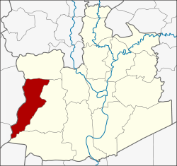 District location in Phra Nakhon Si Ayutthaya province | |
| Coordinates: 14°19′12″N 100°18′0″E | |
| Country | Thailand |
| Province | Ayutthaya |
| Seat | Bang Sai |
| Area | |
| • Total | 150.756 km2 (58.207 sq mi) |
| Population (2007) | |
| • Total | 19,579 |
| • Density | 129.9/km2 (336/sq mi) |
| Time zone | UTC+7 (ICT) |
| Postal code | 13270 |
| Geocode | 1413 |
History
The district was created as a minor district (king amphoe) in 1948 with territory taken from Sena district.[1] It was upgraded to a full district in 1958.[2]
Geography
Neighboring districts are (from the north clockwise) Phak Hai, Sena and Lat Bua Luang of Ayutthaya Province, and Bang Pla Ma of Suphanburi province.
Administration
The district is divided into six sub-districts (tambons), which are further subdivided into 53 villages (mubans). The sub-district municipality (thesaban tambon) Bang Sai covers parts of the tambons Bang Sai, Kaeo Fa, and Tao Lao. The non-municipal area is administered by four tambon administrative organizations (TAO).
| No. | Name | Thai | Pop. |
|---|---|---|---|
| 1. | Bang Sai | บางซ้าย | 3,389 |
| 2. | Kaeo Fa | แก้วฟ้า | 2,429 |
| 3. | Tao Lao | เต่าเล่า | 2,821 |
| 4. | Plai Klat | ปลายกลัด | 4,774 |
| 5. | Thepphamongkhon | เทพมงคล | 3,861 |
| 6. | Wang Phatthana | วังพัฒนา | 2,305 |
References
- ประกาศกระทรวงมหาดไทย เรื่อง ยกฐานะตำบลขึ้นเป็นกิ่งอำเภอ (PDF). Royal Gazette (in Thai). 64 (60 ง): 3188–3193. December 9, 1947.
- พระราชกฤษฎีกาจัดตั้งอำเภอกระสัง อำเภอกระนวน อำเภอบางกอกใหญ่ อำเภอขุนหาร อำเภอพนา อำเภอปากช่อง อำเภอวังเหนือ อำเภอวังชิ้น อำเภอแม่ทา อำเภอหนองหมู อำเภอสระแก้ว อำเภออมก๋อย อำเภอบางซ้าย อำเภอทับสะแก อำเภอบุณฑริก อำเภอลานสะกา อำเภอจอมบึง อำเภอท่ายาง อำเภอสามเงา อำเภอฟากท่า อำเภอบ้านเขว้า อำเภอชานุมาน อำเภอแม่พริก อำเภอท่าสองยาง อำเภอสะเมิง อำเภอหนองแขม อำเภอพระแสง พ.ศ. ๒๕๐๑ (PDF). Royal Gazette (in Thai). 75 (55 ก): 321–327. July 22, 1958.
External links
- amphoe.com (Thai)
This Ayutthaya Province location article is a stub. You can help Wikipedia by expanding it. |
Другой контент может иметь иную лицензию. Перед использованием материалов сайта WikiSort.org внимательно изучите правила лицензирования конкретных элементов наполнения сайта.
WikiSort.org - проект по пересортировке и дополнению контента Википедии