world.wikisort.org - Thailand
Ban Thaen (Thai: บ้านแท่น, pronounced [bâːn tʰɛ̂n]) is the northeasternmost district (amphoe) of Chaiyaphum province, northeastern Thailand.
Ban Thaen
บ้านแท่น | |
|---|---|
District | |
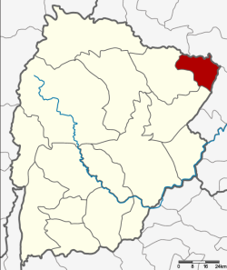 District location in Chaiyaphum province | |
| Coordinates: 16°24′18″N 102°20′31″E | |
| Country | Thailand |
| Province | Chaiyaphum |
| Seat | Ban Thaen |
| Area | |
| • Total | 308.707 km2 (119.192 sq mi) |
| Population (2000) | |
| • Total | 43,992 |
| • Density | 142.5/km2 (369/sq mi) |
| Time zone | UTC+7 (ICT) |
| Postal code | 36190 |
| Geocode | 3611 |
History
Tambon Sam Suan, Ban Tao, and Ban Thaen were separated from Phu Khiao District to create Ban Thaen minor district (king amphoe) on 16 June 1965.[1] It was upgraded to a full district on 25 February 1969.[2]
Geography
Neighboring districts are (from the southwest clockwise): Kaeng Khro and Phu Khiao of Chaiyaphum Province; Nong Ruea and Mancha Khiri of Khon Kaen province.
Administration
The district is divided into five subdistricts (tambons), which are further subdivided into 66 villages (mubans). The township (thesaban tambon) Ban Thaen covers parts of tambon Ban Thaen. There are a further five tambon administrative organizations (TAO).
| 1. | Ban Thaen | บ้านแท่น | |
| 2. | Sam Suan | สามสวน | |
| 3. | Sa Phang | สระพัง | |
| 4. | Ban Tao | บ้านเต่า | |
| 5. | Nong Khu | หนองคู |
References
- ประกาศกระทรวงมหาดไทย เรื่อง แบ่งท้องที่ตั้งเป็นกิ่งอำเภอ (PDF). Royal Gazette (in Thai). 81 (47 ง): 1616–. June 15, 1965.
- พระราชกฤษฎีกาจัดตั้งอำเภอสมเด็จ อำเภอสีชมพู อำเภอหนองบัวแดง อำเภอบ้านแท่น อำเภอดอนตูม อำเภอนากลาง อำเภอศรีบุญเรือง และอำเภอป่าติ้ว พ.ศ. ๒๕๑๒ (PDF). Royal Gazette (in Thai). 86 (16 ก): 225–229. February 25, 1969.
External links
Authority control | |
|---|---|
| General |
|
| National libraries | |
This Chaiyaphum Province location article is a stub. You can help Wikipedia by expanding it. |
Другой контент может иметь иную лицензию. Перед использованием материалов сайта WikiSort.org внимательно изучите правила лицензирования конкретных элементов наполнения сайта.
WikiSort.org - проект по пересортировке и дополнению контента Википедии