world.wikisort.org - Sri_Lanka
Matara (Sinhala: මාතර දිස්ත්රික්කය Mātara distrikkaya; Tamil: மாத்தறை மாவட்டம் Māttaṛai māvaṭṭam) is a district in Southern Province, Sri Lanka. It is one of 25 districts of Sri Lanka, the second level administrative division of the country. The district is administered by a District Secretariat headed by a District Secretary (previously known as a Government Agent) appointed by the central government of Sri Lanka.
Matara District
මාතර දිස්ත්රික්කය மாத்தறை மாவட்டம் | |
|---|---|
Administrative District | |
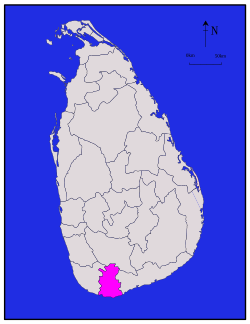 Map of Sri Lanka with Matara District highlighted | |
| Coordinates: 6°10′N 80°30′E | |
| Country | Sri Lanka |
| Province | Southern Province |
| Largest City | Matara |
| Divisions | List
|
| Government | |
| • District Secretary | Pradeep Ratnayaka |
| • Local | |
| Area | |
| • Total | 1,282.5 km2 (495.2 sq mi) |
| Population (2012)[1] | |
| • Total | 809,344 |
| • Density | 630/km2 (1,600/sq mi) |
| Time zone | UTC+05:30 (Sri Lanka) |
| ISO 3166 code | LK-32 |
| Website | matara.dist.gov.lk/ |
Geography
Matara District is located in the south west of Sri Lanka and has an area of 1,282.5 square kilometres (495.2 sq mi).[2]
It is represented in the Sri Lankan Parliament following the 2010 Sri Lankan parliamentary election by former Sri Lankan national Cricketer Sanath Jayasuriya who stood for the United People's Freedom Alliance.
Administrative units
Matara District is divided into 16 Divisional Secretary's Division (DS Divisions), each headed by a Divisional Secretary (previously known as an Assistant Government Agent).[3] The DS Divisions are further sub-divided into 650 Grama Niladhari Divisions (GN Divisions),[3] with 1,658 villages.
| DS Division | Main Town | Divisional Secretary | GN Divisions [3] |
Area (km2) [4] |
Population (2012 Census)[5] | Population Density (/km2) | |||||
|---|---|---|---|---|---|---|---|---|---|---|---|
| Sinhalese | Sri Lankan Moors | Sri Lankan Tamil | Indian Tamil | Other | Total | ||||||
| Akuressa | Akuressa | Mr. O.V.Chandana Tilakerathne | 46 | 148.8 | 51,280 | 7 | 519 | 865 | 5 | 52,595 | 357 |
| Athuraliya | Athuraliya | Mr. T.G.S.Sarath Kumara | 28 | 62.9 | 29,674 | 1,675 | 602 | 155 | 67 | 31,869 | 512 |
| Devinuwara | Devinuwara | Mr. D.D.K.Wickramarachchi | 41 | 39.9 | 47,217 | 663 | 66 | 14 | 19 | 47,979 | 1,183 |
| Dickwella | Dickwella | Mr. B.S. Ranjitha | 48 | 51.9 | 51,530 | 2,680 | 70 | 81 | 9 | 54,187 | 1,055 |
| Hakmana | Hakmana | Mr. Kusalaka Nanayakkara | 34 | 47.7 | 30,465 | 977 | 16 | 1 | 5 | 31,892 | - |
| Kamburupitiya | Kamburupitiya | Mrs. N.M.M.W.W.N.Herath Kumari | 39 | 60.9 | 40,738 | 10 | 28 | 17 | 10 | 39,438 | 676 |
| Kirinda Puhuwella | Kirinda Puhuwella | Mr. Chinthaka Abeywickrama | 25 | 37.5 | 19,480 | 648 | 5 | - | 2 | 20,574 | 655 |
| Kotapola | Kotapola | Mr. Ganesha Amarasinghe | 37 | 175.6 | 51,057 | 110 | 4,041 | 7,855 | 9 | 67,596 | 389 |
| Malimbada | Malimbada | Mrs. Deepika Kumari Gunarathne | 66 | 44.7 | 34,180 | 476 | 51 | 21 | 7 | 33,289 | 753 |
| Matara | Matara | Mr. Ranjith Yapa | 29 | 53.9 | 110,221 | 4,314 | 304 | 22 | 109 | 114,298 | 2,144 |
| Mulatiyana | Mulatiyana | Mr. Susantha Attanayake | 48 | 115.2 | 49,689 | 1 | 192 | 61 | - | 48,645 | 427 |
| Pasgoda | Pasgoda | Mrs. Nadeeka Kaushalya Kumari | 43 | 148.2 | 57,224 | 2 | 347 | 1,289 | 7 | 59,285 | 404 |
| Pitabeddara | Pitabeddara | Mr. Ravindra Jayanath | 40 | 141.5 | 47,149 | 24 | 2,086 | 1,555 | 13 | 52,081 | 372 |
| Thihagoda | Thihagoda | Mrs. K.P.C.N.Mahindagnana | 40 | 45.2 | 33,168 | 8 | 16 | - | 10 | 32,640 | 730 |
| Weligama | Weligama | Mr. K.P.G.Sumith Shantha | 48 | 44.0 | 64,927 | 7,366 | 159 | 26 | 33 | 70,180 | 1,120 |
| Welipitiya | Welipitiya | Mrs. Tushari Sooriyarachchi. | 38 | 64.4 | 45,122 | 6,339 | 60 | 22 | 72 | 48,756 | 1,102 |
| Total | 650 | 1,282.5 | 757,046 | 23,635 | 5,060 | 17,937 | 321 | 803,999 | 638 | ||
Major cities
- Matara (Municipal Council)
Other towns
Demographics
Population
Matara District's population was 803,999 in 2012.[6] The majority of the population are Sinhalese, with a minority Sri Lankan Moor and Indian Tamil population.
Ethnicity
| Year | Sinhalese | Sri Lankan Moors | Sri Lankan Tamil | Indian Tamil | Other | Total No. | |||||
|---|---|---|---|---|---|---|---|---|---|---|---|
| No. | % | No. | % | No. | % | No. | % | No. | % | ||
| 2012 Census | 757,046 | 94.16% | 23,635 | 2.94% | 5,060 | 0.63% | 17,937 | 2.23% | 321 | 0.04% | 803,999 |
Religion
Religions in Matara District (2011)[1]
| Year | Buddhist | Muslim | Christian[lower-alpha 1] | Hindu | Other | Total No. | |||||
|---|---|---|---|---|---|---|---|---|---|---|---|
| No. | % | No. | % | No. | % | No. | % | No. | % | ||
| 2012 Census | 756,098 | 94.0% | 18,908 | 2.35% | 25,982 | 3.23% | 2,901 | 0.36% | 110 | 0.01% | 803,999 |
Notes
- Roman Catholic and Other Christian.
References
- Department of Census and Statistics,The Census of Population and Housing of Sri Lanka-2011
- "Area of Sri Lanka by province and district" (PDF). Statistical Abstract 2011. Department of Census & Statistics, Sri Lanka. Archived from the original (PDF) on 2012-11-13.
- "Grama Niladhari Divisions". Matara District Secretariat.
- "Land area by province, district and divisional secretariat division" (PDF). Department of Census & Statistics, Sri Lanka.
- "A6 : Population by ethnicity and district according to Divisional Secretary's Division, 2012". Census of Population & Housing, 2011. Department of Census & Statistics, Sri Lanka.
- "A2 : Population by ethnic group according to districts, 2012". Census of Population & Housing, 2011. Department of Census & Statistics, Sri Lanka.
- "A3 : Population by religion according to districts, 2012". Census of Population & Housing, 2011. Department of Census & Statistics, Sri Lanka.
External links
- Kaut, Christoph; International Labour Office (2007). Matara district book : facts & figures and economic development. International Labour Office. ISBN 978-92-2-120189-2.
Districts of Sri Lanka | ||
|---|---|---|
| Central Province | ||
| Eastern Province | ||
| North Central Province | ||
| Northern Province |
| |
| North Western Province | ||
| Sabaragamuwa Province | ||
| Southern Province |
| |
| Uva Province |
| |
| Western Province | ||
На других языках
[de] Matara (Distrikt)
5.94777880.538333- [en] Matara District
[ru] Матара (округ)
Матара (синг. මාතර දිස්ත්රික්කය, там. மாத்தறை மாவட்டம்) — один из 25 округов Шри-Ланки. Входит в состав Южной провинции страны. Административный центр — город Матара.Другой контент может иметь иную лицензию. Перед использованием материалов сайта WikiSort.org внимательно изучите правила лицензирования конкретных элементов наполнения сайта.
WikiSort.org - проект по пересортировке и дополнению контента Википедии