world.wikisort.org - Spagna
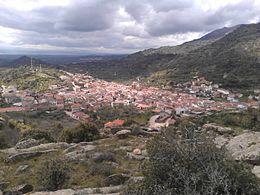
El Real de San Vicente è un comune spagnolo di 1.031 abitanti situato nella comunità autonoma di Castiglia-La Mancia.
| El Real de San Vicente comune | ||
|---|---|---|
| ||
 | ||
| Localizzazione | ||
| Stato | ||
| Comunità autonoma | ||
| Provincia | ||
| Territorio | ||
| Coordinate | 40°08′21.12″N 4°41′25.08″W | |
| Altitudine | 800 m s.l.m. | |
| Superficie | 54 km² | |
| Abitanti | 1 031 (2015) | |
| Densità | 19,09 ab./km² | |
| Comuni confinanti | Almendral de la Cañada, Castillo de Bayuela, Fresnedilla (AV), Garciotum, Higuera de las Dueñas (AV), Hinojosa de San Vicente, La Iglesuela, Navamorcuende, Pelahustán | |
| Altre informazioni | ||
| Cod. postale | 45640 | |
| Prefisso | (+34) 925 | |
| Fuso orario | UTC+1 | |
| Codice INE | 45144 | |
| Targa | TO | |
| Nome abitanti | realeño/a, realengo/a | |
| Patrono | Santi Nicasio di Reims e Caterina[1] | |
| Cartografia | ||
 | ||
Note
Altri progetti
 Wikimedia Commons contiene immagini o altri file su El Real de San Vicente
| Controllo di autorità | VIAF (EN) 316734353 |
|---|
На других языках
[en] El Real de San Vicente
El Real de San Vicente is a municipality located in the province of Toledo, Castile-La Mancha, Spain. According to the 2006 census (INE), the municipality has a population of 1050 inhabitants.[es] El Real de San Vicente
El Real de San Vicente es un municipio español perteneciente a la provincia de Toledo, en la comunidad autónoma de Castilla-La Mancha.[fr] El Real de San Vicente
El Real de San Vicente est une commune d'Espagne de la province de Tolède dans la communauté autonome de Castille-La Manche.- [it] El Real de San Vicente
[ru] Эль-Реаль-де-Сан-Висенте
Эль-Реаль-де-Сан-Висенте (исп. El Real de San Vicente) — муниципалитет в Испании, входит в провинцию Толедо, в составе автономного сообщества Кастилия — Ла-Манча. Муниципалитет находится в составе района (комарки) Сьерра-де-Сан-Висенте. Занимает площадь 54 км². Население — 1089 человек (на 2010 год). Расстояние до административного центра провинции — 76 км.Текст в блоке "Читать" взят с сайта "Википедия" и доступен по лицензии Creative Commons Attribution-ShareAlike; в отдельных случаях могут действовать дополнительные условия.
Другой контент может иметь иную лицензию. Перед использованием материалов сайта WikiSort.org внимательно изучите правила лицензирования конкретных элементов наполнения сайта.
Другой контент может иметь иную лицензию. Перед использованием материалов сайта WikiSort.org внимательно изучите правила лицензирования конкретных элементов наполнения сайта.
2019-2025
WikiSort.org - проект по пересортировке и дополнению контента Википедии
WikiSort.org - проект по пересортировке и дополнению контента Википедии

