world.wikisort.org - Spain
Paradela is a municipality in Lugo province in Galicia in north-west Spain. It is situated in the region of Sarria. There were 2,193 people living in Paradela as of 2008 (1,101 men and 1,092 women).[2] It is known for the connection it has with the Way of St. James. The French route of such a way, ending in Santiago de Compostela, passes through five parishes of Paradela: Ferreiros, Francos, Laxe, Cortes and Loio.[3]
This article uses bare URLs, which are uninformative and vulnerable to link rot. (August 2022) |
Paradela | |
|---|---|
Municipality | |
 | |
 Flag  Coat of arms | |
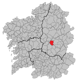 | |
 Paradela Location in Spain | |
| Coordinates: 42°58′N 7°57′W | |
| Country | |
| Autonomous community | |
| Province | Lugo |
| Comarca | Sarria |
| Government | |
| • Alcalde | José Manuel Mato Díaz (2007) |
| Area | |
| • Total | 121.12 km2 (46.76 sq mi) |
| Population (2018)[1] | |
| • Total | 1,820 |
| • Density | 15/km2 (39/sq mi) |
| Demonym | Paradelense |
| Time zone | UTC+1 (CET) |
| • Summer (DST) | UTC+2 (CEST) |
| Official language(s) | Galician, Spanish |
| Website | Official website |
Etymology
The name Paradela comes from the diminutive of the Latin word parata, which can be translated as hostal, or near the end of the journey.
Parishes
Here is a list of all parishes within Paradela, each having their own saint shown in brackets.[4]
- Aldosende (Santiago)
- Andreade (Santiago)
- Barán (San Pedro)
- Castro (San Mamede)
- Castro de Rei de Lemos (Santa María)
- As Cortes (San Salvador)
- Ferreiros (Santa María)
- Francos (Santa María)
- A Laxe (Santiago)
- Loio (San Xoán)
- Paradela (San Miguel)
- San Facundo de Ribas de Miño (San Facundo)
- San Martiño de Castro (San Martiño)
- San Vicente de Paradela (San Vicente)
- Santa Cristina de Paradela (Santa Cristina)
- Santalla de Paradela (Santalla)
- Suar (San Lourenzo)
- Vilaragunte (Santa María)
Famous people from Paradela
- Manuel Rodriguez Lopez (1934-1990) - poet, writer and translator
- Diego López Rodríguez (1981-) - football goalkeeper
Sources
- Municipal Register of Spain 2018. National Statistics Institute.
- The Spanish National Institute of Statistics (INE),
- "O Camiño de Santiago en Paradela | Concello de Paradela". Archived from the original on 3 May 2013. Retrieved 17 December 2012.
- http://www.galiciaparaelmundo.com/blog/?page_id=34&recurso_id=27042
External links
Municipalities in the province of Lugo | ||
|---|---|---|
| ||
| Authority control |
|
|---|
This article about a location in the autonomous community of Galicia, Spain is a stub. You can help Wikipedia by expanding it. |
На других языках
[de] Paradela (Lugo)
Paradela ist eine spanische Gemeinde (Concello) mit 1.779 Einwohnern (Stand: 1. Januar 2019) in der Provinz Lugo der Autonomen Gemeinschaft Galicien.- [en] Paradela, Lugo
[es] Paradela
Paradela es un municipio español situado al suroeste de la provincia de Lugo en Galicia. Pertenece a la Comarca de Sarria.[ru] Парадела (Испания)
Парадела (исп. Paradela) — муниципалитет в Испании, входит в провинцию Луго в составе автономного сообщества Галисия. Муниципалитет находится в составе района (комарки) Саррия. Занимает площадь 120 км². Население — 2091 человек (на 2010 год).Другой контент может иметь иную лицензию. Перед использованием материалов сайта WikiSort.org внимательно изучите правила лицензирования конкретных элементов наполнения сайта.
WikiSort.org - проект по пересортировке и дополнению контента Википедии