world.wikisort.org - Spain
La Taha, is a municipality in the Alpujarras region of the province of Granada, Spain. The modern municipality consists of three distinct villages, though several of these are themselves clusters of distinct settlements. It lies to the east of the villages of the Río Poqueira gorge, and to the south and west of Trevélez. The villages are all on south-facing slopes overlooking the Río Trevélez.
This article does not cite any sources. (November 2013) |
La Taha | |
|---|---|
Municipality | |
 Village of Ferreirola, in La Taha municipality | |
 Coat of arms | |
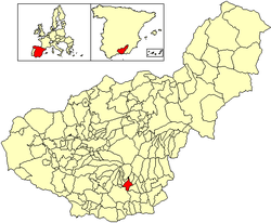 Location of La Taha | |
 La Taha Location in Spain | |
| Coordinates: 36°56′N 3°19′W | |
| Country | |
| Autonomous community | |
| Province | Granada |
| Comarca | Alpujarras |
| Judicial district | Órgiva |
| Government | |
| • Alcalde | Marcelo Avilés Gómez (2021) (Partido Popular) |
| Area | |
| • Total | 26 km2 (10 sq mi) |
| Elevation | 1,295 m (4,249 ft) |
| Population (2018)[1] | |
| • Total | 653 |
| • Density | 25/km2 (65/sq mi) |
| Demonym(s) | Bárbaro, -ra Pitreño, -ña Talabita |
| Time zone | UTC+1 (CET) |
| • Summer (DST) | UTC+2 (CEST) |
| Postal code | 18414 |
| Website | Official website |
The villages of La Taha are:
- Pitres, with the smaller settlement of Capilerilla above it; this is the administrative centre, the largest of the three villages, and the only one on the through road
- Mecina Fondales, which comprises Mecina, Mecinilla, and Fondales
- Ferreirola, which is below the smaller village of Atalbéitar
In guidebooks and other sources, some other neighbouring villages are often included in La Taha, though they do not belong to the municipality. These include Pórtugos and Busquístar.
The name La Taha comes from Arabic Tá, meaning "obedience". Under the Nasrid kings of Granada, the region was divided into a number of administrative districts called "tahas", each containing several settlements; for example, the villages of the Poquiera gorge formed "La Taha de Poqueira". Modern La Taha is the only one of these districts to have retained the name.
There is a modest tourist trade in La Taha, though the villages do not attract the intense interest either of the Poqueira river villages or of Trevélez. Pitres has a market on Friday. The GR 7 long-distance footpath passes through the municipality.
Atalbeitar is one of the best villages in which to learn about the original characteristics of the houses and streets of the Alpujarras, due to the lack of new buildings that other more touristic villages have been constructing.
References
http://multiportal.dipgra.es/web/ayuntamiento-de-la-taha/historia-de-la-ciudad
Bibliography
- Cressier, Patrice (1984). "Le chateau et la division territoriale dans l'Alpujarra médiévale: du ḥinṣ à la ṭāʿa" (PDF). Melanges de la Casa de Velázquez (20): 115–144. Retrieved 29 October 2010.[dead link] Existe traducción al castellano en: *Cressier, Patrice (1992). "El castillo y la división territorial en la Alpujarra medieval: del ḥinṣ a la ṭāʿa" (PDF). Estudios de arqueología medieval en Almería. Almería: Instituto de Estudios Almerienses: 7–48. Retrieved 29 October 2010.
External links
Municipalities in the province of Granada | ||
|---|---|---|
| ||
Authority control | |
|---|---|
| General |
|
| National libraries | |
This article about a location in the province of Granada is a stub. You can help Wikipedia by expanding it. |
- Municipal Register of Spain 2018. National Statistics Institute.
На других языках
- [en] La Taha
[es] La Taha
La Taha[2] (pronunciado correctamente [la ˈtaa]) es un municipio español situado en la parte central de la comarca de la Alpujarra Granadina, en la provincia de Granada, comunidad autónoma de Andalucía. En 2018 contaba con una población de 653 habitantes.[3] Limita con los municipios de Pampaneira, Bubión, Capileira, Pórtugos, Busquístar, Almegíjar, Torvizcón, Órgiva y Carataunas. Por su término discurren los ríos Trevélez, Guadalfeo y Poqueira.[ru] Ла-Таа
Ла-Таа (исп. La Taha) — город и муниципалитет в Испании, входит в провинцию Гранада, в составе автономного сообщества Андалусия. Муниципалитет находится в составе района (комарки) Альпухарра-Гранадина. Занимает площадь 26 км². Население — 776 человек (на 2010 год). Расстояние — 79 км до административного центра провинции.Другой контент может иметь иную лицензию. Перед использованием материалов сайта WikiSort.org внимательно изучите правила лицензирования конкретных элементов наполнения сайта.
WikiSort.org - проект по пересортировке и дополнению контента Википедии