world.wikisort.org - Spain
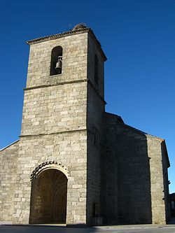
Fuenterroble de Salvatierra is a village and municipality in the province of Salamanca, western Spain, part of the autonomous community of Castile-Leon. It is located 54 kilometres (34 mi) from the provincial capital city of Salamanca and has a population of 243 people.
Fuenterroble de Salvatierra | |
|---|---|
Municipality | |
 | |
 Seal | |
 Location in Salamanca | |
 Fuenterroble de Salvatierra Location in Spain | |
| Coordinates: 40°33′53″N 5°44′2″W | |
| Country | Spain |
| Autonomous community | Castile and León |
| Province | Salamanca |
| Comarca | Comarca de Guijuelo |
| Subcomarca | Salvatierra |
| Government | |
| • Mayor | Juan José Serrano García (PSOE) |
| Area | |
| • Total | 27 km2 (10 sq mi) |
| Elevation | 951 m (3,120 ft) |
| Population (2018)[2] | |
| • Total | 248 |
| • Density | 9.2/km2 (24/sq mi) |
| Time zone | UTC+1 (CET) |
| • Summer (DST) | UTC+2 (CEST) |
| Postal code | 37768 |
Geography
The municipality covers an area of 27 square kilometres (10 sq mi) and lies 951 metres (3,120 ft) above sea level and the postal code is 37768.
See also
- Los Santos mine
References
- "Municipio:Fuenterroble de Salvatierra". www.lasalina.es. Retrieved 2017-11-02.
- Municipal Register of Spain 2018. National Statistics Institute.
На других языках
- [en] Fuenterroble de Salvatierra
[es] Fuenterroble de Salvatierra
Fuenterroble de Salvatierra es un municipio y localidad española de la provincia de Salamanca, en la comunidad autónoma de Castilla y León. Se integra dentro de la comarca de Guijuelo y la subcomarca de Salvatierra. Pertenece al partido judicial de Béjar.[1]Текст в блоке "Читать" взят с сайта "Википедия" и доступен по лицензии Creative Commons Attribution-ShareAlike; в отдельных случаях могут действовать дополнительные условия.
Другой контент может иметь иную лицензию. Перед использованием материалов сайта WikiSort.org внимательно изучите правила лицензирования конкретных элементов наполнения сайта.
Другой контент может иметь иную лицензию. Перед использованием материалов сайта WikiSort.org внимательно изучите правила лицензирования конкретных элементов наполнения сайта.
2019-2025
WikiSort.org - проект по пересортировке и дополнению контента Википедии
WikiSort.org - проект по пересортировке и дополнению контента Википедии