world.wikisort.org - Spain
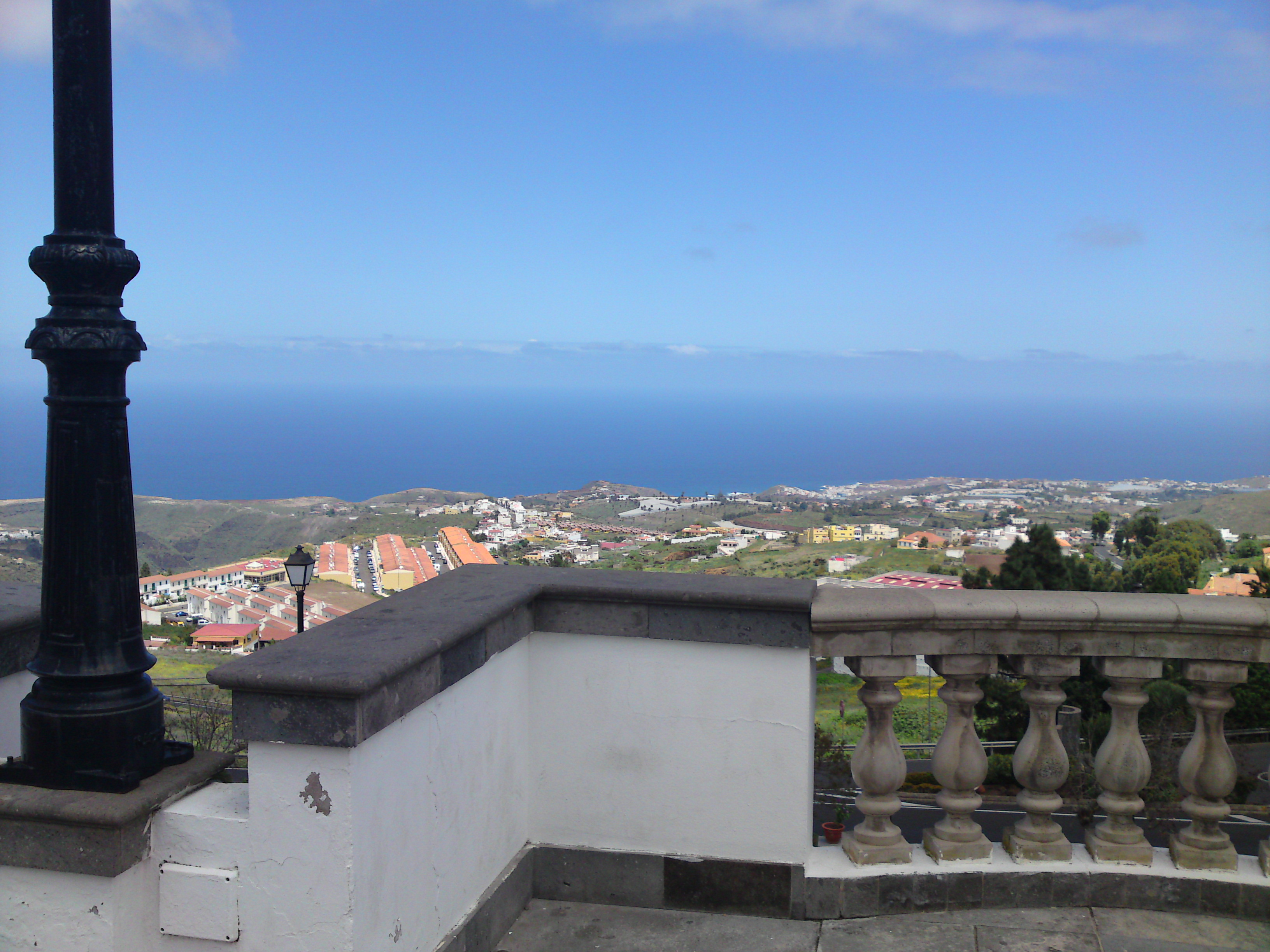
Firgas is a town and a municipality in the northern part of the island of Gran Canaria, in the Province of Las Palmas, in the Canary Islands. Its population is 7,628 (2013),[3] and its area is 15.77 km².[1] Firgas was founded in 1488, and it is situated in the mountains, 13 km west of Las Palmas. The town, which is located in a green and rural zone, is also known as the balcony of the Atlantic, as it provides good views of the northern coast of the island. Bottled water is produced in the town.
This article may be expanded with text translated from the corresponding article in Spanish. (May 2020) Click [show] for important translation instructions.
|
Firgas | |
|---|---|
Municipality | |
 Flag Seal | |
 Municipal location in Gran Canaria | |
 Firgas Location in the province of Las Palmas  Firgas Firgas (Canary Islands)  Firgas Firgas (Spain, Canary Islands) | |
| Coordinates: 28°6′20″N 15°33′50″W | |
| Country | Spain |
| Autonomous Region | Canary Islands |
| Province | Las Palmas |
| Island | Gran Canaria |
| Area | |
| • Total | 15.77 km2 (6.09 sq mi) |
| Elevation | 500 m (1,600 ft) |
| Population (2018)[2] | |
| • Total | 7,491 |
| • Density | 480/km2 (1,200/sq mi) |
| Time zone | UTC+0 (GMT) |
Historical population
|
|

The town
The central square, which has a church and town hall, is called San Roque. Important attractions are the different squares, and the Paseo de Gran Canaria, where a 30-meter-high (98 ft) waterfall, as well as relief models of the different islands have been laid out.
Physical geography
Location
Firgas is located in the north of the island of Gran Canaria, 28 kilometres from the island's capital.[4]
It borders the municipalities of Moya, Valleseco, Teror and Arucas.
With an area of 15.77 km², Firgas is the smallest municipality on the island of Gran Canaria.
The municipal head is located at 465 m.[4] The municipality has no exit from the sea, being its minimum altitude of 41 m located at a point in the ravine of Quintanilla, on the municipal boundary with Arucas. The highest point of Firgas is reached at 967 meters above sea level on the Pico de Osorio.[5]
Climate
The municipality of Firgas has a dry semi-arid cold climate, according to the Köppen classification.
The average annual temperature is 17.8 °C, the hottest month being August at 21.8 °C and the coldest January at 14.4 °C.[6]
As for rainfall, Firgas registers an average of 268 mm per year, with the rainiest months being November and December with 54 mm, and the driest months being July and August with 1 mm.[6]
See also
- List of municipalities in Las Palmas
References
- Instituto Canario de Estadística, area
- Municipal Register of Spain 2018. National Statistics Institute.
- Instituto Canario de Estadística Archived 2014-04-22 at the Wayback Machine, population
- "ISTAC: Estadísticas de la Comunidad Autónoma de Canarias". www.gobiernodecanarias.org. Retrieved 2020-05-13.
- "IDECanarias visor 4.5.1". visor.grafcan.es. Retrieved 2020-05-13.
- "Clima Firgas: Temperatura, Climograma y Temperatura del agua de Firgas - Climate-Data.org". es.climate-data.org. Retrieved 2020-05-13.
External links
| Wikimedia Commons has media related to Firgas. |
Places adjacent to Firgas | ||||||||||||||||
|---|---|---|---|---|---|---|---|---|---|---|---|---|---|---|---|---|
| ||||||||||||||||
Municipalities in the province of Las Palmas | ||
|---|---|---|
| Gran Canaria |
| |
| Lanzarote |
| |
| Fuerteventura | ||
| |||||||||
| Governance |
|   | |||||||
| Municipalities |
| ||||||||
| History |
| ||||||||
| Nature |
| ||||||||
| Landmarks and attractions |
| ||||||||
| Transport |
| ||||||||
| Sport |
| ||||||||
| Education and science |
| ||||||||
Authority control | |
|---|---|
| General |
|
| National libraries | |
| Other |
|
На других языках
- [en] Firgas
[es] Firgas
Firgas es una localidad y municipio español perteneciente a la isla de Gran Canaria, en la provincia de Las Palmas, comunidad autónoma de Canarias.[1][ru] Фиргас
Фиргас (исп. Firgas) — населённый пункт и муниципалитет в Испании, входит в провинцию Лас-Пальмас в составе автономного сообщества Канарские острова. Находится на острове Гран-Канария. Занимает площадь 15,77 км². Население — 7564 человека (на 2010 год).Другой контент может иметь иную лицензию. Перед использованием материалов сайта WikiSort.org внимательно изучите правила лицензирования конкретных элементов наполнения сайта.
WikiSort.org - проект по пересортировке и дополнению контента Википедии