world.wikisort.org - Spain
El Recuenco is a municipality located in the province of Guadalajara, Castile-La Mancha, Spain, between the mountains of Cuenca, Alcarria and the Alto Tajo.
This article does not cite any sources. (October 2012) |
El Recuenco, Spain | |
|---|---|
 | |
 Flag  Seal | |
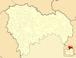 El Recuenco, Spain  El Recuenco, Spain  El Recuenco, Spain | |
| Coordinates: 40°37′0″N 2°20′18″W | |
| Country | |
| Autonomous community | Castile-La Mancha |
| Province | Guadalajara |
| Municipality | El Recuenco |
| judicial Party | Guadalajara |
| Government | |
| • Mayor | Collada Paulino Ruiz |
| Area | |
| • Total | 75.18 km2 (29.03 sq mi) |
| Population (2018)[1] | |
| • Total | 60 |
| • Density | 0.80/km2 (2.1/sq mi) |
| Time zone | UTC+1 (CET) |
| • Summer (DST) | UTC+2 (CEST) |
Geography
Land
The municipality is located on a plateau, with an average altitude of 1,200 meters and a high point 1,302 meters above sea level, at its northern part. This high position permits a slight adjustment in plants with the ability to grow, examples being: pines, oaks, rosemary, and juniper.
Ruins
While few ruins are known in the region, specifically because of the centuries of farmland use by the poor, a few to note are tucked away in the hills, marking the peasants' past presence here. These ruins are of huts and livestock, simple and fragile structures and animal remains from the 3rd and 4th centuries, abandoned in the miod-20th century[citation needed].
Fossils have been found in this region dating as far back as the Plio-Pleistocene era.
Demographics
According to the 2010 census (INE), the municipality had a population of 97 inhabitants, five more than at the 2004 census.
The population has decreased since the 2001 census, with 114 inhabitants.
External links
See also
- Guadalajara, Castile-La Mancha
- Province of Guadalajara
References
- Municipal Register of Spain 2018. National Statistics Institute.
Municipalities in the province of Guadalajara | ||
|---|---|---|
| ||
| Authority control |
|
|---|
This article about a location in the autonomous community of Castilla–La Mancha, Spain is a stub. You can help Wikipedia by expanding it. |
На других языках
- [en] El Recuenco
[es] El Recuenco
El Recuenco es un municipio español de la provincia de Guadalajara, en la comunidad autónoma de Castilla-La Mancha. Está ubicado entre la serranía de Cuenca, la Alcarria y el Alto Tajo.[ru] Эль-Рекуэнко
Эль-Рекуэнко (исп. El Recuenco) — муниципалитет в Испании, входит в провинцию Гвадалахара, в составе автономного сообщества Кастилия-Ла-Манча. Муниципалитет находится в составе района (комарки) Ла-Серрания. Занимает площадь 75,18 км². Население — 97 человек (на 2010 год).Другой контент может иметь иную лицензию. Перед использованием материалов сайта WikiSort.org внимательно изучите правила лицензирования конкретных элементов наполнения сайта.
WikiSort.org - проект по пересортировке и дополнению контента Википедии