world.wikisort.org - Spain
A Baña is a municipality in the province of A Coruña in the autonomous community of Galicia in northwestern Spain. It is 52 kilometers from the provincial capital of A Coruña. It has an area of 98.63 km², a population of 4,888 (2004 estimate), and a population density of 49.56 people/km²
Concello de A Baña | |
|---|---|
municipality | |
 City Hall | |
 Seal | |
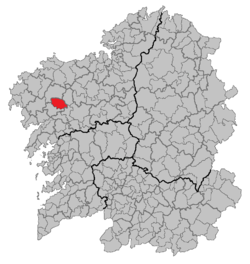 Location of A Baña within Galicia | |
| Coordinates: 42.967°N 8.767°W | |
| Country | Spain |
| Autonomous community | Galicia |
| Province | A Coruña |
| Area | |
| • Total | 98.63 km2 (38.08 sq mi) |
| Population (2018)[1] | |
| • Total | 3,505 |
| • Density | 36/km2 (92/sq mi) |
| Time zone | UTC+1 (CET) |
| • Summer (DST) | UTC+2 (CEST) |
| Website | http://concellodabana.gal/ |
Demographics
| Population change of the municipality from 1991 to 2004 | |||
|---|---|---|---|
| 2004 | 2001 | 1996 | 1991 |
| 4888 | 4800 | 5836 | 5864 |
Vesía
Vesía is a town situated near the centre of the A Baña municipality, in the A Coruña province. It is part of the parish of San Vicente, the capital of the municipality. Vesía is at an altitude of 317.6 meters above sea level, and stands at an incline of 20.89%. Vesía has a population of around 40 people, the majority of whom are between 65 and 80 years old as the area has suffered youth emigration. [citation needed]
References
- Municipal Register of Spain 2018. National Statistics Institute.
Municipalities of the province of A Coruña | ||
|---|---|---|
| ||
Authority control | |
|---|---|
| General |
|
| National libraries | |
This article about a location in the autonomous community of Galicia, Spain is a stub. You can help Wikipedia by expanding it. |
На других языках
- [en] A Baña
[es] La Baña (La Coruña)
La Baña[1] (oficialmente y en gallego: A Baña)[2] es un municipio perteneciente a la provincia de La Coruña, en Galicia, situado a 52 km al suroeste de la capital provincial. Es zona de relieve quebrado y abundante vegetación. Su economía se basa en la agricultura (hortalizas, patatas, maíz, forrajes) y la ganadería (vacuna, lanar, porcina). Sus principales monumentos son las iglesias de San Vicente (románica) y del Castro (siglo XVII), renacentista). Su población es de 3415 habitantes (INE 2020).[ru] Ла-Банья
Ла-Банья (исп. La Baña) — город и муниципалитет в Испании, входит в провинцию Ла-Корунья в составе автономного сообщества Галисия. Муниципалитет находится в составе района (комарки) Баркала. Занимает площадь 98,2 км². Население — 4320 человек (на 2010 год). Расстояние до административного центра провинции — 52 км.Другой контент может иметь иную лицензию. Перед использованием материалов сайта WikiSort.org внимательно изучите правила лицензирования конкретных элементов наполнения сайта.
WikiSort.org - проект по пересортировке и дополнению контента Википедии