world.wikisort.org - Sudafrica
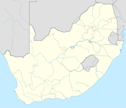
Rooi-Els è una località costiera sudafricana situata nella municipalità distrettuale di Overberg nella provincia del Capo Occidentale.
| Rooi-Els città | |
|---|---|
 | |
| Localizzazione | |
| Stato | |
| Provincia | Capo Occidentale |
| Distretto | Overberg |
| Municipalità locale | Overstrand |
| Territorio | |
| Coordinate | 34°18′05.04″S 18°48′59.04″E |
| Superficie | 1,15[1] km² |
| Abitanti | 125[2] (2011) |
| Densità | 108,7 ab./km² |
| Altre informazioni | |
| Fuso orario | UTC+2 |
| Cartografia | |
Geografia fisica
Il piccolo centro abitato, a carattere prevalentemente residenziale e vacanziero, è affaciato sulla costa orientale della Falsa Baia non troppo lontano dal Capo Hangklip.
Note
Altri progetti
 Wikimedia Commons contiene immagini o altri file su Rooi Els
На других языках
[en] Rooi-Els, South Africa
Rooiels (Afrikaans equivalent of red alder) is a settlement in Overberg District Municipality in the Western Cape province of South Africa. The name is often written as Rooi-Els, but the name of the township was registered as Rooiels (one word). It was declared a township in June 1948, and is situated 5 km north of Pringle Bay, on the eastern shore of False Bay.[2] It was named after the farm and river by this name.[2]- [it] Rooi-Els
Текст в блоке "Читать" взят с сайта "Википедия" и доступен по лицензии Creative Commons Attribution-ShareAlike; в отдельных случаях могут действовать дополнительные условия.
Другой контент может иметь иную лицензию. Перед использованием материалов сайта WikiSort.org внимательно изучите правила лицензирования конкретных элементов наполнения сайта.
Другой контент может иметь иную лицензию. Перед использованием материалов сайта WikiSort.org внимательно изучите правила лицензирования конкретных элементов наполнения сайта.
2019-2025
WikiSort.org - проект по пересортировке и дополнению контента Википедии
WikiSort.org - проект по пересортировке и дополнению контента Википедии
