world.wikisort.org - South_Africa
KwaDukuza is a municipality in KwaZulu-Natal, South Africa. In 2006, the municipal name was changed to KwaDukuza (which incorporates small towns such as Stanger, Balito, Shaka's Kraal, but the Zulu people in the area called it "Dukuza" well before then.
KwaDukuza
Stanger | |
|---|---|
 KwaDukuza  KwaDukuza | |
| Coordinates: 29°20′00″S 31°17′30″E | |
| Country | South Africa |
| Province | KwaZulu-Natal |
| District | iLembe |
| Municipality | KwaDukuza |
| Established | 1825 as Dukuza, 1873 as Stanger[1] |
| Area | |
| • Total | 32.37 km2 (12.50 sq mi) |
| Population (2011)[2] | |
| • Total | 51,536 |
| • Density | 1,600/km2 (4,100/sq mi) |
| Racial makeup (2011) | |
| • Black African | 53.0% |
| • Coloured | 1.9% |
| • Indian/Asian | 43.7% |
| • White | 0.7% |
| • Other | 0.7% |
| First languages (2011) | |
| • English | 47.7% |
| • Zulu | 46.0% |
| • Xhosa | 1.4% |
| • Other | 4.8% |
| Time zone | UTC+2 (SAST) |
| Postal code (street) | 4449 |
| PO box | 4450 |
The city has been under major economical construction since 2015, having built a multi-million rand regional shopping mall in 2018.[3][4][5]
History
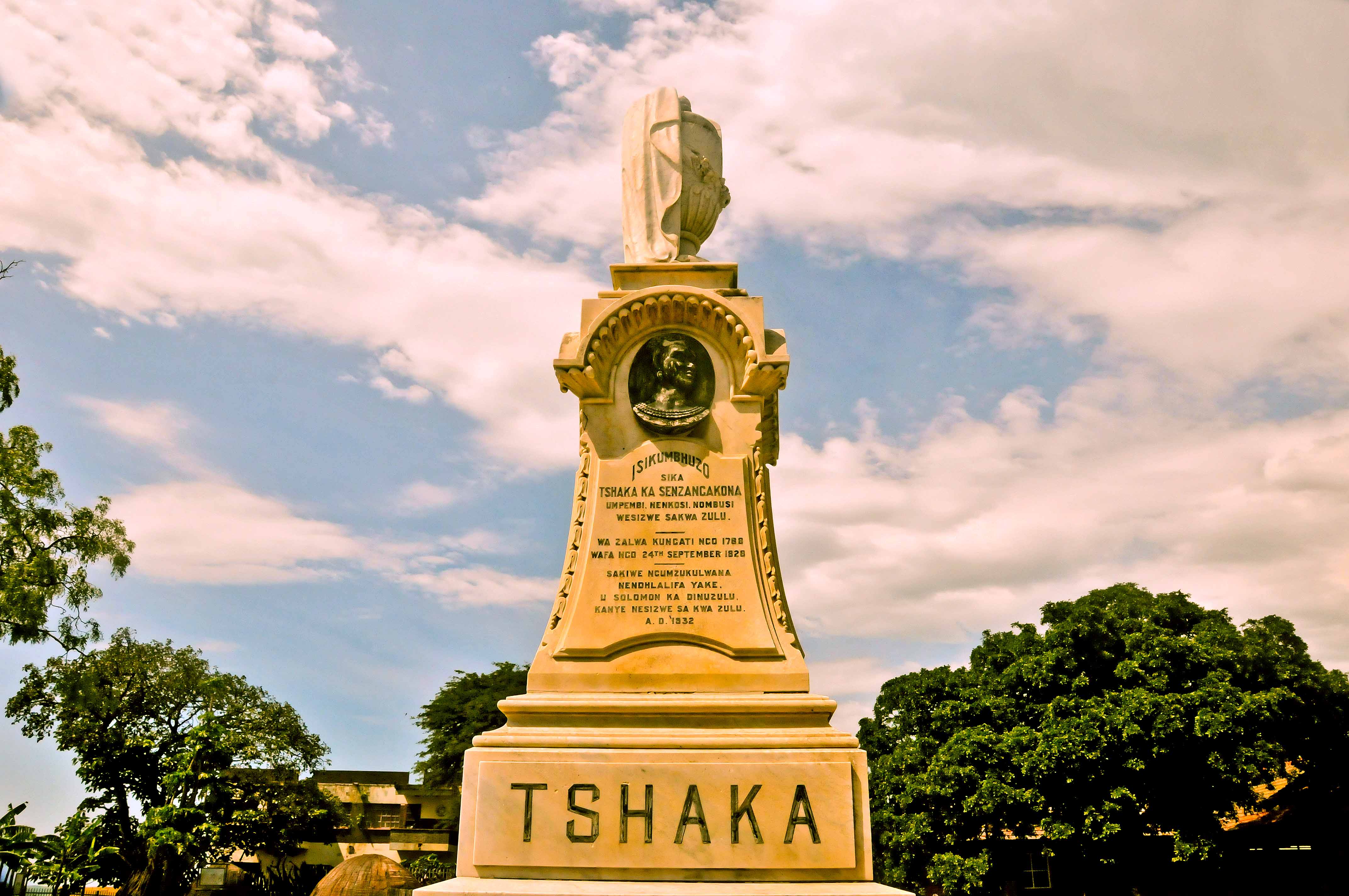
The city was founded about 1820 by King Shaka and was named KwaDukuza (Zulu: Place of the Lost Person) because of the capital's labyrinth of huts. After Shaka was assassinated on 22 September 1828 during a coup by two of his half-brothers, Dingane and Umthlangana (Mhlangane), the city was burnt to the ground. In 1873, European settlers built a town on the site, naming it Stanger after William Stanger, the surveyor-general of Natal.
KwaDukuza became a municipality in 1949 under the name Stanger and is the commercial, magisterial and railway center of an important sugar-producing district. A small museum adjoins the site of Shaka's grave, a grain pit in the city center. The city and its vibrant inhabitants are surrounded by sugar cane fields, bush and the mahogany tree where Shaka held meetings, which still stands in front of the municipal offices. The Shaka Day festival, a colorful ceremony of 10,000 or more Zulus, is held at the KwaDukuza Recreation Grounds on 24 September every year. The festival is usually attended by dignitaries to mark the significance of the Zulu nation.
In 2006, the Minister of Arts and Culture approved a name change from Stanger to KwaDukuza, which was published in the Government Gazette of South Africa on 3 March 2006.
The KwaDukuza Museum houses historical items and information on Shaka, the sugar industry and local history. The city has a South Asian influence because of the influx of labourers from India in the late 19th and the early 20th centuries for sugarcane barons, such as Liege Hulett. The first few hundred Indian families left Port Natal for the cane farms on 17 November 1860. The importation of Indian labourers was stopped in 1911, when their numbers exceeded 100,000. Most Indians did not return when their work contracts expired, but exchanged their return-trip passes for money or property. The growth of the Indian community changed the economic and cultural nature of the city and has successfully developed it into what it is today. Celebrations include Diwali and the Winter Fair, the latter being a fundraiser for child welfare. [citation needed]
In July, 2021, the city was significantly impacted by large scale looting, vandalism, property damage and civil unrest caused during the 2021 South African unrest, much to the dismay of the Indian population.[6][7][8]
Climate
The Köppen-Geiger climate classification system classifies the KwaDuzuka climate as humid subtropical (Cfa),[9] with more rain in the summer.
The highest record temperature was 43 °C (109 °F) on February 3, 2008, and the lowest record temperature was 5 °C (41 °F) on June 12, 2013.[10]
| Climate data for KwaDukuza | |||||||||||||
|---|---|---|---|---|---|---|---|---|---|---|---|---|---|
| Month | Jan | Feb | Mar | Apr | May | Jun | Jul | Aug | Sep | Oct | Nov | Dec | Year |
| Record high °C (°F) | 40 (104) |
43 (109) |
41 (106) |
38 (100) |
39 (102) |
37 (99) |
35 (95) |
39 (102) |
43 (109) |
41 (106) |
41 (106) |
41 (106) |
43 (109) |
| Average high °C (°F) | 28.4 (83.1) |
28.7 (83.7) |
28.3 (82.9) |
26.5 (79.7) |
24.8 (76.6) |
23.2 (73.8) |
22.8 (73.0) |
23.8 (74.8) |
24.6 (76.3) |
25.2 (77.4) |
26.2 (79.2) |
27.8 (82.0) |
25.9 (78.5) |
| Daily mean °C (°F) | 24.2 (75.6) |
24.5 (76.1) |
23.9 (75.0) |
21.8 (71.2) |
19.4 (66.9) |
17.3 (63.1) |
16.9 (62.4) |
18.2 (64.8) |
19.6 (67.3) |
20.8 (69.4) |
21.9 (71.4) |
23.5 (74.3) |
21.0 (69.8) |
| Average low °C (°F) | 20.1 (68.2) |
20.4 (68.7) |
19.5 (67.1) |
17.1 (62.8) |
14.1 (57.4) |
11.5 (52.7) |
11.1 (52.0) |
12.6 (54.7) |
14.6 (58.3) |
16.4 (61.5) |
17.7 (63.9) |
19.3 (66.7) |
16.2 (61.2) |
| Record low °C (°F) | 16 (61) |
15 (59) |
15 (59) |
11 (52) |
6 (43) |
5 (41) |
6 (43) |
6 (43) |
5 (41) |
10 (50) |
7 (45) |
14 (57) |
5 (41) |
| Average precipitation mm (inches) | 118 (4.6) |
120 (4.7) |
125 (4.9) |
72 (2.8) |
60 (2.4) |
37 (1.5) |
33 (1.3) |
41 (1.6) |
60 (2.4) |
92 (3.6) |
114 (4.5) |
119 (4.7) |
991 (39) |
| Source 1: Climate-Data.org (altitude: 60m)[9] | |||||||||||||
| Source 2: Voodoo Skies for record temperatures[10] | |||||||||||||
Healthcare
In February 2018, the city opened the KwaDukuza Private Hospital, the second major hospital in the area.[citation needed]
Schools
- Stanger Manor Secondary School
- Stanger Secondary School
- Glenhills Secondary School
- Glenhills Primary School
- Stanger M.L. Sultan Secondary School
- Stanger High School
- Dawnview Primary School
- Zakkariyya Muslim School
- Stanger Primary School
- Stanger Manor Primary School
- Stanger South Secondary School
- Tshelenkosi secondary school
Notable residents
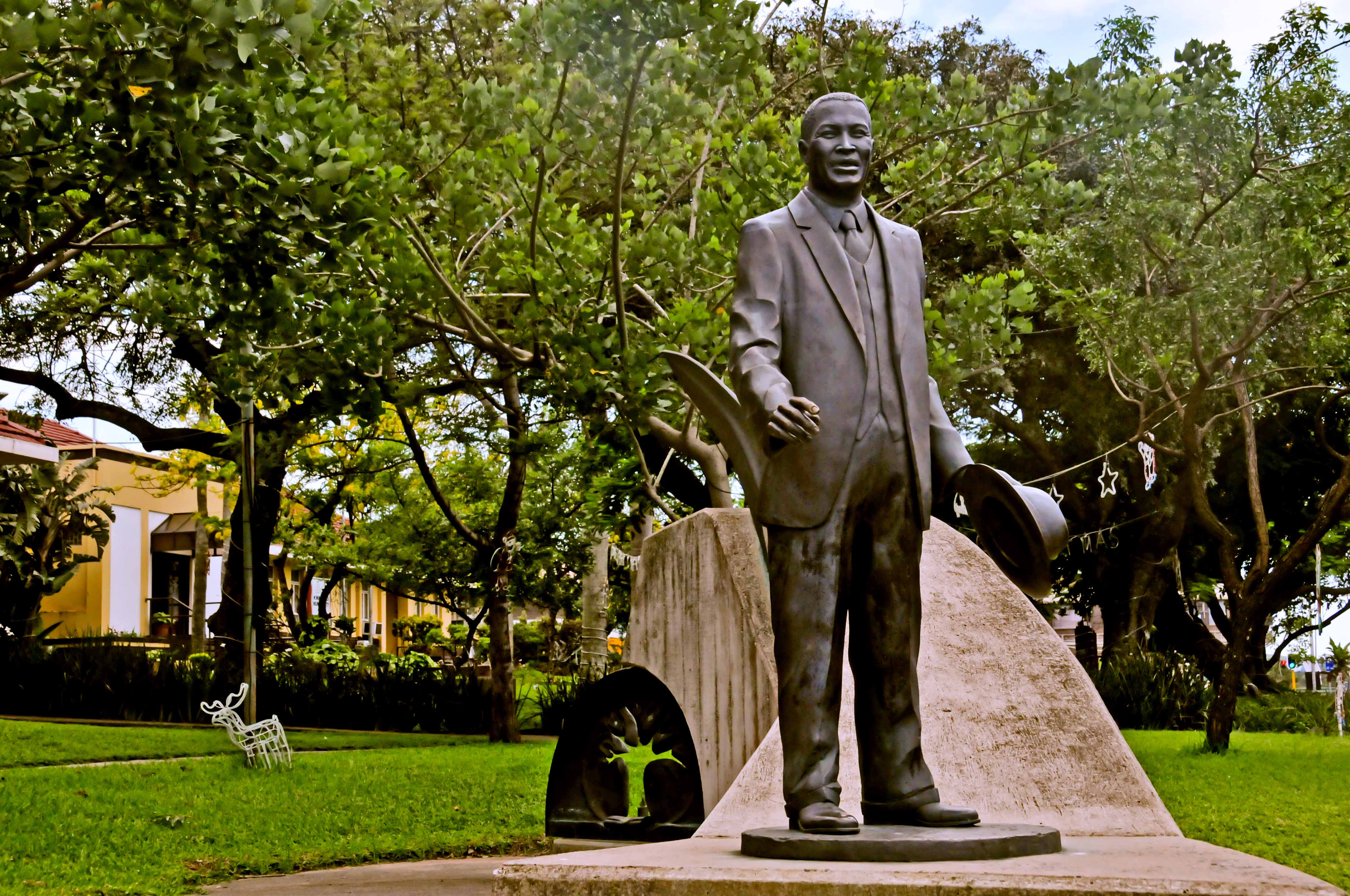
- King Shaka
- Albert Luthuli
- Kader Asmal
- Aldin Grout
- King Dingane
- Elijah 'Tap Tap' Makhatini
See also
- Shaka Memorial
References
- "KwaDUKUZA / STANGER – A History". sahistory.org. Retrieved 2009-08-31.
- "Main Place KwaDukuza". Census 2011.
- "Store Directory – Kwadukuza Regional Mall".
- "KWADUKUZA MALL CELEBRATES 2ND BIRTHDAY - 5 Star Durban - Showcasing Beautiful KwaZulu-Natal". Archived from the original on 2020-10-26.
- "KwaDukuza Mall's social media success | News24".
- "WATCH | Protesters storm KwaDukuza CBD and Tongaat in KZN | Witness".
- "WATCH: Mass looting across KwaDukuza and Mandeni | North Coast Courier".
- "Fear gripped KwaZulu-Natal residents on Monday night while others partied | Witness".
- "Climate: KwaDukuza - Climate graph, Temperature graph, Climate table". Climate-Data.org. Retrieved 2014-01-17.
- "Stanger, South Africa". Voodoo Skies. Retrieved 2014-01-17.
Municipalities and communities of ILembe District Municipality, KwaZulu-Natal | ||
|---|---|---|
District seat: KwaDukuza (Stanger) | ||
| Mandeni |
|  |
| KwaDukuza |
| |
| Ndwedwe |
| |
| Maphumulo |
| |
На других языках
- [en] KwaDukuza
[ru] Квадукуза
Квадукуза (англ. KwaDukuza; до 2006 — Стангер) — город на востоке Южно-Африканской Республики, на территории провинции Квазулу-Натал. Административный центр района Илембе.Другой контент может иметь иную лицензию. Перед использованием материалов сайта WikiSort.org внимательно изучите правила лицензирования конкретных элементов наполнения сайта.
WikiSort.org - проект по пересортировке и дополнению контента Википедии