world.wikisort.org - South_Africa
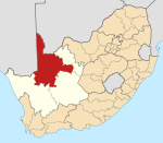
Groblershoop is a settlement in ZF Mgcawu District Municipality in the Northern Cape province of South Africa. It is situated about 2 km west of the Orange River.
Groblershoop | |
|---|---|
 Groblershoop  Groblershoop | |
| Coordinates: 28°53′50″S 21°59′4″E | |
| Country | South Africa |
| Province | Northern Cape |
| District | ZF Mgcawu |
| Municipality | !Kheis |
| Established | 1936 |
| Area | |
| • Total | 13.67 km2 (5.28 sq mi) |
| Population (2011)[1] | |
| • Total | 4,938 |
| • Density | 360/km2 (940/sq mi) |
| Racial makeup (2011) | |
| • Black African | 9.0% |
| • Coloured | 85.1% |
| • Indian/Asian | 0.9% |
| • White | 4.2% |
| • Other | 0.8% |
| First languages (2011) | |
| • Afrikaans | 93.3% |
| • Xhosa | 1.7% |
| • Tswana | 1.4% |
| • Other | 3.6% |
| Time zone | UTC+2 (SAST) |
| Postal code (street) | 8850 |
| PO box | 8850 |
| Area code | 054 |
Groblershoop was founded in 1914 on the farm Sternham, but was renamed in 1939 after Piet Grobler, a former Minister of Agriculture. The region became more developed after the construction of the Boegoeberg Dam and water channels in 1929. Known as the gateway to the Green Kalahari, the Groblershoop region is a major wine-producing area.[2]
References
- "Main Place Groblershoop". Census 2011.
- "Groblershoop, Northern Cape". SA Travel Directory. Archived from the original on 11 July 2015. Retrieved 12 January 2014.
На других языках
[de] Groblershoop
Groblershoop (afrikaans; deutsch etwa: „Groblers Hoffnung“) ist eine Stadt in der südafrikanischen Provinz Nordkap. Sie liegt im Distrikt ZF Mgcawu und ist Verwaltungssitz der Local Municipality !Kheis.- [en] Groblershoop
Текст в блоке "Читать" взят с сайта "Википедия" и доступен по лицензии Creative Commons Attribution-ShareAlike; в отдельных случаях могут действовать дополнительные условия.
Другой контент может иметь иную лицензию. Перед использованием материалов сайта WikiSort.org внимательно изучите правила лицензирования конкретных элементов наполнения сайта.
Другой контент может иметь иную лицензию. Перед использованием материалов сайта WikiSort.org внимательно изучите правила лицензирования конкретных элементов наполнения сайта.
2019-2025
WikiSort.org - проект по пересортировке и дополнению контента Википедии
WikiSort.org - проект по пересортировке и дополнению контента Википедии
