world.wikisort.org - South_Africa
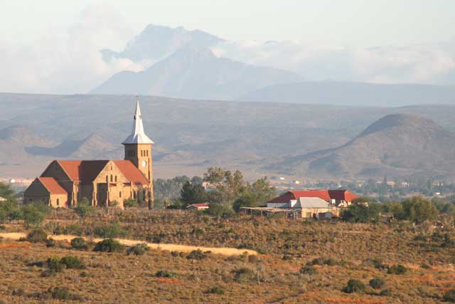
De Hoop is a town in Oudtshoorn Local Municipality in the Western Cape province of South Africa.
De Hoop | |
|---|---|
 De Hoop, Oudtshoorn | |
 De Hoop  De Hoop | |
| Coordinates: 33.607°S 22.045°E | |
| Country | South Africa |
| Province | Western Cape |
| District | Garden Route |
| Municipality | Oudtshoorn |
| Area | |
| • Total | 0.57 km2 (0.22 sq mi) |
| Population (2011)[1] | |
| • Total | 151 |
| • Density | 260/km2 (690/sq mi) |
| Racial makeup (2011) | |
| • Coloured | 71.3% |
| • White | 28.7% |
| First languages (2011) | |
| • Afrikaans | 99.3% |
| • Other | 0.7% |
| Time zone | UTC+2 (SAST) |
Village of the Dutch Reformed Church 16 km west of Oudtshoorn. It was laid out in July 1908 and so named with reference to Rom. 5:5, 'hope maketh not ashamed'; the definite article is often used in Dutch and Afrikaans in conjunction with abstract nouns.[2]
References
- "Main Place De Hoop". Census 2011.
- Raper, Peter E. (1987). Dictionary of Southern African Place Names. Internet Archive. p. 133. Retrieved 28 August 2013.
Municipalities and communities of Garden Route District Municipality, Western Cape | ||
|---|---|---|
District seat: George | ||
| Bitou |
|  |
| George |
| |
| Hessequa |
| |
| Kannaland |
| |
| Knysna |
| |
| Mossel Bay |
| |
| Oudtshoorn |
| |
Текст в блоке "Читать" взят с сайта "Википедия" и доступен по лицензии Creative Commons Attribution-ShareAlike; в отдельных случаях могут действовать дополнительные условия.
Другой контент может иметь иную лицензию. Перед использованием материалов сайта WikiSort.org внимательно изучите правила лицензирования конкретных элементов наполнения сайта.
Другой контент может иметь иную лицензию. Перед использованием материалов сайта WikiSort.org внимательно изучите правила лицензирования конкретных элементов наполнения сайта.
2019-2025
WikiSort.org - проект по пересортировке и дополнению контента Википедии
WikiSort.org - проект по пересортировке и дополнению контента Википедии