world.wikisort.org - South_Africa
Bela-Bela (Tswana/Pedi for "the pot that boils")[2] is a town in the Limpopo Province of South Africa. Deriving its name from the geothermic hot springs around which the town was built, it was called Warmbaths, until 2002.[3]
This article uses bare URLs, which are uninformative and vulnerable to link rot. (September 2022) |
Bela-Bela
Warmbaths | |
|---|---|
|
Coat of arms | |
| Motto: Salus et vita | |
 Bela-Bela  Bela-Bela  Bela-Bela | |
| Coordinates: 24°53′S 28°17′E | |
| Country | South Africa |
| Province | Limpopo |
| District | Waterberg |
| Municipality | Bela-Bela |
| Established | 1873 |
| Area | |
| • Total | 23.29 km2 (8.99 sq mi) |
| Population (2011)[1] | |
| • Total | 45,001 |
| • Density | 1,900/km2 (5,000/sq mi) |
| Racial makeup (2011) | |
| • Black African | 89.1% |
| • Coloured | 1.7% |
| • Indian/Asian | 0.7% |
| • White | 8.2% |
| • Other | 0.3% |
| First languages (2011) | |
| • Northern Sotho | 43.0% |
| • Tswana | 18.1% |
| • Tsonga | 12.4% |
| • Afrikaans | 9.4% |
| • Other | 17.1% |
| Time zone | UTC+2 (SAST) |
| Postal code (street) | 0480 |
| Area code | 014 |
The town is situated in the Waterberg District of the Limpopo Province. It lies off the N1 road between Pretoria and Polokwane (Pietersburg). Its hot springs produce 22,000 litres per hour at 52 °C (126 °F).[4]
The main hot springs holiday resort (previously run by state-owned company Aventura, formerly called Overvaal[5])[6] in the town is still branded Warmbaths.[7]
History

When the Tswana tribes first moved into the region in about the 1800s, they discovered hot springs in the area.[8]
The Voortrekker Carl Van Heerden established the first farm in what is now Bela-Bela and called it Het Bad. In 1873, President Burgers' Transvaal government bought the land and established a resort called Hartingsburg after the prominent Dutch biologist Pieter Harting.[3] The British occupied the town during the Anglo-Boer War, and renamed the post office Warm Baths in 1903, and proclaimed the boundaries of Warmbaths to be the entire farm of Het Bad.[2]
In 1920 Warmbaths was proclaimed a township (in the legal, not racial sense) and the township was designed by architect John Abraham Moffat[9] in that year. In 1950, it became a magisterial district. In 1932 Warmbaths became a village town and was established as a town council in 1960.[2]
Called Warmbaths in English, the Afrikaans name for the town was Warmbad.[3]
On 14 June 2002[10] the South African government officially renamed the town to Bela-Bela (meaning "boiling boiling").[11][failed verification]
Incorrect variations on this spelling can also be sometimes found, such as "Bella Bella"[12][13] and "Bela Bela".[4]
Climate
| Climate data for Bela-Bela (1961–1990) | |||||||||||||
|---|---|---|---|---|---|---|---|---|---|---|---|---|---|
| Month | Jan | Feb | Mar | Apr | May | Jun | Jul | Aug | Sep | Oct | Nov | Dec | Year |
| Record high °C (°F) | 40 (104) |
37 (99) |
37 (99) |
34 (93) |
32 (90) |
28 (82) |
28 (82) |
33 (91) |
37 (99) |
38 (100) |
38 (100) |
39 (102) |
40 (104) |
| Average high °C (°F) | 30 (86) |
29 (84) |
28 (82) |
26 (79) |
24 (75) |
21 (70) |
21 (70) |
24 (75) |
28 (82) |
29 (84) |
29 (84) |
30 (86) |
27 (81) |
| Average low °C (°F) | 17 (63) |
17 (63) |
15 (59) |
12 (54) |
7 (45) |
3 (37) |
3 (37) |
6 (43) |
10 (50) |
14 (57) |
15 (59) |
16 (61) |
11 (52) |
| Record low °C (°F) | 9 (48) |
10 (50) |
3 (37) |
2 (36) |
−2 (28) |
−8 (18) |
−6 (21) |
−6 (21) |
−3 (27) |
3 (37) |
6 (43) |
7 (45) |
−8 (18) |
| Average precipitation mm (inches) | 120 (4.7) |
84 (3.3) |
74 (2.9) |
37 (1.5) |
7 (0.3) |
6 (0.2) |
2 (0.1) |
5 (0.2) |
16 (0.6) |
58 (2.3) |
101 (4.0) |
124 (4.9) |
634 (25.0) |
| Average precipitation days (≥ 1.0 mm) | 12 | 9 | 9 | 6 | 2 | 1 | 1 | 1 | 2 | 8 | 11 | 13 | 74 |
| Source: South African Weather Service[14] | |||||||||||||
See also
- List of reduplicated place names
References
- "Main Place Bela-Bela". Census 2011.
- "History of Warmbaths/ Bela-Bela". Marula Marketing. Archived from the original on 10 January 2010. Retrieved 14 December 2009.
- "Warmbaths". ArteFacts. Retrieved 14 December 2009.
- "Warmbad / Bela Bela Information and Accommodation". Archived from the original on 30 December 2008. Retrieved 31 October 2010.
- "Committee Briefed on Repeal of Overvaal Resorts Limited Bill - Parliament of South Africa".
- "Land claims put brakes on sale of Aventura resorts - eProperty News".
- https://www.foreverwarmbaths.co.za/
- "Bela Bela, Limpopo | By South Africa Channel". Retrieved 31 October 2009.
- "Moffat, John Abraham". ArteFacts. Retrieved 14 December 2009.
- "OldPlaceNames". South African Geographical Names System. Archived from the original on 8 February 2010. Retrieved 31 October 2009.
- "Bela-Bela Tourism". Bela Bela Tourism. Retrieved 31 October 2009.
- "Minister says refugee children in SA must attend school". Mail & Guardian. 21 June 2009. Archived from the original on 16 October 2009. Retrieved 31 October 2009.
- "Residential and Commercial Property in Bela-Bela Limpopo South Africa". SA Property Showcase. Archived from the original on 9 October 2011. Retrieved 31 October 2009.
- "Climate data for Bela-Bela". South African Weather Service. Archived from the original on 10 September 2011. Retrieved 19 November 2016.
Municipalities and communities of Waterberg District Municipality, Limpopo | ||
|---|---|---|
District seat: Nylstroom (Modimolle) | ||
| Thabazimbi | 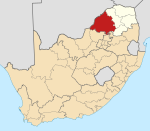 | |
| Lephalale |
| |
| Modimolle–Mookgophong |
| |
| Bela-Bela |
| |
| Mogalakwena |
| |
На других языках
[de] Bela-Bela
Bela-Bela (bis 2002 Warmbaths oder Warmbad)[1] ist eine Stadt in der südafrikanischen Provinz Limpopo. Sie befindet sich in der gleichnamigen Gemeinde im Distrikt Waterberg. Die Stadt hat 45.001 Einwohner (Stand: 2011).[2] Der Name kommt vom Nord-Sotho-Begriff bela, der ‚kochend‘ bedeutet. Er bezieht sich auf die natürlichen heißen Quellen, für die Bela-Bela bekannt ist. Etwa 22.000 Liter 53 °C warmes Wasser strömen pro Stunde aus der Quelle.[3] Das Quellwasser beinhaltet viel Natriumchlorid, Calciumcarbonat und andere Salze, die für die Behandlung von rheumatischen Erkrankungen als förderlich angesehen werden.[4]- [en] Bela-Bela
[ru] Бела-Бела
Бела-Бела (Bela-Bela), бывший Хартингсбург (Hartingsburg) и Вормбатс (Warm Baths) — город, административный центр местного муниципалитета Бела-Бела в районе Ватерберг провинции Лимпопо (ЮАР).Другой контент может иметь иную лицензию. Перед использованием материалов сайта WikiSort.org внимательно изучите правила лицензирования конкретных элементов наполнения сайта.
WikiSort.org - проект по пересортировке и дополнению контента Википедии