world.wikisort.org - Slovenia
Črmlja (pronounced [ˈtʃəːɾmlja]) is a settlement in the Municipality of Trnovska Vas in northeastern Slovenia. It lies in a valley of a minor right tributary of the Pesnica River west of Trnovska Vas. The area is part of the traditional region of Styria. It is now included in the Drava Statistical Region.[2]
Črmlja | |
|---|---|
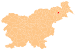
 Črmlja Location in Slovenia | |
| Coordinates: 46°31′22.28″N 15°52′3.22″E | |
| Country | |
| Traditional region | Styria |
| Statistical region | Drava |
| Municipality | Trnovska Vas |
| Area | |
| • Total | 1.48 km2 (0.57 sq mi) |
| Elevation | 262 m (860 ft) |
| Population (2002) | |
| • Total | 88 |
| [1] | |
A number of Roman period burial mounds have been identified in the hills southwest of the settlement in the Črmlja Woods (Slovene: Črmljenski les).[3]
References
- Statistical Office of the Republic of Slovenia
- Trnovska Vas municipal site
- Slovenian Ministry of Culture register of national heritage reference numbers ešd 6443, 6444, 6445, 6446, 6447, 64438
External links
Municipality of Trnovska Vas | ||
|---|---|---|
| Settlements | Administrative seat: Trnovska Vas
|  |
| Landmarks |
| |
This article about the Municipality of Trnovska vas in Slovenia is a stub. You can help Wikipedia by expanding it. |
Текст в блоке "Читать" взят с сайта "Википедия" и доступен по лицензии Creative Commons Attribution-ShareAlike; в отдельных случаях могут действовать дополнительные условия.
Другой контент может иметь иную лицензию. Перед использованием материалов сайта WikiSort.org внимательно изучите правила лицензирования конкретных элементов наполнения сайта.
Другой контент может иметь иную лицензию. Перед использованием материалов сайта WikiSort.org внимательно изучите правила лицензирования конкретных элементов наполнения сайта.
2019-2025
WikiSort.org - проект по пересортировке и дополнению контента Википедии
WikiSort.org - проект по пересортировке и дополнению контента Википедии