world.wikisort.org - Slovenia
Trojane (pronounced [tɾɔˈjaːnɛ]; Latin: Atrans, German: Trojana[2]) is a settlement in the Municipality of Lukovica in central Slovenia.[3] It lies in the northern part of the Sava Hills, on a hill near the border of two Slovene regions, Carniola and Styria. Until the freeway was finished in 2005, Trojane was on the main route from Ljubljana to Maribor.
Trojane | |
|---|---|
 | |
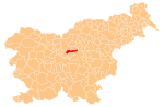
 Trojane Location in Slovenia | |
| Coordinates: 46°11′17.08″N 14°52′58.87″E | |
| Country | |
| Traditional region | Upper Carniola |
| Statistical region | Central Slovenia |
| Municipality | Lukovica |
| Area | |
| • Total | 0.88 km2 (0.34 sq mi) |
| Elevation | 561.4 m (1,841.9 ft) |
| Population (2002) | |
| • Total | 103 |
| [1] | |
History
The Romans built a road on the route connecting Aquileia, Emona, Atrans, and Celeia. Trojane was an important way station, military post, and marketplace, and the town was surrounded by a defensive wall.
The archaeological remains of Atrans can be still seen in Trojane. In the Roman Empire, Trojane (Atrans) was on the border between Italy and the province of Noricum.
Popular culture

Trojane is particularly known for the local restaurant's jelly doughnuts (Slovene: krofi), originally made with apricot jam filling.[4] They also come in blueberry and chocolate flavour.
References
- Statistical Office of the Republic of Slovenia
- Leksikon občin kraljestev in dežel zastopanih v državnem zboru, vol. 6: Kranjsko. 1906. Vienna: C. Kr. Dvorna in Državna Tiskarna, p. 22.
- Lukovica Municipality site
- Slovenian Tourist Board site
External links
 Media related to Trojane at Wikimedia Commons
- Trojane on Geopedia
Municipality of Lukovica | ||||||
|---|---|---|---|---|---|---|
| Settlements | Administrative seat: Lukovica pri Domžalah
|  | ||||
| Landmarks |
| |||||
| Notable people |
| |||||
This article about the Municipality of Lukovica in Slovenia is a stub. You can help Wikipedia by expanding it. |
Другой контент может иметь иную лицензию. Перед использованием материалов сайта WikiSort.org внимательно изучите правила лицензирования конкретных элементов наполнения сайта.
WikiSort.org - проект по пересортировке и дополнению контента Википедии