world.wikisort.org - Slovenia
Smoleva (pronounced [smɔˈleːʋa]) is a village in the Municipality of Železniki in the Upper Carniola region of Slovenia. It lies in the valley of Lower Smoleva Creek (Slovene: Prednja Smoleva) between Špik Hill (882 meters or 2,894 feet) to the northeast and Mount Vancovec (1,085 meters or 3,560 feet) to the southwest.
Smoleva | |
|---|---|
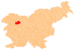
 Smoleva Location in Slovenia | |
| Coordinates: 46°12′39.99″N 14°9′57.19″E | |
| Country | |
| Traditional Region | Upper Carniola |
| Statistical region | Upper Carniola |
| Municipality | Železniki |
| Elevation | 591.8 m (1,941.6 ft) |
| Population (2002) | |
| • Total | 59 |
| [1] | |
References
External links
Municipality of Železniki | ||||||
|---|---|---|---|---|---|---|
| Settlements | Administrative seat: Železniki
|  | ||||
| Landmarks |
| |||||
| Notable people | ||||||
This article about the Municipality of Železniki in Slovenia is a stub. You can help Wikipedia by expanding it. |
Текст в блоке "Читать" взят с сайта "Википедия" и доступен по лицензии Creative Commons Attribution-ShareAlike; в отдельных случаях могут действовать дополнительные условия.
Другой контент может иметь иную лицензию. Перед использованием материалов сайта WikiSort.org внимательно изучите правила лицензирования конкретных элементов наполнения сайта.
Другой контент может иметь иную лицензию. Перед использованием материалов сайта WikiSort.org внимательно изучите правила лицензирования конкретных элементов наполнения сайта.
2019-2026
WikiSort.org - проект по пересортировке и дополнению контента Википедии
WikiSort.org - проект по пересортировке и дополнению контента Википедии