world.wikisort.org - Slovenia
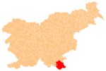
Sečje Selo (pronounced [ˈseːtʃjɛ ˈsɛːlɔ]; Slovene: Sečje selo) is a settlement on the left bank of the Kolpa River west of Vinica in the Municipality of Črnomelj in the White Carniola area of southeastern Slovenia. The area is part of the traditional region of Lower Carniola and is now included in the Southeast Slovenia Statistical Region.[2]
Sečje Selo | |
|---|---|
 Sečje Selo Location in Slovenia | |
| Coordinates: 45°27′26.03″N 15°14′40.94″E | |
| Country | |
| Traditional region | White Carniola |
| Statistical region | Southeast Slovenia |
| Municipality | Črnomelj |
| Area | |
| • Total | 2.37 km2 (0.92 sq mi) |
| Elevation | 182 m (597 ft) |
| Population (2020) | |
| • Total | 104 |
| • Density | 44/km2 (110/sq mi) |
| [1] | |
References
External links
This article about the Municipality of Črnomelj in Slovenia is a stub. You can help Wikipedia by expanding it. |
Текст в блоке "Читать" взят с сайта "Википедия" и доступен по лицензии Creative Commons Attribution-ShareAlike; в отдельных случаях могут действовать дополнительные условия.
Другой контент может иметь иную лицензию. Перед использованием материалов сайта WikiSort.org внимательно изучите правила лицензирования конкретных элементов наполнения сайта.
Другой контент может иметь иную лицензию. Перед использованием материалов сайта WikiSort.org внимательно изучите правила лицензирования конкретных элементов наполнения сайта.
2019-2026
WikiSort.org - проект по пересортировке и дополнению контента Википедии
WikiSort.org - проект по пересортировке и дополнению контента Википедии